Related Research Articles

The Mawson Station, commonly called Mawson, is one of three permanent bases and research outposts in Antarctica managed by the Australian Antarctic Division (AAD). Mawson lies in Holme Bay in Mac. Robertson Land, East Antarctica in the Australian Antarctic Territory, a territory claimed by Australia. Established in 1954, Mawson is Australia's oldest Antarctic station and the oldest continuously inhabited Antarctic station south of the Antarctic Circle.

The Prince Charles Mountains are a major group of mountains in Mac. Robertson Land in Antarctica, including the Athos Range, the Porthos Range, and the Aramis Range. The highest peak is Mount Menzies. Other prominent peaks are Mount Izabelle and Mount Stinear. These mountains together with other scattered peaks form an arc about 260 miles long, extending from the vicinity of Mount Starlight in the north to Goodspeed Nunataks in the south.
The Napier Mountains are a group of close set peaks, the highest being Mount Elkins, at about 2,300 meters above sea level. This mountain range is located in Enderby Land, in the claimed Australian Antarctic Territory, East Antarctica.
The Scott Mountains are a large number of isolated peaks lying south of Amundsen Bay in Enderby Land of East Antarctica, Antarctica. Discovered on 13 January 1930 by the British Australian New Zealand Antarctic Research Expedition (BANZARE) under Sir Douglas Mawson. He named the feature Scott Range after Captain Robert Falcon Scott, Royal Navy. The term mountains is considered more appropriate because of the isolation of its individual features.
Phillip Garth Law, AC, CBE, FAA, FTSE was an Australian scientist and explorer who served as director of Australian National Antarctic Research Expeditions (ANARE) from 1949 to 1966.
Athos Range is the northernmost range in the Prince Charles Mountains of Mac. Robertson Land, Antarctica. The range consists of many individual mountains and nunataks that trend east–west for 40 miles (64 km) along the north side of Scylla Glacier.
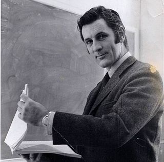
John Mayston Béchervaise OAM, MBE was an Australian writer, photographer, artist, historian and explorer. He is especially notable for his work and achievements in Antarctica.

Mount Kjerringa is an isolated peak, 1,220 metres (4,000 ft) above sea level, situated roughly 8 nmi (15 km) north of the Aker Peaks, 26 nmi (48 km) west of Magnet Bay, and 57 km (31 nmi) northeast of Mount Elkins in Enderby Land, East Antarctica.
Mount Elkins, also known as Jökelen is a dark, steep-sided mountain with three major peaks, the highest 2,300 meters (7,500 ft) above sea level, in the Napier Mountains of Enderby Land. Enderby Land is part of East Antarctica, and is claimed by Australia as part of the Australian Antarctic Territory. The mountain was named after Terence James Elkins, an ionospheric physicist with the Australian National Antarctic Research Expeditions at Mawson Station in 1960.
Terence James Elkins is an Australian-born American physicist. In 1960, he participated in an expedition from Mawson Station which conducted the first geological surveys of the Napier Mountains in Antarctica. The highest of this group of mountains, Mount Elkins, was subsequently named after him. In 1979, he received the Harold Brown Award, the Air Force's highest honour for research and development, for research he conducted that contributed to the development of the AN/FPS-118 over-the-horizon backscatter (OTH-B) air defence radar system. This system, consisting of six one-megawatt transmitters and their associated horizontal linear phased array antennas, is currently the largest radar system in the world.
Mount Kirkby is a very large, prominent, linear, flat-topped mountain on the northern face of the Porthos Range in the Prince Charles Mountains of Antarctica. Situated about 3 nautical miles (6 km) east of Crohn Massif, it is approximately 9 kilometres (5 nmi) long east–west and 4 kilometres (2 nmi) wide at the western end, tapering to the east. It rises to 2,100 metres (6,890 ft). The mountain was first visited by the Australian National Antarctic Research Expeditions southern party led by William G. Bewsher in December 1956, and was named by the Antarctic Names Committee of Australia for Sydney L. Kirkby, a surveyor at Mawson Station in 1956 and 1960.
Kirkby Glacier is a glacier, 20 miles (30 km) in length. This glacier drains the central Anare Mountains of Antarctica and flows northwest to the sea 3 miles (5 km) from Cape North, and just north of Arthurson Bluff, northern Victoria Land. Richardson Bluff rises from its east side.
Kirkby Head is a sheer coastal outcrop on Tange Promontory in Enderby Land, Antarctica, which is claimed by Australia as part of the Australian Antarctic Territory. Continental ice reaches almost to the top on its southern side. It is located at the east side of the entrance to Alasheyev Bight.
Kirkby Shoal is a small shoal area with depths of less than 10 fathoms (18 m) extending about 150 yards (140 m) westwards and south-southwestwards, about 3.4 km (2.1 mi) from the summit of Shirley Island, Windmill Islands, and 0.15 mi (0.24 km) northwest of Stonehocker Point, Clark Peninsula.
The Porthos Range is the second range south in the Prince Charles Mountains of Antarctica, extending for about 30 miles in an east-to-west direction between Scylla Glacier and Charybdis Glacier. First visited in December 1956 by the ANARE southern party under W.G. Bewsher and named after Porthos, a character in Alexandre Dumas, père's novel The Three Musketeers, the most popular book read on the southern journey.
Rippon Glacier is a small glacier located in Kemp Land, East Antarctica. It is close east of Seaton Glacier, flowing southward into Edward VIII Ice Shelf.
Mount King is a large, smooth-crested mountain in the eastern extremity of the Tula Mountains. Part of the Australian Antarctic Gazetteer and the SCAR Composite Gazetteer of Antarctica, it is located in Enderby Land, East Antarctica, which is claimed by Australia as part of the Australian Antarctic Territory. The head of Beaver Glacier is located very close to the base of Mount King.
Wilma Glacier is the western of two glaciers entering the southern part of Edward VIII Ice Shelf in Kemp Land, East Antarctica. The second, eastern glacier is Robert Glacier.
Armstrong Peak is a peak, 1,470 metres (4,820 ft) high, standing 15 nautical miles (28 km) southeast of Mount Codrington in Enderby Land of East Antarctica.
Mount Arthur is a mountain, 1,290 m, just west of Mount Douglas at the west end of the Scott Mountains, Enderby Land in Antarctica. Plotted from air photos taken from ANARE aircraft in 1956. Named by Antarctic Names Committee of Australia (ANCA) for J. Arthur, electrical fitter at Mawson station in 1960.
References
- 1 2 Carstens, David (2003). "Sydney Kirkby MBE, Polar Medal". The White Hat Guide to 200 Significant Australians. Docklands, Victoria, Australia: White Hat. Retrieved 30 November 2011.
