Talalolae

Last updated

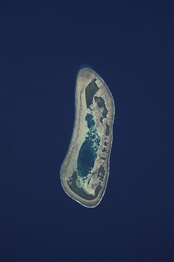
Talalolae is an islet located in Nui atoll in the Pacific Ocean state of Tuvalu. [1] [2]

Related Research Articles

Nui (atoll) Atoll in Tuvalu

Nui is an atoll and one of nine districts of the Pacific Ocean state of Tuvalu. It has a land area of 3.37 km² and a population of 610.

German Bight

The German Bight is the southeastern bight of the North Sea bounded by the Netherlands and Germany to the south, and Denmark and Germany to the east. To the north and west it is limited by the Dogger Bank. The Bight contains the Frisian and Danish Islands. The Wadden Sea is approximately ten to twelve kilometres wide at the location of the German Bight. The Frisian islands and the nearby coastal areas are collectively known as Frisia. The southern portion of the bight is also known as the Heligoland Bight. Between 1949 and 1956 the BBC Sea Area Forecast used "Heligoland" as the designation for the area now referred to as German Bight.

Çatalada, a.k.a.Çatal Ada, is a Turkish island located in the Aegean Sea, 3 miles off the town Turgutreis, west of Bodrum peninsula in southwestern Turkey. An island with three conical hills, its name means literally "fork island".

St. Cyril Peak

St. Cyril Peak rises to 1,505m in Friesland Ridge in Tangra Mountains on Livingston Island in the South Shetland Islands, Antarctica. The peak is linked to St. Methodius Peak to the southwest by Vladaya Saddle and surmounts Ruen Icefall to the west, Macy Glacier to the east and Prespa Glacier to the south.

Fenua Tapu

Fenua Tapu is an islet of Nui atoll in the Pacific Ocean state of Tuvalu.

Motupuakaka is an islet of Nui atoll in the Pacific Ocean state of Tuvalu.

Pakantou is an islet of Nui atoll in the Pacific Ocean state of Tuvalu.

Piliaieve is an islet in the Pacific Ocean located in the state of Nui, Tuvalu.

Pongalei is an islet of Nui atoll in the Pacific Ocean state of Tuvalu.

Tokinivae is an islet of Nui atoll, in the Pacific Ocean state of Tuvalu.< Nui tradition is that Kolaka, a warrior from Nukufetau came on several raiding expeditions to Tokinivae, until he was killed and buried at Tararorae.

Unimai is an islet of Nui atoll in the Pacific Ocean state of Tuvalu.

Nuhaka Place in New Zealand

Nuhaka is a small settlement in the northern Hawke's Bay Region of New Zealand's eastern North Island, lying on State Highway 2 between Wairoa and Gisborne.

Rzędków, Skierniewice County Village in Łódź Voivodeship, Poland

Rzędków is a village in the administrative district of Gmina Nowy Kawęczyn, within Skierniewice County, Łódź Voivodeship, in central Poland. It lies approximately 7 kilometres (4 mi) west of Nowy Kawęczyn, 9 km (6 mi) south of Skierniewice, and 49 km (30 mi) east of the regional capital Łódź.

Tanrake Village in Tuvalu

Tanrake is a village in Tuvalu. It is on Nui atoll, on Fenua Tapu islet. The location is 7.25°S 177.15°E.

Rucava Municipality Municipality of Latvia

Rucava Municipality is a municipality in Courland, Latvia. The municipality was formed in 2009 by merging Dunika Parish and Rucava Parish, the administrative centre being Rucava.

Mercedes, Paraná is a municipality in the state of Paraná in the Southern Region of Brazil.

Corrente, Piauí Municipality in Northeast, Brazil

Corrente, Piaui is a municipality in the state of Piauí in the Northeast region of Brazil.

Telikiai is an islet of Nui atoll in the Pacific Ocean state of Tuvalu. Meang means "west". The islet features in the legends of the Tekaunibiti family, whose members went to catch birds on the islet and found three teanti-ma-aomata and captured two.

The Battle of Phú Lộc took place from 28 August to 10 December 1974 when North Vietnamese forces captured a series of hills and installed artillery that closed Phu Bai Air Base and interdicted Highway 1. The hills were recaptured by the South Vietnamese in costly fighting that depleted its reserve forces.

References

  1. Map of Nui. Tuvaluislands.com.
  2. British Admiralty Nautical Chart 766 Ellice Islands (1893 ed.). United Kingdom Hydrographic Office (UKHO). 21 March 1872.

Coordinates: 7°12′50″S177°9′43″E / 7.21389°S 177.16194°E / -7.21389; 177.16194