You can help expand this article with text translated from the corresponding article in Estonian. (August 2023)Click [show] for important translation instructions.
|
UNESCO World Heritage Site | |
---|---|
Location | Tallinn, Estonia |
Criteria | Cultural: (ii) (iv) |
Reference | 822bis |
Inscription | 1997 (21st Session) |
Area | 113 ha (280 acres) |
Buffer zone | 2,253 ha (5,570 acres) |
Coordinates | 59°26′14″N24°44′43″E / 59.437222°N 24.745278°E |
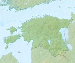
Tallinn Old Town (Estonian : Tallinna vanalinn) is the oldest part of Tallinn, Estonia. Old Town of Tallinn has managed to wholly preserve its structure of medieval and Hanseatic origin. Old Town represents an exceptionally intact 13th century city plan. [1] Since 1997, the area has been registered in the UNESCO World Heritage List. The old town is bordered by the Walls of Tallinn. Its area is 113 ha and there is a buffer zone of 2,253 ha. [2]
The majority of the Old Town's structures were built during the 13th–16th centuries. [3]
During World War II, while the German army occupied Estonia in 1941–1944, Tallinn Old Town suffered from several instances of aerial bombing by the Soviet air force. During the most destructive Soviet bombing raid on 9–10 March 1944, over a thousand incendiary bombs were dropped on Tallinn, causing widespread fires, destroying about 10% of the buildings in the Old Town, killing hundreds, and leaving over 20,000 people without shelter.
Tallinn is the capital and most populous city of Estonia. Situated on a bay in north Estonia, on the shore of the Gulf of Finland of the Baltic Sea, Tallinn has a population of about 454,000 and administratively lies in the Harju maakond (county). Tallinn is the main financial, industrial, and cultural centre of Estonia. It is located 187 km (116 mi) northwest of the country's second largest city, Tartu, however only 80 km (50 mi) south of Helsinki, Finland, also 320 km (200 mi) west of Saint Petersburg, Russia, 300 km (190 mi) north of Riga, Latvia, and 380 km (240 mi) east of Stockholm, Sweden. From the 13th century until the first half of the 20th century, Tallinn was known in most of the world by variants of its other historical name Reval.
Tartu is the second largest city in Estonia after Tallinn. Tartu has a population of 97,435. It is 186 kilometres southeast of Tallinn and 245 kilometres northeast of Riga, Latvia. Tartu lies on the Emajõgi river, which connects the two largest lakes in Estonia, Lake Võrtsjärv and Lake Peipus. From the 13th century until the end of the 19th century, Tartu was known in most of the world by variants of its historical name Dorpat.
Narva is a municipality and city in Estonia. It is located in the Ida-Viru County, at the eastern extreme point of Estonia, on the west bank of the Narva river which forms the Estonia–Russia international border. With 53,626 inhabitants Narva is Estonia's third largest city after capital Tallinn and Tartu.
Pärnu is the fourth largest city in Estonia and third in terms of the ethnic Estonian population. Situated in southwest Estonia, Pärnu is located 128 kilometres (80 mi) south of the Estonian capital, Tallinn, and 176 kilometres (109 mi) west of Estonia's second largest city, Tartu. The city sits off the coast of Pärnu Bay, an inlet of the Gulf of Riga, which is a part of the Baltic Sea. In the city, the Pärnu River drains into the Gulf of Riga.
Harju County, is one of the fifteen counties of Estonia. It is situated in Northern Estonia, on the southern coast of the Gulf of Finland, and borders Lääne-Viru County to the east, Järva County to the southeast, Rapla County to the south, and Lääne County to the southwest. The capital and largest city of Estonia, Tallinn, is situated in Harju County. Harju County is the largest county in Estonia in terms of population, as almost half (45%) of the Estonia's population lives in Harju County.
The Governorate of Estonia, also known as the Governorate of Esthonia was a governorate in the Baltic region, along with the Livonian and Courland Governorates. It was a part of the Imperial Russian administration (guberniya), which is located in modern-day northern Estonia and some islands in the West Estonian archipelago, including the islands of Hiiumaa and Vormsi. The Governorate was established in 1796 when Paul I's reform abolished the Viceroyalty (namestnik). Previously, the Reval Governorate existed under Peter I's reign from the Treaty of Nystad, which ceded territory from Sweden to the newly established Russian Empire, until its inexistence in 1783.
The Kopli cemetery was Estonia's largest Lutheran Baltic German cemetery, located in the suburb of Kopli in Tallinn. It contained thousands of graves of prominent citizens of Tallinn and stood from 1774 to shortly after World War II, when it was completely flattened and destroyed by the Soviet occupation authorities governing the country at the time. The former cemetery is now a public park.
Tõnismägi is a 36-metre high hillock adjacent to Toompea hill in Tallinn, Estonia.
During World War II, the Estonian capital Tallinn suffered from many instances of aerial bombing by the Soviet air force and the German Luftwaffe. The first bombings by Luftwaffe occurred during the Summer War of 1941 as part of Operation Barbarossa. A number of Soviet bombing missions to then German-occupied Tallinn followed in 1942–1944.
Kesklinn is one of the 8 administrative districts of Tallinn, the capital of Estonia. It is situated on the Tallinn Bay and bordered to the northwest by the district of Põhja-Tallinn, to the west by Kristiine, to the southwest by Nõmme, to the east by Lasnamäe and Pirita, and to the south by Rae Parish, beyond Lake Ülemiste. The island of Aegna, located in the Tallinn Bay, also falls within this administrative district. Kesklinn has an area of 30.6 km2 (11.8 sq mi) and a population of 57,731 ; population density is 1,886.6/km2 (4,886/sq mi).
The Kalamaja cemetery, in Tallinn in Estonia was once the city's oldest existing cemetery, located in the suburb of Kalamaja in the north of the city. It contained thousands of graves of ethnic Estonian and Swedish residents of Tallinn and stood for at least 400 years, from the 15th or 16th century to 1964 when it was completely flattened and destroyed by the Soviet occupation authorities governing the country at that time. The former cemetery is now a public park: "Kalamaja kalmistupark".
Kalamaja is a subdistrict of the district of Põhja-Tallinn in Tallinn, the capital of Estonia. It is located just northwest of the historical town centre, on the coast of the Tallinn Bay. Kalamaja has a population of 9,820.
This article covers the architecture of Estonia.
Tallinn Christmas Market is a Christmas market held every year in Tallinn, Estonia. The modern market was founded in 2001 by Paul Oberschneider, and is open from Christmas Day until Epiphany. The latter also marks the end of the Christmas season according to the Gregorian calendar. The market brings tourists from all over the world to Tallinn.
Freedom Square is a plaza on the southern end of the Old Town in Tallinn, Estonia, where state functions and various concerts take place. It is bounded on the east by St. John's Church, on the south by Kaarli Boulevard and an underground shopping center (2008–09), and on the west by a Victory Column (2009) commemorating the Estonian War of Independence 1918–1920.
Maakri is a subdistrict in the district of Kesklinn (Midtown), Tallinn, the capital of Estonia. It has a population of 1,099. In the last decade Maakri has developed into the main business centre of Tallinn. Many high-rise buildings have been built into the area during this period.
Vanalinn is a subdistrict in the district of Kesklinn (Midtown), Tallinn, the capital of Estonia. It has a population of 4,939.
The Estonian Knighthood House is a building in Toompea, the upper part of Vanalinn, the historic inner town of Tallinn, the capital of Estonia. Its address is Kiriku plats 1. The Dome Church is situated at the same square.
This is the overview article of the history of Tallinn, Estonia. For the timeline, see Timeline of Tallinn
Danish King's Garden is a park in Tallinn Old Town, Estonia.