Albaredo per San Marco is a comune (municipality) in the Province of Sondrio in the Italian region of Lombardy, located about 80 kilometres (50 mi) northeast of Milan and about 25 kilometres (16 mi) southwest of Sondrio.
Albosaggia is a comune (municipality) in the Province of Sondrio in the Italian region Lombardy, located about 90 kilometres (56 mi) northeast of Milan and about 2 kilometres (1 mi) southwest of Sondrio. As of 31 December 2004, it had a population of 3,135 and an area of 34.3 square kilometres (13.2 sq mi).
Caiolo is a comune (municipality) in the Province of Sondrio in the Italian region of Lombardy, located about 90 kilometres (56 mi) northeast of Milan and about 5 kilometres (3 mi) southwest of Sondrio. As of 31 December 2004, it had a population of 994 and an area of 33.3 square kilometres (12.9 sq mi).

Castello dell'Acqua is a comune (municipality) in the Province of Sondrio in the Italian region Lombardy, located about 100 kilometres (62 mi) northeast of Milan and about 12 kilometres (7 mi) east of Sondrio. As of 31 December 2004, it had a population of 693 and an area of 13.9 square kilometres (5.4 sq mi).
Castione Andevenno is a comune (municipality) in the Province of Sondrio in the Italian region Lombardy, located about 90 kilometres (56 mi) northeast of Milan and about 5 kilometres (3 mi) west of Sondrio. As of 31 December 2004, it had a population of 1,545 and an area of 17.1 square kilometres (6.6 sq mi).

Colorina is a comune (municipality) in the Province of Sondrio in the Italian region Lombardy, located about 90 kilometres (56 mi) northeast of Milan and about 10 kilometres (6 mi) west of Sondrio. As of 31 December 2004, it had a population of 1,468 and an area of 18.0 square kilometres (6.9 sq mi).

Dazio is a comune (municipality) in the Province of Sondrio in the Italian region Lombardy, located about 80 kilometres (50 mi) northeast of Milan and about 20 kilometres (12 mi) west of Sondrio. As of 31 December 2004, it had a population of 380 and an area of 3.7 square kilometres (1.4 sq mi).
Forcola is a comune (municipality) in the Province of Sondrio in the Italian region Lombardy, located about 90 kilometres (56 mi) northeast of Milan and about 15 kilometres (9 mi) west of Sondrio. As of 31 December 2004, it had a population of 870 and an area of 15.7 square kilometres (6.1 sq mi).

Fusine is a comune (municipality) in the Province of Sondrio in the Italian region Lombardy, located about 90 kilometres (56 mi) northeast of Milan and about 11 kilometres (7 mi) southwest of Sondrio. As of 31 December 2004, it had a population of 650 and an area of 37.5 square kilometres (14.5 sq mi). Its territory was historically part of Carniola.
Lovero is a comune (municipality) in the Province of Sondrio in the Italian region Lombardy, located about 120 kilometres (75 mi) northeast of Milan and about 30 kilometres (19 mi) east of Sondrio. As of 31 December 2004, it had a population of 663 and an area of 13.4 square kilometres (5.2 sq mi).

Pedesina is a comune (municipality) in the Province of Sondrio in the Italian region Lombardy, located about 120 kilometres (75 mi) northeast of Milan and about 40 kilometres (25 mi) southwest of Sondrio. As of 31 December 2008, it had a population of 33, and an area of 6.3 square kilometres (2.4 sq mi). Pedesina borders the following municipalities: Bema, Gerola Alta, Premana, Rasura, Rogolo. It is one of the least populated municipalities in Italy, along with Morterone.

Poggiridenti is a comune (municipality) in the Province of Sondrio in the Italian region Lombardy, located about 100 kilometres (62 mi) northeast of Milan and about 4 kilometres (2 mi) east of Sondrio. As of 31 December 2013, it had a population of 1,895 and an area of 2.9 square kilometres (1.1 sq mi).

Ponte in Valtellina is a comune (municipality) in the Province of Sondrio in the Italian region Lombardy, located about 100 kilometres (62 mi) northeast of Milan and about 9 kilometres (6 mi) east of Sondrio. As of 31 December 2004, it had a population of 2,222 and an area of 69.5 square kilometres (26.8 sq mi).
Prata Camportaccio is a comune (municipality) in the Province of Sondrio in the Italian region Lombardy, located about 100 kilometres (62 mi) north of Milan and about 40 kilometres (25 mi) northwest of Sondrio. As of 31 December 2004, it had a population of 2,758 and an area of 27.9 square kilometres (10.8 sq mi).
Rasura is a comune (municipality) in the Province of Sondrio in the Italian region of Lombardy, located about 80 kilometres (50 mi) northeast of Milan and about 25 kilometres (16 mi) southwest of Sondrio. As of 31 December 2004, it had a population of 297 and an area of 5.5 square kilometres (2.1 sq mi).
Spriana is a comune (municipality) in the Province of Sondrio in the Italian region Lombardy, located about 100 kilometres (62 mi) northeast of Milan and about 6 kilometres (4 mi) north of Sondrio. As of 31 December 2004, it had a population of 101 and an area of 8.2 square kilometres (3.2 sq mi).

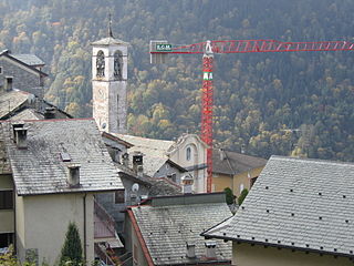
Talamona is a comune (municipality) in the Province of Sondrio in the Italian region of Lombardy, located about 80 kilometres (50 mi) northeast of Milan and about 20 kilometres (12 mi) west of Sondrio. As of 31 December 2004, it had a population of 4,623 and an area of 21.2 square kilometres (8.2 sq mi).

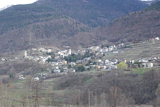
Traona is a comune (municipality) in the Province of Sondrio in the Italian region Lombardy, located about 80 kilometres (50 mi) northeast of Milan and about 25 kilometres (16 mi) west of Sondrio. As of 31 December 2004, it had a population of 2,314 and an area of 6.2 square kilometres (2.4 sq mi).
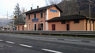
Villa di Tirano is a comune (municipality) in the Province of Sondrio in the Italian region Lombardy, located about 110 kilometres (68 mi) northeast of Milan and about 20 kilometres (12 mi) east of Sondrio, on the border with Switzerland. As of 31 December 2004, it had a population of 2,997 and an area of 24.6 square kilometres (9.5 sq mi).

Mezzoldo is a comune (municipality) in the Province of Bergamo in the Italian region of Lombardy, located about 70 kilometres (43 mi) northeast of Milan and about 35 kilometres (22 mi) north of Bergamo. As of 31 December 2004, it had a population of 225 and an area of 18.8 square kilometres (7.3 sq mi).


