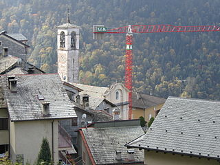
Albaredo per San Marco is a comune (municipality) in the Province of Sondrio in the Italian region Lombardy, located about 80 kilometres (50 mi) northeast of Milan and about 25 kilometres (16 mi) southwest of Sondrio.

Albosaggia is a comune (municipality) in the Province of Sondrio in the Italian region Lombardy, located about 90 kilometres (56 mi) northeast of Milan and about 2 kilometres (1 mi) southwest of Sondrio. As of 31 December 2004, it had a population of 3,135 and an area of 34.3 square kilometres (13.2 sq mi).

Andalo Valtellino is a comune (municipality) in the Province of Sondrio in the Italian region Lombardy, located about 80 kilometres (50 mi) northeast of Milan and about 30 kilometres (19 mi) west of Sondrio.

Bema is a comune (municipality) in the Province of Sondrio in the Italian region of Lombardy, located about 80 kilometres (50 mi) northeast of Milan and about 25 kilometres (16 mi) west of Sondrio.

Bianzone is a comune (municipality) in the Province of Sondrio in the Italian region Lombardy, located about 110 kilometres (68 mi) northeast of Milan and about 20 kilometres (12 mi) east of Sondrio, on the border with Switzerland. As of 31 December 2004, it had a population of 1,250 and an area of 17.3 square kilometres (6.7 sq mi).

Caiolo is a comune (municipality) in the Province of Sondrio in the Italian region Lombardy, located about 90 kilometres (56 mi) northeast of Milan and about 5 kilometres (3 mi) southwest of Sondrio. As of 31 December 2004, it had a population of 994 and an area of 33.3 square kilometres (12.9 sq mi).

Caspoggio is a comune (municipality) in the Province of Sondrio in the Italian region Lombardy, located about 130 kilometres (81 mi) northeast of Milan and about 11 kilometres (7 mi) north of Sondrio.

Castione Andevenno is a comune (municipality) in the Province of Sondrio in the Italian region Lombardy, located about 90 kilometres (56 mi) northeast of Milan and about 5 kilometres (3 mi) west of Sondrio. As of 31 December 2004, it had a population of 1,545 and an area of 17.1 square kilometres (6.6 sq mi).

Cedrasco is a comune (municipality) in the Province of Sondrio in the Italian region Lombardy, located about 90 kilometres (56 mi) northeast of Milan and about 8 kilometres (5 mi) west of Sondrio. As of 31 December 2004, it had a population of 476 and an area of 14.8 square kilometres (5.7 sq mi).

Cosio Valtellino is a comune (municipality) in the Province of Sondrio in the Italian region Lombardy, located about 80 kilometres (50 mi) northeast of Milan and about 25 kilometres (16 mi) west of Sondrio.

Faedo Valtellino is a comune (municipality) in the Province of Sondrio in the Italian region Lombardy, located about 90 kilometres (56 mi) northeast of Milan and about 3 kilometres (2 mi) southeast of Sondrio.

Gerola Alta is a comune (municipality) in the Province of Sondrio in the Italian region Lombardy, located about 70 kilometres (43 mi) northeast of Milan and about 25 kilometres (16 mi) southwest of Sondrio.

Montagna in Valtellina is a comune (municipality) in the Province of Sondrio in the Italian region Lombardy, located about 100 kilometres (62 mi) northeast of Milan and about 3 kilometres (2 mi) northeast of Sondrio.

Postalesio is a comune (municipality) in the Province of Sondrio in the Italian region Lombardy, located about 90 kilometres (56 mi) northeast of Milan and about 6 kilometres (4 mi) west of Sondrio. As of 31 December 2004, it had a population of 618 and an area of 10.6 square kilometres (4.1 sq mi).

Prata Camportaccio is a comune (municipality) in the Province of Sondrio in the Italian region Lombardy, located about 100 kilometres (62 mi) north of Milan and about 40 kilometres (25 mi) northwest of Sondrio. As of 31 December 2004, it had a population of 2,758 and an area of 27.9 square kilometres (10.8 sq mi).

Sernio is a comune (municipality) in the Province of Sondrio in the Italian region Lombardy, located about 120 kilometres (75 mi) northeast of Milan and about 25 kilometres (16 mi) east of Sondrio.

Spriana is a comune (municipality) in the Province of Sondrio in the Italian region Lombardy, located about 100 kilometres (62 mi) northeast of Milan and about 6 kilometres (4 mi) north of Sondrio. As of 31 December 2004, it had a population of 101 and an area of 8.2 square kilometres (3.2 sq mi).

Talamona is a comune (municipality) in the Province of Sondrio in the Italian region Lombardy, located about 80 kilometres (50 mi) northeast of Milan and about 20 kilometres (12 mi) west of Sondrio. As of 31 December 2004, it had a population of 4,623 and an area of 21.2 square kilometres (8.2 sq mi).

Traona is a comune (municipality) in the Province of Sondrio in the Italian region Lombardy, located about 80 kilometres (50 mi) northeast of Milan and about 25 kilometres (16 mi) west of Sondrio. As of 31 December 2004, it had a population of 2,314 and an area of 6.2 square kilometres (2.4 sq mi).

Verceia is a comune (municipality) in the Province of Sondrio in the Italian region Lombardy, located about 80 kilometres (50 mi) northeast of Milan and about 30 kilometres (19 mi) west of Sondrio. As of 31 December 2004, it had a population of 1,101 and an area of 11.2 square kilometres (4.3 sq mi).


