Related Research Articles

Pike County is a county in the Commonwealth of Pennsylvania. It is part of Northeastern Pennsylvania. As of the 2020 census, the population was 58,535. Its county seat is Milford.

Bristol is a borough in Bucks County, Pennsylvania, United States. It is located 23 miles (37 km) northeast of Center City Philadelphia, opposite Burlington, New Jersey on the Delaware River.

Falls Township is a suburban Philadelphia township in Bucks County, Pennsylvania, United States. The population was 34,300 at the 2010 census. Portions of Fairless Hills and Levittown, Pennsylvania, are located in the township. Portions of Falls Township are called Morrisville and Yardley, due to the location of the Morrisville Post Office outside the Borough of Morrisville in Falls Township. As originally chartered in 1692, the villages of Morrisville and Tullytown were part of Falls Township. Morrisville was granted borough status in 1804. Tullytown was established as a borough in 1891.

Morrisville is a borough in Bucks County, Pennsylvania, United States. It is located just below the falls of the Delaware River opposite Trenton, New Jersey. The population was 9,809 in the 2020 Census.

New Hope is a borough in Bucks County, Pennsylvania, United States. The population was 2,612 at the 2020 census. New Hope is located approximately 30 mi (48 km) north of Philadelphia, and lies on the west bank of the Delaware River at its confluence with Aquetong Creek. New Hope and neighboring Solebury and Upper Makefield townships are part of the Philadelphia metropolitan area. The two-lane New Hope–Lambertville Bridge carries automobile and foot traffic across the Delaware to Lambertville, New Jersey, on the east bank. New Hope's primary industry is tourism.

Upper Black Eddy, locally referred to as UBE, is a village located in northern Bucks County, Pennsylvania, United States. The village is 58 miles (93 km) west-southwest of New York City and 45 miles (72 km) north of Philadelphia.

Washington Crossing Historic Park is a 500-acre (2 km2) state park operated by the Pennsylvania Department of Conservation and Natural Resources in partnership with the Friends of Washington Crossing Park. The park is divided into two sections. One section of the park, the "lower park," is headquartered in the village of Washington Crossing located in Upper Makefield Township in Bucks County, Pennsylvania. It marks the location of George Washington's crossing of the Delaware River during the American Revolutionary War.

The Delaware and Hudson Canal was the first venture of the Delaware and Hudson Canal Company, which would later build the Delaware and Hudson Railway. Between 1828 and 1899, the canal's barges carried anthracite coal from the mines of northeastern Pennsylvania to the Hudson River and thence to market in New York City.

Pennsylvania Route 611 is a state highway in eastern Pennsylvania running 109.7 mi (176.5 km) from Interstate 95 (I-95) in the southern part of Philadelphia north to I-380 in Coolbaugh Township in the Pocono Mountains.

Pennsylvania Route 32 is a scenic two-lane highway that runs along the west side of the Delaware River in Bucks County, Pennsylvania. Signed north-south, it runs from U.S. Route 1 in Falls Township outside of Morrisville northwest to PA 611 in the village of Kintnersville in Nockamixon Township. PA 32 passes through Washington Crossing Historic Park, a Revolutionary War-themed historical park on the site of George Washington's crossing on the night of December 25–26, 1776. It also passes through the boroughs of Morrisville, Yardley, and New Hope.

William Penn State Forest is a Pennsylvania State Forest in Pennsylvania Bureau of Forestry District #17. The main offices are located in Elverson in Chester County, Pennsylvania in the United States.

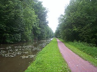
The Delaware Division of the Pennsylvania Canal, more commonly called the Delaware Canal, runs for 60 miles (97 km) parallel to the right bank of the Delaware River from the entry locks near the mouth of the Lehigh River and terminal end of the Lehigh Canal at Easton south to Bristol. At Easton, which today is the home of The National Canal Museum, the Delaware Canal also connected with the Morris Canal built to carry anthracite coal to energy-starved New Jersey industries.

Lumberville is a village on the Delaware River in Solebury Township, Bucks County, Pennsylvania, United States. It is located seven miles north of New Hope and is situated along River Road. Its ZIP Code is 18933.

The Lehigh Canal is a navigable canal that begins at the mouth of Nesquehoning Creek on the Lehigh River in the Lehigh Valley and Northeastern regions of Pennsylvania. It was built in two sections over a span of 20 years beginning in 1818. The lower section spanned the distance between Easton and present-day Jim Thorpe. In Easton, the canal met the Delaware and Morris Canals, which allowed anthracite coal and other goods to be transported further up the U.S. East Coast. At its height, the Lehigh Canal was 72 miles (116 km) long.

Delaware Canal State Park is a 830-acre (336 ha) Pennsylvania state park in Bucks and Northampton Counties in Pennsylvania. The main attraction of the park is the Delaware Canal which runs parallel to the Delaware River between Easton and Bristol.

Neshaminy State Park is a 330-acre (134 ha) Pennsylvania state park in Bensalem Township, Bucks County, Pennsylvania in the United States. Visitors to the park can catch a glimpse of the Philadelphia skyline from a hiking trail on Logan Point. The park is located at the confluence of Neshaminy Creek and the Delaware River. Neshaminy State Park is just off Interstate 95 on Pennsylvania Route 132.

The Delaware & Lehigh Canal National and State Heritage Corridor (D&L) is a 165-mile (266 km) National Heritage Area in eastern Pennsylvania in the United States. It stretches from north to south, across five counties and over one hundred municipalities. It follows the historic routes of the Lehigh and Susquehanna Railroad, Lehigh Valley Railroad, the Lehigh Navigation, Lehigh Canal, and the Delaware Canal, from Bristol northeast of Philadelphia to Wilkes-Barre in the northeastern part of the state.

The High Falls Historic District corresponds roughly to the downtown section of the hamlet of that name in Marbletown, New York, United States. It is a 21-acre (8.5 ha) area around the intersection of state highway NY 213, Main Street, Mohonk Road (Ulster County Route 6A0 and Bruceville Road just south of Rondout Creek.

The D&H Canal Co. Office, now known as the Roebling Inn, is located on Scenic Drive in Lackawaxen, Pennsylvania, United States. It is a mid-19th century wooden house in the Greek Revival architectural style.

Pursley's Ferry Historic District is a 61-acre (25 ha) historic district located along Old River Road near Church Road by the Delaware River in Holland Township, Hunterdon County, New Jersey. It was added to the National Register of Historic Places on October 8, 1980 for its significance in architecture, commerce, and transportation. The district includes 4 contributing buildings.
References
- 1 2 Rivinus, Willis M. (2004). "Guide to the Delaware Canal" (PDF).
- 1 2 MacReynolds, Geroge (1955). Place names in bucks County Pennsylvania. University of Michigan: The Bucks County Historical Society. pp. 122–123.
