Sellersville, Pennsylvania

Last updated
Sellersville, Pennsylvania
Sellersville, PA 04.JPG
Main Street
Sellersville Seal.png
Bucks County Pennsylvania Incorporated and Unincorporated areas Sellersville Highlighted.svg
Location of Sellersville in Bucks County, Pennsylvania
USA Pennsylvania location map.svg
Red pog.svg
Sellersville
Location in Pennsylvania
Usa edcp location map.svg
Red pog.svg
Sellersville
Location in the United States
Coordinates: 40°21′31″N75°18′36″W / 40.35861°N 75.31000°W / 40.35861; -75.31000
CountryUnited States
State Pennsylvania
County Bucks
Area
[1]
  Total1.17 sq mi (3.03 km2)
  Land1.14 sq mi (2.96 km2)
  Water0.03 sq mi (0.06 km2)
Elevation
381 ft (116 m)
Population
 (2010)
  Total4,249
  Estimate 
(2019) [2]
4,283
  Density3,743.88/sq mi (1,445.66/km2)
Time zone UTC-5 (Eastern (EST))
  Summer (DST) UTC-4 (EDT)
Zip Code
18960
Area code(s) 215, 267, and 445
FIPS code 42-69248
Website sellersvilleboro.org

Sellersville is a borough in Bucks County, Pennsylvania, United States. The population was 4,249 at the 2010 census. It is in the Pennridge School District.

Contents

History

Bird's eye view of Sellersville in 1894 Sellersville.gif
Bird's eye view of Sellersville in 1894

Sellersville was founded in the early 18th century. It was centered on a major road known as Bethlehem Pike that connected Philadelphia to Bethlehem and the rest of what was then far Western Pennsylvania. The town was very small and was called Sellers Tavern. Its most notable feature was a large inn. The present Washington House in Sellersville, however, was not Sellers Tavern. The town grew slowly over the years until the Industrial Revolution. In the 1860s the North Pennsylvania Railroad was built, running parallel to Bethlehem Pike: this stimulated the growth of light textile industries and brought a wave of population growth. The East Branch of the Perkiomen Creek runs through the town which connects it to an adjacent town of Perkasie. This creek was dammed in the early 20th century creating a small body of water known as Lake Lenape. Along the length of the lake a park was built on Perkasie and Sellersville lands. In the 1920s and 1930s this park housed a carousel, a roller coaster and several other amusements. The railroad brought hundreds of people from Philadelphia in the summer time, and it became a well known vacation spot for blue collar city workers.

In August 1938, Deutschhorst Country Club, a summer retreat created by the German American Bund, a Pro-Nazi organization moved to the area after purchasing a 40-acre ranch outside of the town. The group used the area as a summer camp where family functions and activities were pursued in addition to political rallies. As World War II approached, the club sought to distance itself several times from the Nazi cause in local newspapers and was reported as "almost abandoned" from a lack of use by 1940. FBI agents were reported to have been watching the club grounds and visitors were reported to have covered their license plates in order to avoid being identified as a Bund member. In September, 1939 – shortly after the start of World War II – the leader of German American Bund, Fritz Julius Kuhn, gave a speech to gathered members of the German American Bund and associated groups such as the World War I German Veteran league known as the Kyffhauser Bund, declaring that with the start of the war Adolf Hitler would "lick the world" in the new conflict. The camp would eventually be closed after the dissolution of the German American Bund on December 8, 1941 - after the Japanese attack on Pearl Harbor. [3] [4] [5]

The town was also home to the Radium Company of America, which was the largest uranium milling facility in the world at the time. A business operating under the name of the United States Gauge Company originated in Sellersville in 1904 and allegedly became a prominent manufacturer of gauges for military use, many of which were coated with radium-based paint [6] for night-time luminescence. The company later became instrumental in the production of nuclear weapons, [7] leaving behind a legacy of industrial and radioactive contamination that has been well-hidden by local, county, state, and federal government agencies for decades. [8] [9] [10] [11] [12] [13] [14] [15] [16]

Today the town is still relatively small, sandwiched in between a ridge line and the larger town of Perkasie. The center of town still runs along Bethlehem Pike which is now called Old Route 309. The Washington House has recently been restored to become an upscale restaurant. Next door to the restaurant was a livery stable, which was converted into a theater (later a movie theater) in 1894. It has since been restored, and reopened in 2001 as Sellersville Theater 1894- a popular live music venue. The creek is still dammed but only the carousel in Perkasie remains of the amusements.

The textile industry has long moved out of the area and Sellersville has become mainly a residential town for people working in the many urban centers that are only a short commute away. Grand View Hospital, Bucks County’s first hospital, has provided residents of Bucks and Montgomery counties with comprehensive healthcare services since 1913. The town is surrounded on three sides by open country and spread out housing developments. The local firehouse provides various activities throughout the year, including a carnival in the summer. The Holiday House Pool and Recreation Center becomes a hotspot for people to escape the heat during the summer as well. There are various businesses along Main Street, one being the Washington House, which provide some jobs as well, but largely the town remains a residential area. Sellersville Museum is located off Main Street in Sellersville and displays different exhibits every month.

The Teller Cigar Factory was listed on the National Register of Historic Places in 1987. [17]

Geography

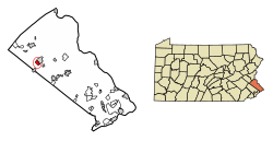
According to the U.S. Census Bureau, the borough has a total area of 1.2 square miles (3.1 km2), of which 1.2 square miles (3.1 km2) is land and 0.04 square miles (0.10 km2) (1.69%) is water. It is located in Southeastern Pennsylvania as part of Northern Bucks County (colloquially referred to as Upper Bucks) which borders Northampton and Lehigh counties.

Demographics

Historical population
CensusPop.Note
1880 490
1890 79462.0%
1900 1,24757.1%
1910 1,57226.1%
1920 1,73910.6%
1930 2,06318.6%
1940 2,1152.5%
1950 2,37312.2%
1960 2,4975.2%
1970 2,82913.3%
1980 3,14311.1%
1990 4,47942.5%
2000 4,5641.9%
2010 4,249−6.9%
2020 4,5677.5%
Sources: [18] [19] [20] [21]

As of the census [19] of 2010, there were 4,249 people living in the borough. The racial makeup of the borough was 93.6% White, 1.8% African American, 0.3% Native American, 1.0% Asian, 0.0% Pacific Islander, 1.0% from other races, and 2.3% from two or more races. Hispanic or Latino of any race were 3.4% of the population.

As of the census [19] of 2000, there were 4,564 people, 1,770 households, and 1,198 families living in the borough. The population density was 3,934.1 inhabitants per square mile (1,519.0/km2). There were 1,827 housing units at an average density of 1,574.8 per square mile (608.0/km2). The racial makeup of the borough was 97.30% White, 0.57% African American, 0.15% Native American, 0.35% Asian, 0.04% Pacific Islander, 0.48% from other races, and 1.10% from two or more races. Hispanic or Latino of any race were 1.99% of the population.

There were 1,770 households, out of which 36.8% had children under the age of 18 living with them, 53.1% were married couples living together, 11.0% had a female householder with no husband present, and 32.3% were non-families. 26.5% of all households were made up of individuals, and 5.9% had someone living alone who was 65 years of age or older. The average household size was 2.56 and the average family size was 3.13.

In the borough the population was spread out, with 27.6% under the age of 18, 8.2% from 18 to 24, 36.9% from 25 to 44, 19.1% from 45 to 64, and 8.2% who were 65 years of age or older. The median age was 34 years. For every 100 females there were 101.1 males. For every 100 females age 18 and over, there were 95.9 males.

The median income for a household in the borough was $46,500, and the median income for a family was $55,313. Males had a median income of $38,018 versus $27,056 for females. The per capita income for the borough was $19,970. About 5.4% of families and 5.2% of the population were below the poverty line, including 6.5% of those under age 18 and 5.6% of those age 65 or over.

Infrastructure

Transportation

PA 152 northbound in Sellersville 2022-10-30 14 57 44 View north along Pennsylvania State Route 152 (Main Street) just north of Diamond Street and Park Avenue in Sellersville, Bucks County, Pennsylvania.jpg
PA 152 northbound in Sellersville

As of 2020 there were 13.33 miles (21.45 km) of public roads in Sellersville, of which 3.68 miles (5.92 km) were maintained by the Pennsylvania Department of Transportation (PennDOT) and 9.65 miles (15.53 km) were maintained by the borough. [22]

Main Street serves as the main north-south road through Sellersville, becoming Bethlehem Pike to the north and south. Pennsylvania Route 152 passes through Sellersville southwest-northeast along Main Street and Park Avenue, heading northeast into Perkasie. Pennsylvania Route 309 bypasses Sellersville to the west along a freeway, with interchanges at PA 152 and Lawn Avenue providing access to Sellersville. Pennsylvania Route 563 passes east-west to the north of Sellersville. [23]

There is currently no public transportation in Sellersville. [24] Sellersville was once served by SEPTA's Bethlehem Line which provided passenger service north to Quakertown and Bethlehem and south to Philadelphia, but service ended in 1981. Restoration of train service to Quakertown has been proposed. The East Penn Railroad operates freight service through Sellersville along a branch from Telford to Quakertown along the former SEPTA tracks. [25] The Sellersville station currently serves as Borough offices.

Utilities

PPL Corporation in Allentown provides electricity to Sellersville. [26] [27] [28] Natural gas service in Sellersville is provided by UGI Utilities. [26] [29] [30] The North Penn Water Authority provides water to Sellersville, having taken over the borough's water system in 2011. [26] [31] [32] The borough provides sewer service, with sewage treated at the Pennridge Waste Water Treatment plant. [26] Trash and recycling collection in Sellersville is provided under contract by Republic Services. [33] Cable and internet service in Sellersville is provided by Verizon, Frontier Communications, and Xfinity. [26]

Health care

Grand View Health operates Grand View Hospital outside Sellersville, serving northern Bucks County. The hospital offers various services including an emergency room, Cancer Care, Orthopaedics, Pediatrics, Surgery, and Women's Health. [34]

Climate

According to the Köppen climate classification system, Sellersville has a Hot-summer, Humid continental climate (Dfa). Dfa climates are characterized by at least one month having an average mean temperature ≤ 32.0 °F (0.0 °C), at least four months with an average mean temperature ≥ 50.0 °F (10.0 °C), at least one month with an average mean temperature ≥ 71.6 °F (22.0 °C) and no significant precipitation difference between seasons. Although most summer days are slightly humid in Sellersville, episodes of heat and high humidity can occur with heat index values > 106 °F (41 °C). Since 1981, the highest air temperature was 101.5 °F (38.6 °C) on 07/22/2011, and the highest daily average mean dew point was 74.3 °F (23.5 °C) on 08/12/2016. The average wettest month is July which corresponds with the annual peak in thunderstorm activity. Since 1981, the wettest calendar day was 6.86 inches (174 mm) on 08/27/2011. During the winter months, the average annual extreme minimum air temperature is −1.0 °F (−18.3 °C). [35] Since 1981, the coldest air temperature was −12.9 °F (−24.9 °C) on 01/22/1984. Episodes of extreme cold and wind can occur with wind chill values < −12 °F (−24 °C). The average annual snowfall (Nov-Apr) is between 30 inches (76 cm) and 36 inches (91 cm). Ice storms and large snowstorms depositing ≥ 12 inches (30 cm) of snow occur once every few years, particularly during nor’easters from December through February.

Climate data for Sellersville, Elevation 328 ft (100 m), 1981-2010 normals, extremes 1981-2018
MonthJanFebMarAprMayJunJulAugSepOctNovDecYear
Record high °F (°C)70.3
(21.3)
77.8
(25.4)
85.9
(29.9)
92.7
(33.7)
94.1
(34.5)
95.3
(35.2)
101.5
(38.6)
99.2
(37.3)
96.8
(36.0)
88.1
(31.2)
80.0
(26.7)
74.8
(23.8)
101.5
(38.6)
Mean daily maximum °F (°C)38.6
(3.7)
42.0
(5.6)
50.4
(10.2)
62.6
(17.0)
72.7
(22.6)
81.3
(27.4)
85.3
(29.6)
83.7
(28.7)
76.9
(24.9)
65.3
(18.5)
54.2
(12.3)
42.8
(6.0)
63.1
(17.3)
Daily mean °F (°C)30.1
(−1.1)
32.8
(0.4)
40.4
(4.7)
51.3
(10.7)
61.2
(16.2)
70.2
(21.2)
74.6
(23.7)
73.1
(22.8)
65.7
(18.7)
54.0
(12.2)
44.3
(6.8)
34.4
(1.3)
52.8
(11.6)
Mean daily minimum °F (°C)21.5
(−5.8)
23.6
(−4.7)
30.5
(−0.8)
40.1
(4.5)
49.6
(9.8)
59.1
(15.1)
64.0
(17.8)
62.4
(16.9)
54.5
(12.5)
42.7
(5.9)
34.4
(1.3)
26.1
(−3.3)
42.5
(5.8)
Record low °F (°C)−12.9
(−24.9)
−5.3
(−20.7)
1.6
(−16.9)
16.5
(−8.6)
29.9
(−1.2)
40.2
(4.6)
46.7
(8.2)
41.4
(5.2)
34.2
(1.2)
23.0
(−5.0)
10.2
(−12.1)
−2.6
(−19.2)
−12.9
(−24.9)
Average precipitation inches (mm)3.44
(87)
2.84
(72)
3.89
(99)
4.09
(104)
4.34
(110)
4.38
(111)
4.75
(121)
3.89
(99)
4.55
(116)
4.31
(109)
3.72
(94)
3.96
(101)
48.16
(1,223)
Average relative humidity (%)67.464.460.058.662.567.968.470.771.770.769.469.666.8
Average dew point °F (°C)20.6
(−6.3)
22.1
(−5.5)
27.6
(−2.4)
37.3
(2.9)
48.3
(9.1)
59.1
(15.1)
63.5
(17.5)
63.0
(17.2)
56.3
(13.5)
44.7
(7.1)
34.9
(1.6)
25.5
(−3.6)
42.0
(5.6)
Source: PRISM [36]

Ecology

According to the A. W. Kuchler U.S. potential natural vegetation types, Sellersville would have a dominant vegetation type of Appalachian Oak (104) with a dominant vegetation form of Eastern Hardwood Forest (25). [37] The plant hardiness zone is 6b with an average annual extreme minimum air temperature of −1.0 °F (−18.3 °C). [35] The spring bloom typically begins by April 11 and fall color usually peaks by October 29.

Notable people

Notable current and former residents of Sellersville include:

Related Research Articles

<span class="mw-page-title-main">Northampton County, Pennsylvania</span> County in Pennsylvania, United States

Northampton County is a county in the Commonwealth of Pennsylvania, United States. As of the 2020 census, the population was 312,951. Its county seat is Easton. The county was formed in 1752 from parts of Bucks County. Its namesake was the county of Northamptonshire in England, and the county seat of Easton was named for Easton Neston, a country house in Northamptonshire.

<span class="mw-page-title-main">Bucks County, Pennsylvania</span> County in Pennsylvania, United States

Bucks County is a county in the Commonwealth of Pennsylvania. As of the 2020 census, the population was 646,538, making it the fourth-most populous county in Pennsylvania. Its county seat is Doylestown. The county is named after the English county of Buckinghamshire.

<span class="mw-page-title-main">Hilltown Township, Pennsylvania</span> Township in Pennsylvania, United States

Hilltown Township is a township in Bucks County, Pennsylvania, United States. The population was 15,029 at the 2010 census. Most of Hilltown is part of Pennridge School District, while a small portion in Line Lexington is part of North Penn School District.

<span class="mw-page-title-main">Newtown, Bucks County, Pennsylvania</span> Borough in Pennsylvania, United States

Newtown is a borough in Bucks County, Pennsylvania, United States. The population was 2,268 at the 2020 census. It is located just west of the Trenton, New Jersey metropolitan area, and is part of the larger Philadelphia metropolitan area. It is entirely surrounded by Newtown Township, from which it separated in 1838. State Street is the main commercial thoroughfare with wide sidewalks, shops, taverns, and restaurants.

<span class="mw-page-title-main">Perkasie, Pennsylvania</span> Borough in Pennsylvania, United States

Perkasie is a borough in Bucks County, Pennsylvania, United States. Perkasie is 21.5 miles (34.6 km) southeast of Allentown and 39.2 miles (63.1 km) north of Philadelphia.

<span class="mw-page-title-main">Quakertown, Pennsylvania</span> Borough in Pennsylvania, United States

Quakertown is a borough in Bucks County, Pennsylvania, United States. As of 2020, it had a population of 9,359. The borough is 15 miles (24 km) south of Allentown and Bethlehem and 40 miles (64 km) north of Philadelphia, making Quakertown a border town of both the Delaware Valley and Lehigh Valley metropolitan areas.

<span class="mw-page-title-main">West Rockhill Township, Pennsylvania</span> Township in Pennsylvania, United States

West Rockhill Township is a township in Bucks County, Pennsylvania, United States. The original Rockhill Township was established in 1740 and was divided into East Rockhill and West Rockhill Townships in 1890. The population was 5,256 at the 2010 census. West Rockhill Township is part of Pennridge School District.

<span class="mw-page-title-main">Lansdowne, Pennsylvania</span> Borough in Pennsylvania, United States

Lansdowne is a borough in Delaware County, Pennsylvania, United States, located 6 miles (10 km) southwest of Center City Philadelphia. It was named for the Marquess of Lansdowne. As of the 2010 census, the borough had a population of 10,620.

<span class="mw-page-title-main">Hatfield, Pennsylvania</span> Borough in Pennsylvania, United States

Hatfield is a borough in Montgomery County, Pennsylvania, United States. The population was 3,290 at the time of the 2010 census. It is part of the North Penn Valley region that is centered around the borough of Lansdale. The borough is surrounded by Hatfield Township.

<span class="mw-page-title-main">Hatfield Township, Pennsylvania</span> Township in Pennsylvania, United States

Hatfield Township is a township in Montgomery County, Pennsylvania, United States. The population was 17,249 at the 2010 census. It is part of the North Penn Valley region which is centered around the borough of Lansdale.

<span class="mw-page-title-main">Montgomery Township, Montgomery County, Pennsylvania</span> Township in Pennsylvania, United States

Montgomery Township is a township in Montgomery County, Pennsylvania. It is the location of the Montgomery Mall, a regional shopping mall serving the Route 309 corridor of the Philadelphia suburbs. Much of Montgomery Township's development is suburban in character, with newer tract houses and strip shopping centers. Homes in Montgomery Township have North Wales and Lansdale addresses, but businesses that are located within the township boundaries are given the Montgomeryville ZIP Code. The township is in the North Penn School District and is part of the North Penn Valley region that is centered around the borough of Lansdale.

<span class="mw-page-title-main">Souderton, Pennsylvania</span> Borough of Pennsylvania, US

Souderton is a borough in Montgomery County, Pennsylvania, United States. The population was 7,246 in 2022 according to the Census Bureau.

<span class="mw-page-title-main">Hellertown, Pennsylvania</span> Place in Pennsylvania, United States

Hellertown is a borough in Northampton County, Pennsylvania. Its population was 6,131 at the 2020 census. Hellertown is part of the Lehigh Valley metropolitan area, which had a population of 861,899 and was the 68th-most populous metropolitan area in the U.S. as of 2020.

<span class="mw-page-title-main">Telford, Pennsylvania</span> Borough in Pennsylvania, United States

Telford is a borough in Bucks and Montgomery counties in the U.S. state of Pennsylvania. The population was 4,872 at the time of the 2010 census. Of this, 2,665 were in Montgomery County, and 2,207 were in Bucks County.

<span class="mw-page-title-main">Liberty Bell Trail</span>

The Liberty Bell Trail is a suburban rail trail under construction in southeastern Pennsylvania.

<span class="mw-page-title-main">Bethlehem Pike</span>

Bethlehem Pike is a historic 42.21 mi (67.93 km) long road in the U.S. state of Pennsylvania that connects Philadelphia and Bethlehem, Pennsylvania. It began as a Native American path called the Minsi Trail which developed into a colonial highway called the King's Road in the 1760s. Most of the route later became part of U.S. Route 309, now Pennsylvania Route 309.

<span class="mw-page-title-main">Pennsylvania Route 152</span> State highway in Pennsylvania, US

Pennsylvania Route 152 (PA 152) is a 25.3-mile-long (40.7 km) state highway located in the U.S. state of Pennsylvania. The route travels north–south from an interchange with PA 309 located in the Cedarbrook neighborhood of Cheltenham Township in Montgomery County north to another interchange with PA 309 located northeast of Telford in Bucks County. PA 152 is known as Limekiln Pike for most of its length. From the southern terminus, the route passes through suburban areas to the north of Philadelphia, serving Dresher, Maple Glen, and Chalfont. North of Chalfont, PA 152 runs through rural suburbs of Philadelphia before reaching Silverdale. Past here, the road continues northwest through Perkasie, where it turns southwest and passes through Sellersville before reaching its northern terminus.

<span class="mw-page-title-main">Pennsylvania Route 413</span> State highway in Bucks County, Pennsylvania, United States

Pennsylvania Route 413 is a 31-mile-long (50 km), north–south state highway in Bucks County, Pennsylvania. The route runs from the New Jersey state line on the Burlington–Bristol Bridge over the Delaware River outside Bristol, where the road continues as Route 413 into New Jersey, north to PA 611 in Bedminster Township. The route passes through the lower and central portions of Bucks County, serving Bristol, Levittown, Langhorne, Newtown, and Buckingham. The route intersects U.S. Route 13 and Interstate 95 (I-95) near Bristol, I-295 near Penndel, US 1 in Langhorne Manor, and US 202 in Buckingham.

<span class="mw-page-title-main">Quakertown station</span> Historic train station

The Quakertown Passenger and Freight Station is a historic train station and freight depot located at Quakertown, Bucks County, Pennsylvania. The two buildings were designed by Wilson Bros. & Company in 1889 and built by Cramp and Co. for the Philadelphia and Reading Railroad in 1902. The passenger station is constructed of dark Rockhill granite and Indiana limestone and is in a Late Victorian style. It is 1+12 stories tall and measures 25 feet wide by 97 feet 6 inches, long. It has a hipped roof with an eight-foot overhang. The freight station is a 1+12-story, rectangular stone block building measuring 128 by 30 feet. Also on the property is a large crane that was used for freight movement. The Quakertown station had passenger rail service along the Bethlehem Line to Bethlehem and Philadelphia until July 27, 1981, when SEPTA ended service on all its intercity diesel-powered lines. SEPTA still owns the line and leases it to the East Penn Railroad. Other towns, stations, and landmarks on the Bethlehem Line are Perkasie, Pennsylvania, Perkasie Tunnel, and Perkasie station.

<span class="mw-page-title-main">Perkasie station</span>

Perkasie is a defunct train station formerly operated by SEPTA Regional Rail in Perkasie, Pennsylvania, USA. It closed on July 29, 1981, after SEPTA cancelled its diesel train routes.

References

  1. "2019 U.S. Gazetteer Files". United States Census Bureau. Retrieved July 28, 2020.
  2. "Population and Housing Unit Estimates". United States Census Bureau. May 24, 2020. Retrieved May 27, 2020.
  3. "Nazi Party Sympathizers in Philadelphia Before the War (Part 1) | Historical Society of Pennsylvania".
  4. "Nazi Party Sympathizers in Philadelphia Before the War (Part 2) | Historical Society of Pennsylvania".
  5. "Cloak and dagger mailbag – Bucks County Adventures".
  6. Ferry, Joseph P., “DEP to Begin Cleanup in Sellersville; 3,000 Cubic Yards of Soil Contaminated by Radioactivity Will Be Excavated in a $1.7 Million Project,” Allentown Morning Call, August 16, 1996, http://articles.mcall.com/1996-08-16/news/3105359_1_radium-contaminated-goldberg.
  7. Etheridge, A.C., "Engineer Recalls First Visit to White Room," Perkasie News Herald, October 28, 1992.
  8. Duhigg, C., Ericson, M., Evans, T., Hamman, B., Willis, D. “Toxic Waters.” New York Times. December 16, 2009. Published testing data from Sellersville Boro Water Works obtained by the Environmental Working Group exposed serious industrial contamination of Sellersville's municipal water supply that had been removed from all public disclosure provided by Sellersville Borough, the Bucks County Department of Health, the Pennsylvania Department of Environmental Protection, and the United States Environmental Protection Agency throughout each entity's oversight of said water supplier.
  9. Halliburton Nuclear Utility Services Environmental Corporation. “Final Screening Site Inspection – Inactive Landfill – EPA Work Assignment No. 37-34-3JZZ.” June 16, 1992. Retrieved December 19, 2014 via FOIA Appeal #EPA-HQ-2014-010618 submitted on September 22, 2014, mandating the provision of information requested initially in FOIA Request #EPA-R3-2014-006974 submitted on June 2, 2014. A portion of said report was provided upon appeal...with 58 of its 60 pages fully redacted: https://www.slideshare.net/secret/5sydRQLjXyj4cN .
  10. Pennsylvania Department of Environmental Protection. Commonwealth of Pennsylvania: Department of Environmental Resources vs. PTI. p. 28-29, 67. Bucks County Court of Common Pleas No. 94-007754-15-5. 17 October 1994. Retrieved 2012 via Freedom of Information Act Request. Litigation regarding high-level radiation contamination in Sellersville, Pennsylvania which references the aforesaid Halliburton “Final Screening Site Inspection – Inactive Landfill” report that was redacted in full by the USEPA upon its provision in appeal. Page 28-29 of the legal transcript indicates that said report was to be withheld from inclusion in the court's records: “I'm not going to have this marked for the record, Your Honor, if you don't mind. I'm not sure we want it in the record;” Page 67 indicates that radioactive “hot spots” are located “all over Sellersville.” The aforesaid Halliburton “Final Screening Site Inspection – Inactive Landfill” report designates the location of these areas. This report continues to be withheld from the general public, having been 1) omitted from Bucks County court records, 2) eliminated from the PADEP's FOIA request provision, 3) deemed denied by Sellersville Borough in a 3/2014 FOIA request, 4) deemed denied by the USEPA in a 6/2014 FOIA request, and 5) provided in part in subsequent USEPA FOIA requests/appeals with 58 of its 60 pages fully redacted (blackened-out) and absent the information included in N.R.A. 1-4D2-167 respectively. The USEPA issued a letter on 4/1/2016 to reiterate that said redaction was made to protect “geological and geophysical information and data, including maps regarding wells” from public disclosure, and to advise that the rest of the appeal pertaining to radiation issues in Sellersville, Pennsylvania was denied due to various regulations protecting the disclosure of confidential business information (“CBI”), government contract information, and information about individuals in “medical and similar files.”
  11. Pennsylvania Department of Environmental Protection. Administrative Record – AMETEK U.S. Gauge Division, Sellersville, PA. Reporting shows the drilling of groundwater monitoring wells per the directive of the USEPA at AMETEK Plant #2 as bypassing the confined aquifer containing the underground chemical plume and extracting from the confined aquifer beneath where the chemical plume contamination is not present. This creates testing results within “acceptable” range for human health/exposure and is inclusive of wells drilled by AMETEK on the grounds of an adjacent residential subdivision. Retrieved 2012 via Freedom of Information Act Request. Reference page 18: https://www.slideshare.net/secret/9swclB48uWVxl3 .
  12. Pennsylvania Department of Environmental Protection. Internal Memorandum (excerpt) dated January 22, 2014 acknowledging radiation issues at AMETEK Plant #2, Sellersville, PA. Said issues continue to be denied by Sellersville Borough, Bucks County, and the United States Environmental Protection Agency. Retrieved November 20, 2014 via Freedom of Information Act Request. Reference page 1, highlighted: https://www.slideshare.net/secret/BOVOX3S34Yf7jR .
  13. United States Census Bureau, 1920. “Home Farm” is listed as the industry for individuals residing at 215 Diamont Street in Sellersville Borough, Bucks County, Pennsylvania. Said description was written over the words “Radium Plant” on Sheet 2A, Line 14 of this federal document. Reference addendum 7, page 8: http://www.slideshare.net/Ax318960/freedom-of-information-request-sellersville-borough-1816 .
  14. “Sellersville Proud of Its Fame as Home of Big Plant that Now Produces Radium.” Author Unknown. Trenton Evening Times. January 8, 1914. Additional information and newspaper citations: http://www.slideshare.net/Ax318960/trenton-evening-times-january-8-1914 .
  15. “U.S. Material Safety Data Sheet - AMETEK U.S. Gauge, Sellersville, PA.” United States National MSDS Repository. Retrieved May 2, 2016. A Material Safety Data Sheet (MSDS) is an informational document of a hazardous chemical or product that a manufacturer has produced at its facility which describes its physical and chemical properties, hazards, and recommended precautions for handling, storage and disposal. A 2016 search of national MSDS archives revealed a previously unseen MSDS for product “AW1 7-8 2OUF2,” otherwise known as “Radium 226,” with the producer/manufacturer for said product listed as “AMETEK U.S. Gauge, 900 Clymer Ave., Sellersville, PA.” Reference: http://www.slideshare.net/Ax318960/ametek-us-gauge-manufacturer-of-radium-226 .
  16. “WPA Real Estate Survey Reveals Property Line Discrepancies.” Author and Newspaper Unknown. January 24, 1936. Article obtained from the Mercer Museum Library, Doylestown, PA. Additional information: http://www.slideshare.net/Ax318960/removed-posts-and-final-commentary .
  17. "National Register Information System". National Register of Historic Places . National Park Service. July 9, 2010.
  18. "Census of Population and Housing". U.S. Census Bureau. Retrieved 11 December 2013.
  19. 1 2 3 "U.S. Census website". United States Census Bureau . Retrieved 2008-01-31.
  20. "Incorporated Places and Minor Civil Divisions Datasets: Subcounty Resident Population Estimates: April 1, 2010 to July 1, 2012". Population Estimates. U.S. Census Bureau. Archived from the original on 11 June 2013. Retrieved 11 December 2013.
  21. "Census 2020".
  22. "Sellersville Borough map" (PDF). PennDOT. Retrieved March 11, 2023.
  23. Bucks County, Pennsylvania Highway Map (PDF) (Map). PennDOT. 2015. Retrieved January 10, 2016.
  24. "Transit Routes in Bucks County". TMA Bucks. Retrieved March 9, 2020.
  25. East Penn Railroad Map (PDF) (Map). DeskMap Systems. 2011. Retrieved December 12, 2011.
  26. 1 2 3 4 5 "Utilities". Sellersville Borough. Retrieved February 22, 2018.
  27. "Service Area". PPL Electric Utilities. Retrieved August 20, 2017.
  28. "General Tariff" (PDF). PPL Electric Utilities. June 20, 2017. p. 4. Retrieved August 20, 2017.
  29. "Geographic Footprint". UGI. Retrieved October 4, 2017.
  30. "Gas Tariff" (PDF). UGI Utilities. July 7, 2017. pp. 5–6. Retrieved October 10, 2017.
  31. "Service Area". North Penn Water Authority. Retrieved October 11, 2017.
  32. "History". North Penn Water Authority. Retrieved February 22, 2018.
  33. "Garbage & Recycling". Sellerville Borough. Retrieved February 22, 2018.
  34. "Our Services". Grand View Health. Retrieved February 22, 2017.
  35. 1 2 "USDA Interactive Plant Hardiness Map". United States Department of Agriculture . Retrieved October 17, 2019.
  36. "PRISM Climate Group, Oregon State University" . Retrieved October 17, 2019.
  37. "U.S. Potential Natural Vegetation, Original Kuchler Types, v2.0 (Spatially Adjusted to Correct Geometric Distortions)" . Retrieved October 17, 2019.
  38. Wise, Brian. "Eclectic Sounds of New Jersey, Echoing From Coast to Coast", The New York Times , February 8, 2004. Accessed November 22, 2007.
  39. Tannenwald, Jonathan (4 March 2023). "Bucks County native Marissa Sheva plays for the Republic of Ireland women's soccer team". The Philadelphia Inquirer . Retrieved 8 April 2023.