Related Research Articles

Berrien Township is a civil township of Berrien County in the U.S. state of Michigan. As of the 2010 census, the township population was 5,084.
Bryant is a census-designated place (CDP) in Snohomish County, Washington, United States. The population was 1,870 at the 2010 census.
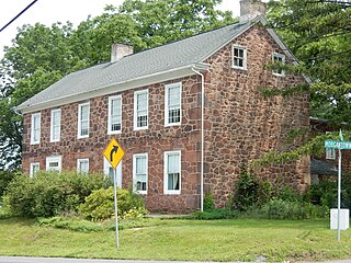
Palisades High School is a public high school in Kintnersville, Bucks County, Pennsylvania, in the United States. It is the only public high school that serves the Palisades School District, with students coming from Tinicum, Nockamixon, Springfield, Durham, and Bridgeton Townships and the borough of Riegelsville.
Barto is an unincorporated community situated between the boroughs of Bally and Bechtelsville in Washington Township, Berks County, Pennsylvania, United States. Barto is part of the Delaware Valley, located near the border with Montgomery County. Its zip code is 19504 and the West Branch Perkiomen Creek flows southeast through it to join the Perkiomen Creek in the Green Lane Reservoir.
Plowville is an unincorporated area of Robeson Township, Berks County, Pennsylvania, United States. it is located on Pennsylvania Route 10, just east of Interstate 176. Its zip code is 19540 and the community is served by the Twin Valley School District. The most recognizable landmark is Plow Church.
Limeport is a small unincorporated community on the Saucon Creek in Lower Milford Township and Upper Saucon Township in Lehigh County, Pennsylvania. It is part of the Lehigh Valley, which has a population of 861,899 and is the 68th-most populous metropolitan area in the U.S., as of the 2020 census.

Boyers Junction is an unincorporated community in Berks County, Pennsylvania, United States. The village is located in the southwestern Rockland Township, near the Ruscombmanor Township line. It is also southeast of Fleetwood and south of Lyons. It is drained by the Bieber Creek southward into the Manatawny Creek, a tributary of the Schuylkill River. The Brandywine Heights Area School District serves Boyers Junction, which uses the Fleetwood zip code of 19522.
Eckville is an unincorporated community in far northern Berks County, Pennsylvania, United States. The town is located in an agricultural zone at the base of Blue Mountain, in northwestern Albany Township. Eckville is served by the Kutztown Area School District, and is approximately 17 miles (27 km) from the high school. It is near the head of the Pine Creek, which flows east-southeastward to the Maiden Creek.
Scarlets Mill is an unincorporated community in Robeson Township, Berks County, Pennsylvania, United States. The Twin Valley School District serves the village, whose zip code is 19508. Scarlets Mill is also located up Haycreek Road from the nearby village of Geigertown.
Landis Store is a village in District Township, Berks County, Pennsylvania, United States. It is drained by the West Branch Perkiomen Creek into the Perkiomen Creek in the Green Lane Reservoir. It is split between the Alburtis zip code of 18011, the Barto zip code of 19504, and the Boyertown zip code of 19512.

Spinnerstown is a census-designated place in Milford Township, Bucks County, Pennsylvania, United States. It is located just northwest of the Quakertown interchange of I-476 with Route 663. As of the 2010 census, the population was 1,826 residents.
Normal Square is a village in western Mahoning Township, Carbon County, Pennsylvania on the edge of Schuylkill County located on Route 443. The Mahoning Creek flows through it eastward to the Lehigh River. The community uses the Lehighton zip code of 18235 and is served by the Mantzville (386) exchange in area code 570.
Shelly is an unincorporated community in northwestern Richland Township, Bucks County, Pennsylvania, United States. The community is located on the Tohickon Creek and Pennsylvania Route 309. It uses the Quakertown ZIP Code of 18951.
The elevation is 169 meters (554 ft.).
Flicksville is a village located in Northampton County, Pennsylvania. It is located 75 miles (121 km) west of New York City and is part of the Lehigh Valley metropolitan area, which had a population of 861,899 and was the 68th-most populous metropolitan area in the U.S. as of the 2020 census.
Elephant is an unincorporated community in Bedminster Township, Bucks County, Pennsylvania, United States, on the southeastern side of Lake Nockamixon. It is two miles northeast of the junction of Pennsylvania Routes 313 and 563. It is also a four building town, which includes a barn that has collapsed It is served by the Perkasie post office, which uses the Zip Code of 18944.
Warwick is an unincorporated community in northwestern Chester County, Pennsylvania, United States. It is located in Warwick Township just west of its municipal building. Routes 23 and 345 meet in the village, which serves as a gateway to French Creek State Park. Warwick is drained by the French Creek eastward into the Schuylkill River. It is served by the Elverson post office, which uses the zip code of 19520.
Ashfield is an unincorporated community in East Penn Township, Carbon County located south of Lehighton and west of Bowmanstown on Route 895 at the northern foot of Blue Mountain. The Lizard Creek flows east through Ashfield into the Lehigh River. Although the village has its own post office with the zip code of 18212, some residents are served by the Lehighton post office, Zip Code 18235.
Unionville is a suburban community in the Delaware Valley located on Pennsylvania Route 309. It is mainly in Hatfield Township, Montgomery County but also in Hilltown Township, Bucks County, Pennsylvania, United States.
Clamtown is an unincorporated community on Route 443 in West Penn Township, Schuylkill County, Pennsylvania, United States, approximately five miles south of Tamaqua. The Little Schuylkill River forms its natural northern and western boundaries and separates it from Walker Township. It is split between the post offices of New Ringgold and Tamaqua, with the zip codes of 17960 and 18252, respectively. Clamtown is in Area Code 570 served by the 386 exchange.
Center Point is an unincorporated community in Worcester Township, Montgomery County, Pennsylvania, United States at the junction of Routes 73 and 363. It is drained by the Zacharias Creek westward into the Skippack Creek, a tributary of the Perkiomen Creek. The community is served by the Methacton School District and by the Collegeville, Lansdale, and Norristown post offices, with the zip codes of 19426, 19446, and 19403, respectively.
References
Places adjacent to Harrow, Pennsylvania | ||||||||||||||||
|---|---|---|---|---|---|---|---|---|---|---|---|---|---|---|---|---|
| ||||||||||||||||
40°29′28″N75°10′28″W / 40.49111°N 75.17444°W

| | This Bucks County, Pennsylvania state location article is a stub. You can help Wikipedia by expanding it. |