Fairless Hills, Pennsylvania

Last updated
Fairless Hills
Fairless Hills, PA.jpg
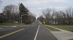
Intersection of Trenton Road and Canterbury Road
USA Pennsylvania location map.svg
Red pog.svg
Fairless Hills
Location of Fairless Hills in Pennsylvania
Usa edcp location map.svg
Red pog.svg
Fairless Hills
Fairless Hills (the United States)
Coordinates: 40°10′44″N74°51′11″W / 40.17889°N 74.85306°W / 40.17889; -74.85306 Coordinates: 40°10′44″N74°51′11″W / 40.17889°N 74.85306°W / 40.17889; -74.85306
CountryUnited States
StatePennsylvania
County Bucks
Township Falls Township
Area
[1]
  Total1.96 sq mi (5.07 km2)
  Land1.94 sq mi (5.03 km2)
  Water0.01 sq mi (0.03 km2)
Elevation
108 ft (33 m)
Population
 (2020) [2]
  Total9,041
  Density4,650.72/sq mi (1,795.98/km2)
Time zone UTC-5 (EST)
  Summer (DST) UTC-4 (EDT)
ZIP Code
19030
Area codes 215, 267 and 445
FIPS code 42-24712

Fairless Hills is a census-designated place (CDP) in Bucks County, Pennsylvania, United States. The CDP is located within c. The population was 9,046 at the 2020 census. [2] That is up from 8,466 at the 2010 census. [3]

Contents

History

Fairless Hills as it is known today began in 1951, when developer Danherst Corporation began erecting prefabricated homes built by Gunnison Magichomes, Inc. Gunnison was a wholly owned subsidiary of U.S. Steel. The development was financed by U.S. Steel with a loan of $50 million. It was named in honor of Benjamin Fairless, then president of U.S. Steel, which operated the "Fairless Works" plant which employed most of Fairless Hills' homeowners at the time. [4]

The Sotcher Farmhouse was listed on the National Register of Historic Places in 1977. [5]

Geography

Fairless Hills is located at 40°10′44″N74°51′11″W / 40.17889°N 74.85306°W / 40.17889; -74.85306 (40.178909, -74.853044). [6]

According to the United States Census Bureau, the CDP has a total area of 1.9 square miles (4.9 km2), of which 0.52% is water. Its climate is humid subtropical (Cfa). Average monthly temperatures range from 32.3 °F in January to 76.8 °F in July. [7] The local hardiness zone is 7a.

Some later developers of Fairless Hills designated several sections, or neighborhoods, such as Heddington, Drexelwood, and Fairbridge North.

Demographics

Historical population
CensusPop.Note
1990 9,026
2000 8,365−7.3%
2010 8,4661.2%
2020 9,0416.8%
[8] [2]

As of the 2010 census, Fairless Hills was 85.2% White, 3.7% Black or African American, 0.1% Native American, 5.6% Asian, 0.1% some other race, and 1.6% were two or more races. 3.6% were of Hispanic or Latino ancestry. 8.4% of the population were foreign-born. [9]

As of the 2000 census, there were 3,220 households, out of which 33.0% had children under the age of 18 living with them, 54.0% were married couples living together, 11.8% had a female householder with no husband present, and 29.8% were non-families. 25.9% of all households were made up of individuals, and 11.2% had someone living alone who was 65 years of age or older. The average household size was 2.59 and the average family size was 3.15.

In the CDP, the population was spread out, with 24.8% under the age of 18, 7.1% from 18 to 24, 31.2% from 25 to 44, 22.5% from 45 to 64, and 14.3% who were 65 years of age or older. The median age was 37 years. For every 100 females, there were 90.8 males. For every 100 women age 18 and over, there were 88.2 men.

The median income for a household in the CDP was $45,424, and the median income for a family was $57,190. Men had a median income of $38,767 versus $31,519 for women. The per capita income for the CDP was $21,111. About 2.7% of families and 5.6% of the population were below the poverty line, including 4.9% of those under age 18 and 8.0% of those age 65 or over.

Related Research Articles

<span class="mw-page-title-main">Mission Hills, Santa Barbara County, California</span> Census-designated place in the U.S. state of California

Mission Hills is a census-designated place (CDP) in Santa Barbara County, California, a short distance north of Lompoc on Highway 1. The population was 3,576 at the 2010 census, up from 3,142 at the 2000 census.

Blue Hills is a community in Hartford County, Connecticut, encompassing the northwest corner of the city of Hartford and the southeast corner of the town of Bloomfield. The Bloomfield portion is listed by the U.S. Census Bureau as a census-designated place (CDP), with a population of 2,762 at the 2020 census.

<span class="mw-page-title-main">Okahumpka, Florida</span> Census-designated place in Florida

Okahumpka is an unincorporated community and census-designated place (CDP) in Lake County, Florida, United States. The population was 267 at the 2010 census. It is part of the Orlando–Kissimmee Metropolitan Statistical Area.

<span class="mw-page-title-main">Pleasant Hills, Maryland</span> Census-designated place in Maryland, United States

Pleasant Hills is a census-designated place (CDP) in Harford County, Maryland, United States. The population was 3,379 at the 2010 census, up from 2,851 in 2000. There is no post office with the designation "Pleasant Hills"; most of the residents have either Fallston or Kingsville addresses and consider themselves as belonging to those communities.

<span class="mw-page-title-main">Greentree, New Jersey</span> Census-designated place in New Jersey, United States

Greentree is an unincorporated community and census-designated place (CDP) located within Cherry Hill Township, in Camden County, New Jersey, United States. As of the 2010 United States Census, the CDP's population was 11,367.

<span class="mw-page-title-main">Princeton North, New Jersey</span> Unincorporated community in New Jersey, United States

Princeton North, also known as North Princeton, is an unincorporated community that is located in Princeton, in Mercer County, New Jersey, United States. As of the 2000 Census, the CDP population was 4,528. While the area was categorized as a census-designated place in the 2000 Census, the CDP status was eliminated by the United States Census Bureau as of the 2010 Census. The community is located in what was formerly Princeton Township.

<span class="mw-page-title-main">Rock Hill, New York</span> CDP in New York, United States

Rock Hill is a hamlet in Sullivan County, New York, United States. At the 2010 census the population was 1,742.

<span class="mw-page-title-main">Orchard Hills, Pennsylvania</span> Census-designated place in Pennsylvania, United States

Orchard Hills is a census-designated place (CDP) in Armstrong County, Pennsylvania, United States. The population was 1,952 at the 2010 census.

<span class="mw-page-title-main">West Hills, Pennsylvania</span> Census-designated place in Pennsylvania, United States

West Hills is a census-designated place (CDP) in Armstrong County, Pennsylvania, United States. The population was 1,263 at the 2010 census.

Flying Hills is a census-designated place (CDP) in Cumru Township, Berks County, Pennsylvania. The population was 2,568 as of the 2010 census.

<span class="mw-page-title-main">Newtown Grant, Pennsylvania</span> Census-designated place in Pennsylvania, United States

Newtown Grant is a census-designated place (CDP) in Bucks County, Pennsylvania, United States. The population was 3,620 at the 2010 census.

Village Shires is a community within Northampton Township, Bucks County in the U.S. state of Pennsylvania. It is defined by the U.S. Census Bureau as a census-designated place (CDP) for statistical purposes and does not have any legal status as a separately incorporated municipality. The population was 3,949 at the 2010 census.

<span class="mw-page-title-main">Woodbourne, Pennsylvania</span> Census-designated place in Pennsylvania, United States

Woodbourne is a census-designated place (CDP) in Bucks County, Pennsylvania, United States. The population was 3,851 at the 2010 census.

<span class="mw-page-title-main">Woodside, Pennsylvania</span> Census-designated place in Pennsylvania, United States

Woodside is a census-designated place (CDP) in Bucks County, Pennsylvania, United States. The population was 2,425 at the 2010 census.

<span class="mw-page-title-main">Spring Hill, Pennsylvania</span>

Spring Hill is a census-designated place (CDP) in Cambria County, Pennsylvania, United States. The population was 839 at the 2010 census, down from 970 at the 2000 census.

<span class="mw-page-title-main">Delano, Pennsylvania</span> CDP in Pennsylvania, United States

Delano is a census-designated place (CDP) in Schuylkill County, Pennsylvania, United States. The population was 377 at the 2000 census.

McKeansburg is a census-designated place (CDP) in Schuylkill County, Pennsylvania, United States. The population was 155 at the 2000 census.

Summit Station is a census-designated place (CDP) in Schuylkill County, Pennsylvania, United States. The population is 174 as of the 2010 census.

<span class="mw-page-title-main">Mineralwells, West Virginia</span> CDP in West Virginia, United States

Mineralwells, also known as Mineral Wells, is a census-designated place (CDP) in Wood County, West Virginia, United States. It is part of the Parkersburg-Marietta-Vienna, WV-OH Metropolitan Statistical Area. The population was 1,950 at the 2010 census.

<span class="mw-page-title-main">Gardiner (CDP), New York</span> CDP in New York, United States

Gardiner is a hamlet in Ulster County, New York, United States. The population was 952 at the 2020 census.

References

  1. "ArcGIS REST Services Directory". United States Census Bureau. Retrieved October 12, 2022.
  2. 1 2 3 "Census Population API". United States Census Bureau. Retrieved Oct 12, 2022.
  3. "Race, Hispanic or Latino, Age, and Housing Occupancy: 2010 Census Redistricting Data (Public Law 94-171) Summary File (QT-PL), Fairless Hills CDP, Pennsylvania". United States Census Bureau . Retrieved August 11, 2011.
  4. "Fairless Hills", Living Places. Last accessed on March 28, 2006.
  5. "National Register Information System". National Register of Historic Places . National Park Service. July 9, 2010.
  6. "US Gazetteer files: 2010, 2000, and 1990". United States Census Bureau. 2011-02-12. Retrieved 2011-04-23.
  7. "PRISM Climate Group, Oregon State U".
  8. http://www.dvrpc.org/data/databull/rdb/db82/appedixa.xls [ dead link ]
  9. "Census 2010: Philadelphia gains, Pittsburgh shrinks in population". USA Today . Archived from the original on 2011-03-14.