
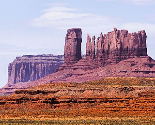
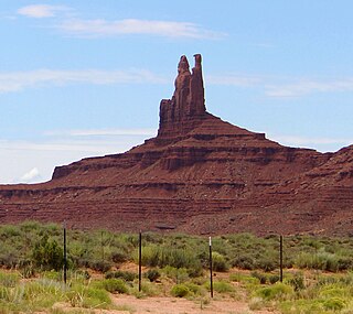
The Three Gossips is a 4,700-foot-elevation (1,433-meter) sandstone pillar in Grand County, Utah, United States.

Eagle Mesa is a 6,624-foot-elevation (2,019-meter) summit in San Juan County, Utah, United States.
Castle Rock is a 6,340-foot-elevation (1,932-meter) summit in San Juan County, Utah, United States.
King-on-his-Throne is a 6,165-foot-elevation (1,879-meter) summit in San Juan County, Utah, United States.

Stagecoach is a 6,302-foot-elevation (1,921-meter) summit in San Juan County, Utah, United States.

Castle Butte is a 5,700-foot-elevation (1,737-meter) summit in San Juan County, Utah, United States.

Rooster Butte is a 5,145-foot-elevation (1,568-meter) summit in San Juan County, Utah, United States.

De Gaulle and His Troops is a 5,540-foot-elevation (1,689-meter) summit in San Juan County, Utah, United States.

Argon Tower is a 4,750-foot-elevation (1,448-meter) pillar in Grand County, Utah. It is located within Arches National Park and like many of the rock formations in the park, Argon Tower is composed of Entrada Sandstone. The tower is 260 feet tall, and topographic relief is significant as the summit rises 450 feet vertically above the Park Avenue Trail in 400 feet laterally. Precipitation runoff from Argon Tower drains to the nearby Colorado River via Courthouse Wash. This landform was shown briefly in the opening scene credits of the 1989 American action-adventure film Indiana Jones and the Last Crusade.
Three Penguins is a 4,488-foot-elevation (1,368-meter) summit in Grand County, Utah, United States.

Tower of Babel is a 4,655-foot-elevation (1,419-meter) summit in Grand County, Utah. It is located within Arches National Park and like many of the rock formations in the park, it is composed of Entrada Sandstone. The tower is 500 feet tall, and topographic relief is significant as the summit rises 500 feet vertically above the main park road in approximately 200 feet laterally. Precipitation runoff from Tower of Babel drains to the nearby Colorado River via Courthouse Wash. This landform's descriptive toponym has been officially adopted by the United States Board on Geographic Names. This landform was shown briefly in the opening scene of the 1989 American action-adventure film Indiana Jones and the Last Crusade.

Queen Nefertiti Rock is a 4,741-foot-elevation (1,445-meter) pillar in Grand County, Utah. The feature is located within Arches National Park and like many of the rock formations in the park, Queen Nefertiti Rock is composed of Entrada Sandstone. Topographic relief is significant as the summit rises 400 feet above the Park Avenue Trail in 0.1 mile. Precipitation runoff from Queen Nefertiti Rock drains to the nearby Colorado River via Courthouse Wash. This landform's descriptive toponym has been officially adopted by the United States Board on Geographic Names, and is so named because the feature resembles the head of Queen Nefertiti.

Cottontail Tower is a 5,980-foot-elevation (1,823-meter) pillar in Grand County, Utah, United States.

Ancient Art is a 5,420-foot-elevation (1,652-meter) pillar in Grand County, Utah, United States.

Sheep Rock is a 4,564-foot-elevation (1,391-meter) pillar in Grand County, Utah. It is located within Arches National Park and like many of the rock formations in the park, it is composed of Entrada Sandstone, specifically the Slick Rock Member overlaying the Dewey Bridge Member. The tower is 440 feet tall, and is approximately 0.15 mile from the main park road. Sheep Rock is believed to be a remnant abutment of an ancient fallen arch. Precipitation runoff from Sheep Rock drains to the nearby Colorado River via Courthouse Wash. This landform's descriptive toponym has been officially adopted by the United States Board on Geographic Names.

Queen Victoria Rock is a 4,780-foot-elevation (1,457-meter) pillar in Grand County, Utah, United States.

Jello Tower is a 4,510-foot-elevation (1,375-meter) pillar in Grand County, Utah, United States.

The Candelabrum is a 4,700-foot-elevation (1,433-meter) pillar in Grand County, Utah, United States.

Mars Hotel is a 4,635-foot-elevation (1,413-meter) summit in Grand County, Utah, United States.

Marching Men is an area of pillars in Grand County, Utah, United States.


