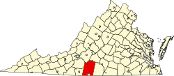
Tightsqueeze is an unincorporated community in the center of Pittsylvania County, Virginia, United States. It is included in the Danville, Virginia Metropolitan Statistical Area.
The community of Tightsqueeze got its name due to the construction of two buildings close to a road that connected Chatham and Danville during the 19th century. In 1870, W. H. Colbert built his general store close enough to the road that women could go straight from their carriages to the store without getting muddy or dusty. [1]
Soon, another merchant, Isaiah Giles, built a blacksmith-wheelwright shop directly across the road from the general store. It, too, was on the road's edge. Due to the closeness of the two buildings, buggies and wagons had to slow down as they passed between the two buildings. Thus, individuals were told to slow down for the "tight squeeze" where the two stores were located.
As related by Virginia journalist Guy Friddell in his book What Is It About Virginia?, at one point, the Pittsylvania County Board of Supervisors changed the name of Tightsqueeze to "Fairview." However, after public protest, the name of Tightsqueeze was restored. It has frequently been noted on lists of unusual place names. [2] [3] [4]
Pittsylvania County is a county located in the Commonwealth of Virginia. As of the 2020 United States Census, the population was 60,501. Chatham is the county seat.
Rocky Mount is a town in and the county seat of Franklin County, Virginia, United States. The town is part of the Roanoke Metropolitan Statistical Area, and had a population of 4,903 as of the 2020 census. It is located in the Roanoke Region of Virginia.
Chatham is a town in Pittsylvania County, Virginia, United States. It is the county seat of Pittsylvania County. Chatham's population was 1,232 at the 2020 census. It is included in the Danville, Virginia Metropolitan Statistical Area. The town was originally called Competition, but the name was changed to Chatham by the Virginia General Assembly on May 1, 1852.
Mount Airy is an unincorporated community in northeastern Pittsylvania County, Virginia, United States. Its altitude is 643 feet (196 m), and it is located at 36°56′35″N79°11′32″W, along State Route 40 between Gretna and Brookneal. It is included in the Danville, Virginia Metropolitan Statistical Area.
Renan is an unincorporated community in the northeastern part of Pittsylvania County, Virginia, United States. It is included in the Danville, Virginia Metropolitan Statistical Area. It is contained within the Staunton River Magisterial District, and is located on a crossroads between Straightstone, Mount Airy, and Hurt.
Claude Augustus Swanson was an American lawyer and Democratic politician from Virginia. He served as U.S. Representative (1893-1906), Governor of Virginia (1906-1910), and U.S. Senator from Virginia (1910-1933), before becoming U.S. Secretary of the Navy under President Franklin D. Roosevelt from 1933 until his death. Swanson and fellow U.S. Senator Thomas Staples Martin led a Democratic political machine in Virginia for decades in the late 19th and early 20th century, which later became known as the Byrd Organization for Swanson's successor as U.S. Senator, Harry Flood Byrd.
Whitmell Pugh Tunstall was a lawyer and state legislator in Chatham, Virginia. He was the long-time advocate most responsible for the creation of the Richmond and Danville Railroad which was completed in 1856.
Purley is an unincorporated community in Caswell County, North Carolina, United States, which, along with the communities of Blanche and Providence, makes up Dan River Township. On a farm in this area, a process for curing brightleaf tobacco was discovered by a slave in 1839 and improved in the 1850s. Tradition relates that the name "Purley" came from the Samuel Satterwhite Harrison House that sat on a hill and was painted a "pearly white" when such a paint scheme was a novelty. This resulted in much comment, and the area eventually was named "Purley." Another community landmark is the Purley Store, operated by the Pleasant family for over fifty years.
U.S. Route 29 (US 29) is a major north–south route in the commonwealth of Virginia. It covers 248 miles (399 km) from the North Carolina border at the city of Danville to the Key Bridge in Washington DC. US 29 roughly bisects Virginia into eastern and western halves and, along with Interstate 81 (I-81) and US 11 in western Virginia and I-85/I-95 as well as US 1 farther east, provides one of the major north–south routes through the commonwealth.
Skinquarter is an unincorporated town located off U.S. Route 360 in the western part of Chesterfield County in Virginia. It is located on the headwaters off Goode's Creek and Skinquarter Creek which flow to different places on the Appomattox River.
Blairs is a census-designated place (CDP) in Pittsylvania County, Virginia, United States. The population as of the 2010 Census was 916 and 841 at the 2020 census.
Brosville is an unincorporated community in Pittsylvania County, in the U.S. state of Virginia.
Brutus is an unincorporated community in Pittsylvania County, in the U.S. state of Virginia.
Callands is an unincorporated community in Pittsylvania County, in the U.S. state of Virginia. It was named after Samuel Calland, a native of Scotland that immigrated during the 18th century, whose general store became a popular fixture of the community. The area around the store served as the county seat of Pittsylvania County until the end of 1776.
Cascade is an unincorporated community in Pittsylvania County, in the U.S. state of Virginia.
Hollywood, Pittsylvania County is an unincorporated community in Pittsylvania County, in the U.S. state of Virginia.
Pittsville is an unincorporated community in Pittsylvania County, in the U.S. state of Virginia.
Burnett's Diner, also known as Main Street Lunch, S&K Diner, and Chatham Cafe, is a historic converted streetcar diner located at Chatham in Pittsylvania County, Virginia. It was built in 1923, and used as a streetcar in Danville, Virginia. It was brought to Chatham in 1939, and converted for use as a diner. It was restored in the 1980s.
The original Maggoty Gap was a wind gap in the Blue Ridge Mountains in the counties of Roanoke, Virginia and Franklin, Virginia. Over time, as roads were improved and relocated, the identified location of the gap moved with them. It is now mapped at a spot in Roanoke County.
Robert C. Vaden was a Virginia businessman and Democratic member of the Senate of Virginia. Allied with the Byrd Organization, Vaden represented a district centered around Danville part time for three decades. During his last term and in the absence of Virginia's Lieutenant Governors, Vaden led the Virginia senate as its President pro tempore.
36°46′52.2″N79°23′49.4″W / 36.781167°N 79.397056°W