Sololá is a city in Guatemala. It is the capital of the department of Sololá and the administrative seat of Sololá municipality. It is located close to Lake Atitlan.

Gudur is a town in Nellore district of the Indian state of Andhra Pradesh. It is a municipality and the headquarters of Gudur mandal and Gudur revenue division.

Kami is a city located in Kōchi Prefecture, Japan.

Mundaragi is a municipal town in Gadag district in the Indian state of Karnataka. Mundargi is close to two district headquarters, being 36 kilometres (22 mi) from Gadag and 50 kilometres (31 mi) from Koppal. It is 99 kilometers from Gajendragad. Mundargi is also the taluka headquarter of the same name. Pin code of Mundaragi is 582118.

Shiggaon, also known as Shiggavi, is a Municipal Town in Haveri district in the Indian state of Karnataka.

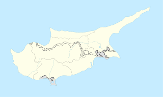
Lysos is a village in Cyprus, about 36 kilometres from Paphos. The population was 160 in 2001. Being the largest in area of the villages of Cyprus, Lysos covers an area of approximately 10,000 acres in the province of Paphos. Built at an average altitude of 560 meters,the peak of Tripylos, located near the location Stavros tis Psokas, is considered to be the highest point of the settlement, which borders eastwards with Nicosia. Most of the village’s area is covered by the Paphos forest, an important biotope of wild and endemic birds, while the wider area is crossed by many nature trails. Lysos is located in the outskirts of Paphos. The name itself has archaic origins and originates from the Greek word "liono" as it was an industrial area for the melting of metals. The archaeological findings here indicate settlements of Greeks from Asia Minor. Lysos receives approximately 615 mm of rainfall annually.The average yearly temperature is around 16.9° C.

Mulakuzha is a village in Alappuzha district in the state of Kerala, India. Mulakuzha is located in Chengannur tehsil, and residents are mostly artisans and farmers.

Shirahatti is a panchayat town in Gadag district in the Indian state of Karnataka.
Hirewaddatti is a village in the southern state of Karnataka, India. It is located in the Mundargi taluk of Gadag district in Karnataka.

Letymvou is a village in the Paphos District of Cyprus, located 12 km north of Paphos. It's located 383m above sea level. It receives 620 mm of rainfall annually. From a transport view, Letymbou is connected with the village Kourdaka in the east with the village Pitargou in the south east and with the village Kallepia in the south west.

Akoursos is a village in the Paphos District of Cyprus, located 3 km south of Kathikas. Akoursos is located at 410 metres above sea level. It receives approximately 650 mm of rainfall annually.

Kritou Terra is a village in the Paphos District of Cyprus, located 3 km east of Dhrousha. Kritou Tera is located 479 m above sea level. It receives 630 mm of rainfall annually. Situated in the area of Laona, as the wider area is called and in a landscape surrounded by high mountain peaks and to the north overlooking the Gulf of Chrysochous, Kritou Terra is built at an altitude of 465 meters, is one of the ampelochoria of the island and is considered one of the most beautiful and picturesque villages of the province. It has fantastic climatic conditions and because it’s located by the third biggest spring in Cyprus it’s green all year round.

Goudi is a village in the Paphos District of Cyprus, located 6 km south of Polis Chrysochous on the Chrysochou River. Funeral announcement in Pileleftheros, 3 January 2014 of a resident of Goudi (Pafos) makes reference to the Church of St. George at Goudi. Also a website gives info, about the 2006 elections at Goudi.

Vythiri is a small town and tourist destination located in the Wayanad district in the Indian state of Kerala. It is one of the three Taluks in the district with the other two being Mananthavady and Sulthan Bathery.

Hammigi is a village in the Mundargi taluk of Gadag district in the Indian state of Karnataka. Hammigi is located south to district headquarters Gadag and Taluka headquarters Mundargi

Korlahalli is a village in the Mundargi taluk of Gadag district in the Indian state of Karnataka. Korlahalli is located south to district headquarters Gadag and Taluka headquarters Mundargi.

Singatalur is a village in the Mundargi taluk of Gadag district in the Indian state of Karnataka. Singatalur is located south to district headquarters Gadag and Taluka headquarters Mundargi.
Jawahar Navodaya Vidyalaya, Gadag is a CBSE affiliated school in Gadag District of Karnataka under the Hyderabad region of Navodaya Vidyalaya Samiti (NVS). JNV Gadag is located near village Korlahalli of Mundargi taluka. This school is a residence school and all facilities to the students is free of cost.

Sampkhanda or Samphakanda is a Hill station of Western Ghats located in Sirsi Taluk of Uttara Kannada District, Karnataka, India. State Highway 69 passes through this village. It is 18 km (11 mi) away from Devimane Ghat and about 16 km (9.9 mi) from its Taluk Headquarters at Sirsi. Sampakhanda is considered as one of the coldest place in Karnataka during summer season.

Bidarahalli is a village located in Mundargi taluk in Gadag district, Karnataka, India.


