Toney Fork, West Virginia

Last updated
Toney Fork, West Virginia
Unincorporated community
USA West Virginia location map.svg
Red pog.svg
Toney Fork, West Virginia
Usa edcp location map.svg
Red pog.svg
Toney Fork, West Virginia
Coordinates: 37°42′46″N81°35′51″W / 37.71278°N 81.59750°W / 37.71278; -81.59750 Coordinates: 37°42′46″N81°35′51″W / 37.71278°N 81.59750°W / 37.71278; -81.59750
Country United States
State West Virginia
County Wyoming
Elevation 1,362 ft (415 m)
Time zone Eastern (EST) (UTC-5)
  Summer (DST) EDT (UTC-4)
Area code(s) 304 & 681
GNIS feature ID 1548155 [1]

Toney Fork is an unincorporated community in Wyoming County, West Virginia, United States. Toney Fork is located on West Virginia Route 85 at the confluence of the Clear Fork and the Toney Fork, 2 miles (3.2 km) northeast of Oceana. [2]

Unincorporated area Region of land not governed by own local government

In law, an unincorporated area is a region of land that is not governed by a local municipal corporation; similarly an unincorporated community is a settlement that is not governed by its own local municipal corporation, but rather is administered as part of larger administrative divisions, such as a township, parish, borough, county, city, canton, state, province or country. Occasionally, municipalities dissolve or disincorporate, which may happen if they become fiscally insolvent, and services become the responsibility of a higher administration. Widespread unincorporated communities and areas are a distinguishing feature of the United States and Canada. In most other countries of the world, there are either no unincorporated areas at all, or these are very rare; typically remote, outlying, sparsely populated or uninhabited areas.

Wyoming County, West Virginia County in the United States

Wyoming County is a county in the U.S. state of West Virginia. As of the 2010 census, the population was 23,796. Its county seat is Pineville. The county was created in 1850 from Logan County and named for the Delaware Indian word meaning "large plains".

West Virginia State of the United States of America

West Virginia is a state located in the Appalachian region in the Southern United States and is also considered to be a part of the Middle Atlantic States. It is bordered by Pennsylvania to the north, Maryland to the east and northeast, Virginia to the southeast, Kentucky to the southwest, and Ohio to the northwest. West Virginia is the 41st largest state by area, and is ranked 38th in population. The capital and largest city is Charleston.

The community takes its name from nearby Toney Fork creek. [3]

Related Research Articles

Harts, West Virginia CDP in West Virginia, United States

Harts is a census-designated place (CDP) at the mouth of Big Harts Creek in Lincoln County, West Virginia, United States, along the Guyandotte River. As of the 2010 census, its population was 656. Harts is a part of the Huntington-Ashland, WV-KY-OH, Metropolitan Statistical Area (MSA). As of the 2010 census, the MSA had a population of 287,702. New definitions from February 28, 2013 placed the population at 363,000.

Milam, Wyoming County, West Virginia Unincorporated community in West Virginia, United States

Milam is an unincorporated community in Wyoming County, West Virginia, United States.

Clear Fork, West Virginia Unincorporated community in West Virginia, United States

Clear Fork is an unincorporated community in Wyoming County, West Virginia, United States, along the Clear Fork.

Pierpont, Wyoming County, West Virginia Unincorporated community in West Virginia, United States

Pierpont is an unincorporated community in Wyoming County, West Virginia, United States, along the Slab Fork and West Virginia Route 54.

Otsego, West Virginia Unincorporated community in West Virginia, United States

Otsego is an unincorporated community in Wyoming County, West Virginia, United States, along the Slab Fork and West Virginia Route 54. It was also known as Caloric.

Glen Fork, West Virginia Census-designated place (CDP) in West Virginia, United States

Glen Fork is a census-designated place (CDP) in Wyoming County, West Virginia, United States. As of the 2010 census, its population was 487. The confluence of the Laurel Fork and its tributary the Glen Fork is located in the community.

Maben, West Virginia Unincorporated community in West Virginia, United States

Maben is an unincorporated community in Wyoming County, West Virginia, United States, along the Slab Fork and West Virginia Route 54.

Jesse, West Virginia Unincorporated community in West Virginia, United States

Jesse is an unincorporated community in Wyoming County, West Virginia, United States, along the Laurel Fork.

Stephenson, West Virginia Unincorporated community in West Virginia, United States

Stephenson is an unincorporated community in Wyoming County, West Virginia, United States. Part of the community was known as Devils Fork, West Virginia until 1935. The community was named after W. G. Stephenson, a mining official.

Lillydale, Wyoming County, West Virginia Unincorporated community in West Virginia, United States

Lillydale is an unincorporated community in Wyoming County, West Virginia, United States. Lillydale is located on West Virginia Route 971 along the Clear Fork, 2.5 miles (4.0 km) southwest of Oceana.

Liverpool, West Virginia Unincorporated community in West Virginia, United States

Liverpool is an unincorporated community in Jackson and Roane counties, West Virginia, United States. Liverpool is located along the Right Fork Sandy Creek at the junction of Jackson County Route 13 and Roane County Route 1, 5.7 miles (9.2 km) west of Reedy Liverpool had a post office, which closed on May 30, 1989. The community was named after Liverpool, in England.

Rocksdale, West Virginia Unincorporated community in West Virginia, United States

Rocksdale is an unincorporated community in Calhoun County, West Virginia, United States. Rocksdale is located along County Route 9 at the confluence of the Henry Fork and the West Fork Little Kanawha River, site of now closed post office established in late 1800s with a country store.7.5 miles (12.1 km) east-northeast of Spencer.

Nuriva, West Virginia Unincorporated community in West Virginia, United States

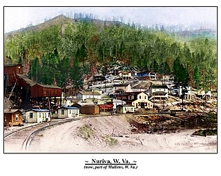
Nuriva is an unincorporated community in Wyoming County, West Virginia, United States.It was also known as Trace Fork and Tracoal. Its post office is closed.

Packsville, West Virginia Unincorporated community in West Virginia, United States

Packsville is an unincorporated community in Raleigh County, West Virginia, United States. Packsville is located on the Little Marsh Fork 4.4 miles (7.1 km) south-southeast of Sylvester.

Elkwater, West Virginia Unincorporated community in West Virginia, United States

Elkwater is an unincorporated community in Randolph County, West Virginia, United States. Elkwater is located on U.S. Route 219 and West Virginia Route 55 along the Tygart Valley River, 5.6 miles (9.0 km) south-southwest of Huttonsville.

Shively, West Virginia Unincorporated community in West Virginia, United States

Shively is an unincorporated community in Logan County, West Virginia, United States. Shively is located on County Route 3 and the Smokehouse Fork 5.5 miles (8.9 km) west of Chapmanville.

Long Branch, Wyoming County, West Virginia Unincorporated community in West Virginia, United States

Long Branch is an unincorporated community in Wyoming County, West Virginia, United States. Long Branch is located on County Route 6 9.25 miles (14.89 km) west-southwest of Oceana.

Toney, West Virginia Unincorporated community in West Virginia, United States

Toney is an unincorporated community in Lincoln County, West Virginia, United States. Its post office was established in 1904 by Brad Toney, merchant.

Clear Fork (Guyandotte River tributary) river in the United States of America

The Clear Fork is a tributary of the Guyandotte River, 29 miles (47 km) long, in southern West Virginia in the United States. Via the Guyandotte and Ohio rivers, it is part of the watershed of the Mississippi River, draining an area of 129 square miles (330 km2) in a rural area on the unglaciated portion of the Allegheny Plateau. The Clear Fork flows for its entire length in Wyoming County; its tributary the Laurel Fork also drains a small area of western Raleigh County.

Sun Hill, West Virginia Unincorporated community in West Virginia, United States

Sun Hill is an unincorporated community in Wyoming County, West Virginia, United States. Sun Hill is located on the Clear Fork and County Route 6 6.4 miles (10.3 km) southwest of Oceana.

References