
Summers County is a county located in the U.S. state of West Virginia. As of the 2010 census, the population was 13,927. Its county seat is Hinton. The county was created by an act of the West Virginia Legislature on February 27, 1871 from parts of Fayette, Greenbrier, Mercer and Monroe counties and named in honor of George W. Summers (1804-68).

Pocahontas County is a county located in the U.S. state of West Virginia. As of the 2010 census, the population was 8,719. Its county seat is Marlinton. The county was established in 1821. It is named after the daughter of the Powhatan Native American chief from Jamestown, Virginia. She married an English settler and their mixed-race children became ancestors of many of the First Families of Virginia.

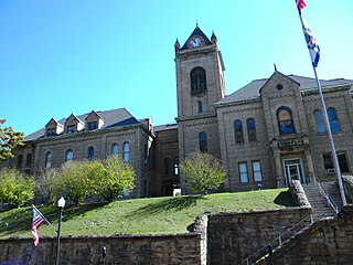
Nicholas County is a county located in the U.S. state of West Virginia. As of the 2010 census, the population was 26,233. Its county seat is Summersville. The county was created in 1818 by the Virginia General Assembly and named for Virginia Governor Wilson Cary Nicholas.

Monroe County is a county in the U.S. state of West Virginia. As of the 2010 United States Census, the population was 13,502. Its county seat is Union.
McDowell County is a county in the U.S. state of West Virginia. As of the 2010 census, the population was 22,113. Its county seat is Welch. McDowell county is the southernmost county in the state. It was created in 1858 by the Virginia General Assembly and named for Virginia Governor James McDowell. It became a part of West Virginia in 1863, when several counties seceded from the state of Virginia during the American Civil War.

Marion County is a county in the U.S. state of West Virginia. As of the 2010 census, the population was 56,418. Its county seat is Fairmont. The county was named in honor of General Francis Marion, known to history as "The Swamp Fox".

Kanawha County is a county in the U.S. state of West Virginia. As of the 2010 census, the population was 193,063, making it West Virginia's most populous county. Its county seat is Charleston, the state capital.

Brooke County is a county in the Northern Panhandle of the U.S. state of West Virginia. As of the 2010 census, the population was 24,069. Its county seat is Wellsburg. The county was created in 1797 from part of Ohio County and named in honor of Robert Brooke, Governor of Virginia from 1794 to 1796.
Lilydale, Lily Dale, Lillydale or Lillydale may refer to:
Lillydale Lake is an artificial lake and wetlands area created in Lilydale, Melbourne, Australia. The park in which it is situated covers over 100 hectares and includes extensive recreational facilities.
West Virginia Route 971 is a 9.9-mile (15.9 km) north–south state highway in Wyoming County, West Virginia. The route runs from West Virginia Route 97 in Baileysville north to West Virginia Route 10 in Oceana. It runs through mountainous, rural terrain, connecting Baileysville and Oceana to the communities of Clear Fork, Lillydale, and Lillyhaven.
The Wheeling, WV-OH Metropolitan Statistical Area, as defined by the United States Census Bureau, is an area consisting of two counties in the Northern Panhandle of West Virginia and one in eastern Ohio, anchored by the city of Wheeling. As of the 2010 census, the MSA had a population of 147,950. This represents a decline of 3.4% from the 2000 census population of 153,172.

The Shire of Lillydale was a local government area about 40 kilometres (25 mi) northeast of Melbourne, the state capital of Victoria, Australia. The shire covered an area of 397.49 square kilometres (153.5 sq mi), and existed from 1856 until 1994.
The Weirton–Steubenville, WV-OH Metropolitan Statistical Area, also known as the Upper Ohio Valley, is a metropolitan area consisting of two counties in the Northern Panhandle of West Virginia and one in Ohio, anchored by the cities of Weirton and Steubenville. As of the 2010 census, the MSA had a population of 124,454. In 2017, the population was estimated to have gone down to 118,250. This puts it at 329th largest in the United States.
The Parkersburg–Marietta–Vienna Metropolitan Statistical Area, as defined by the United States Census Bureau, is an area consisting of three counties in West Virginia and one in Ohio, anchored by the cities of Parkersburg, West Virginia, Marietta, Ohio, and Vienna, West Virginia. As of the 2000 census, the MSA had a population of 164,264.
The Bluefield Micropolitan Statistical Area, as defined by the United States Census Bureau, is an area consisting of two counties – one in West Virginia and one in Virginia – anchored by the city of Bluefield, West Virginia.

Lillydale is an unincorporated community in Monroe County, West Virginia, United States. Lillydale is southwest of Union.
Lillydale, West Virginia may refer to:

Laurel Creek Covered Bridge is a historic covered bridge located near Lillydale, Monroe County, West Virginia. It was built in 1910. The shortest covered bridge in the state, it measures 34 feet, 6 inches long and 13 feet, 2 1/2 inches wide. It has wood siding painted red and a galvanized metal roof. By 1981, it was one of only 17 covered bridges left in West Virginia.

The Clear Fork is a tributary of the Guyandotte River, 29 miles (47 km) long, in southern West Virginia in the United States. Via the Guyandotte and Ohio rivers, it is part of the watershed of the Mississippi River, draining an area of 129 square miles (330 km2) in a rural area on the unglaciated portion of the Allegheny Plateau. The Clear Fork flows for its entire length in Wyoming County; its tributary the Laurel Fork also drains a small area of western Raleigh County.


