This article needs additional citations for verification .(March 2015) (Learn how and when to remove this template message) |

Treskerby is a hamlet south of Scorrier in west Cornwall, England, United Kingdom. [1]
This article needs additional citations for verification .(March 2015) (Learn how and when to remove this template message) |
Treskerby is a hamlet south of Scorrier in west Cornwall, England, United Kingdom. [1]
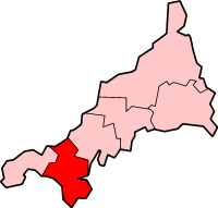
Kerrier was a local government district in Cornwall, England, United Kingdom. It was the most southerly district in the United Kingdom, other than the Isles of Scilly. Its council was based in Camborne. Other towns in the district included Redruth and Helston. The district also contained the Lizard Peninsula.
Caradon was a local government district in Cornwall, United Kingdom. It contained five towns: Callington, Liskeard, Looe, Saltash and Torpoint, and over 80 villages and hamlets within 41 civil parishes. Its District Council was based in Liskeard 50.453°N 4.465°W.

BBC Radio Cornwall is the BBC Local Radio service for Cornwall and the Isles of Scilly in the United Kingdom. It broadcasts from its studios on Phoenix Wharf in Truro on 95.2 in the east, 96.0 on the Isles of Scilly and 103.9 in the west MHz FM, as well as on DAB.

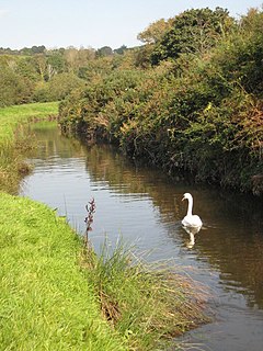
The Truro River is a river in the city of Truro in Cornwall, England, UK. It is the product of the convergence of the two rivers named Kenwyn and Allen which run under the city: the Truro River flows into the River Fal, estuarial waters where wildlife is abundant, and then out into the Carrick Roads. The river is navigable up to Truro.
Cornwall Hills Provincial Park is a provincial park in British Columbia, Canada, immediately west of Cache Creek, protecting part of the Cornwall Hills including their highest summit which features an old fire lookout.

The River Hayle is a small river in West Cornwall, England, United Kingdom which issues into St Ives Bay at Hayle on Cornwall's Atlantic coast.
There are seventeen disused railway stations on the Cornish Main Line between Plymouth in Devon and Penzance in Cornwall, England. The remains of nine of these can be seen from passing trains. While a number of these were closed following the so-called "Beeching Axe" in the 1960s, many of them had been closed much earlier, the traffic for which they had been built failing to materialise.

Cornwall Record Office (CRO), part of Cornwall Council, is situated at Old County Hall in Truro and is the main repository for the historical archives of Cornwall, England. It closed in September 2018 to enable staff to prepare the collections for their move to Kresen Kernow, Cornwall's new archive centre in Redruth, which is due to open in 2019.

Port Navas Creek, or Porthnavas Creek, is one of seven creeks off the Helford River in Cornwall, England, United Kingdom. It splits into three sections with the village of Porth Navas on the west, Trenarth Bridge in the middle and the eastern one is near Budock Veane. The creek is well known for the oyster beds.

The River Inny is a small river in east Cornwall, United Kingdom. It is a tributary of the River Tamar and is about twenty miles (32 km) long from its source near Davidstow on the eastern flank of Bodmin Moor to its confluence with the Tamar at Inny Foot near Dunterton.

The River Menalhyl is a river in Cornwall, England, that flows through the civil parishes of St Columb Major and Mawgan-in-Pydar. Its length is about 12 miles and it flows in a generally north-west direction. The name comes from the Cornish words melyn meaning mill and heyl meaning estuary - estuary mills. The name was recorded as Mellynheyl in the 19th century, but it had been known as Glyvion.
The Cornish Way is a cycle route which is part of the National Cycle Network that links Bude to Land's End. The route is via Padstow or St Austell and is 180 miles in length.
The River Cober is a short river in west Cornwall, England, United Kingdom. It rises in Nine Maidens Downs, directly between Hangman's Barrow to the west and the Nine Maidens stone circle to the east, in the former Kerrier District and runs to the west of the town of Helston before entering the largest natural lake in Cornwall – Loe Pool. The water is impounded by the natural barrier, Loe Bar, and the river system can be traced several kilometres out into Mount's Bay. Mining activity of over one hundred years in the river catchment, ceased in 1938, in the Wendron and Porkellis mining districts; and the engine house of Castle Wary, near Nansloe can still be seen on the east side of the river below Helston. The lower reaches of river was canalised in 1946 and a causeway built over Loe Marsh in 1987. The meaning of the name is uncertain, but two of the earliest records are: "in 1260 we find, 'Chohor' and a few years later, 'Coffar'". The present name 'Cober' is unlikely to be derived from 'Coffar', since it was known as the 'River Loe or River Looe' around four hundred years ago, in Carew's time, according to the map of Powder Hundred.

The River Allen in north Cornwall is one of two rivers of the same name in Cornwall which share this name. In this case the name is the result of a mistake made in 1888 by Ordnance Survey, replacing the name Layne with Allen which is the old name for the lower reaches of the Camel. The other River Allen runs through Truro.

The River Ottery is a small river in northeast Cornwall, United Kingdom. The river is about twenty miles (32 km) long from its source southeast of Otterham to its confluence with the River Tamar at Nether Bridge, two miles (3.2 km) northeast of Launceston.

The De Lank River is a small river in north Cornwall, England. It is a tributary of the River Camel and is approximately nine miles (14.5 km) long from its source on Bodmin Moor to its confluence with the Camel two miles (3 km) south of St Breward.

The St Austell River properly known as the River Vinnick, but historically called The White River, is a 12 kilometres (7.5 mi) long river located in south Cornwall, England, United Kingdom. 50.337°N 4.793°W. The river has also been known as the "red river" due to tin streaming and mining activity upstream.
Loggans Moor is a nature reserve and Site of Special Scientific Interest, noted for its biological characteristics, in west Cornwall, England, UK. It is located 1 mile north-east of the town of Hayle, off the A30 road.

Inka Wasi or Inkawasi is an archaeological site in Peru. It is located in the Ayacucho Region, Parinacochas Province, Pullo District.

The River Kensey is a river in east Cornwall, England, UK which is a tributary of the River Tamar.
| Unitary authorities | |
|---|---|
| Major settlements |
|
| Rivers | |
| Topics | |
Coordinates: 50°14′48″N5°12′13″W / 50.2468°N 5.2035°W
| This Cornwall location article is a stub. You can help Wikipedia by expanding it. |