Related Research Articles

Bodmin Moor is a granite moorland in north-eastern Cornwall, England, United Kingdom. It is 208 square kilometres (80 sq mi) in size, and dates from the Carboniferous period of geological history. It includes Brown Willy, the highest point in Cornwall, and Rough Tor, a slightly lower peak. Many of Cornwall's rivers have their sources here. It has been inhabited since at least the Neolithic era, when early farmers started clearing trees and farming the land. They left their megalithic monuments, hut circles and cairns, and the Bronze Age culture that followed left further cairns, and more stone circles and stone rows. By medieval and modern times, nearly all the forest was gone and livestock rearing predominated.

Towednack is a churchtown and civil parish in Cornwall, England, United Kingdom. The parish is bounded by those of Zennor in the west, Gulval in the south, Ludgvan in the west and south, and St Ives and the Atlantic Ocean in the north and east. The church is about two miles (3 km) from St Ives and six miles (10 km) from Penzance.

Trewellard is a small village on the north coast road between St Just and St Ives in Cornwall, England, United Kingdom. It lies along the B3306 road which connects St Ives to the A30 road. It is situated 7 miles from Land's End and 7 miles from Penzance. It is in the civil parish of St Just and the electoral division of St Just in Penwith.

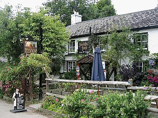
Treen is a small village in the parish of St Levan, in the far west of Cornwall, England, United Kingdom. It is about 3 miles (4.8 km) inland from Land's End on a short unclassified spur road from the B3315. Treen overlooks the Penberth Valley and sits about 1 kilometre (0.62 mi) inland from Treryn Dinas, an Iron Age promontory fort, or cliff castle, with five lines of fortification. On the headland is the Logan Rock and to the west is Pedn Vounder tidal beach, which is popular with naturists. Treen Cliff is to either side of Treryn Dinas. The village has a popular pub, The Logan Rock Inn, a village shop, cafe and campsite with views to both Logan Rock and nearby Porthcurno.
Mylor Bridge is a village in Cornwall, England, United Kingdom. It is in Mylor civil parish at the head of Mylor Creek, about five miles north of Falmouth.

Gunwalloe is a coastal civil parish in Cornwall, England, United Kingdom. It is situated on the Lizard Peninsula three miles (4.8 km) south of Helston and partly contains The Loe, the largest natural freshwater lake in Cornwall. The parish population including Berepper at the 2011 census was 219. The hamlets in the parish are Chyanvounder, Berepper and Chyvarloe. To the east are the Halzephron cliffs and further east the parish church.

Porthcothan is a coastal village between Newquay and Padstow in Cornwall, England, UK. It is within the civil parish of St Eval.

Manaccan is a civil parish and village on the Lizard peninsula in south Cornwall, England, United Kingdom. The village is about five miles (8 km) south-southwest of Falmouth.

St Michael Caerhays is a civil parish and village in Cornwall, England, United Kingdom. The village is about seven miles (11 km) south-southwest of St Austell. The population as of the 2011 census was 96
Feock is a coastal civil parish and village in Cornwall, England, United Kingdom. It is about 5 miles (8.0 km) south of Truro at the head of Carrick Roads on the River Fal. To the south, the parish is bordered by Restronguet Creek and to the east by Carrick Roads and the River Fal. To the north, it is bordered by Kea parish and to the west by Perranarworthal parish.
Philleigh is a civil parish and village in Cornwall, England, one of the four civil parishes in the Roseland Peninsula. The civil parish includes the hamlets of Treworlas, Treworthal and a number of smaller settlements.

St Martin-in-Meneage is a civil parish and village in the Meneage district of the Lizard Peninsula in Cornwall, England, United Kingdom.

Lesnewth is a civil parish and village in Cornwall, England, United Kingdom. It is about six miles east of Tintagel Head and two miles east of Boscastle.

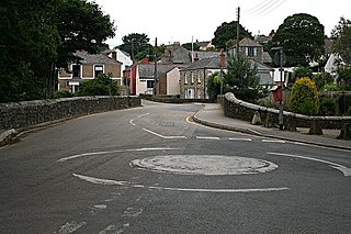
Portmellon is a coastal settlement in south Cornwall, Britain, United Kingdom. It is one mile south of Mevagissey and six miles south of St Austell.

Gribbin Head is a promontory on the south coast of Cornwall, England, UK, owned and managed by the National Trust. It separates St Austell Bay from the estuary of the River Fowey and is marked by a large tower used to aid navigation of ships approaching the local harbours. The nearest town is Fowey. The western point of the headland is called Little Gribbin.

Portscatho is a coastal village on the Roseland Peninsula in Cornwall, England, United Kingdom. The village adjoins Gerrans on the east side of the peninsula, about seven miles (11 km) south-southeast of Truro. It has an estimated population of 1,500 people.

Gwenter is a hamlet in the parish of St Keverne, Cornwall, England.

Trenarren is a hamlet northeast of Pentewan in mid Cornwall, England, United Kingdom. A. L. Rowse the historian lived in his retirement in Trenarren House.

Trethewey is a hamlet in west Cornwall, England, United Kingdom. It forms part of St Levan civil parish. The village includes a Wesleyan chapel and schoolroom, built in 1868.

Trewithian is a hamlet near Portscatho in Cornwall, England.
References
- ↑ Place-names in the Standard Written Form (SWF) : List of place-names agreed by the MAGA Signage Panel. Cornish Language Partnership.
- ↑ Ordnance Survey One-inch Map of Great Britain; Truro and Falmouth, sheet 190. 1961
| Unitary authorities | |
|---|---|
| Major settlements (cities in italics) |
|
| Rivers | |
| Topics | |
| | This article about a location in the former borough of Restormel, Cornwall is a stub. You can help Wikipedia by expanding it. |