Trimbelle, Wisconsin

Last updated

Trimbelle, Wisconsin
WIMap-doton-Trimbelle.png
Location of Trimbelle, Wisconsin
Coordinates: 44°44′34″N92°33′30″W / 44.74278°N 92.55833°W / 44.74278; -92.55833
Country Flag of the United States.svg  United States
State Flag of Wisconsin.svg  Wisconsin
County Pierce
Area
  Total36.2 sq mi (93.7 km2)
  Land36.2 sq mi (93.7 km2)
  Water0.0 sq mi (0.0 km2)
Elevation
[1]
955 ft (291 m)
Population
 (2000)
  Total1,511
  Density41.8/sq mi (16.1/km2)
Time zone UTC-6 (Central (CST))
  Summer (DST) UTC-5 (CDT)
Area code(s) 715 & 534
FIPS code 55-80700 [2]
GNIS feature ID1584295 [1]

Trimbelle is a town in Pierce County, Wisconsin, United States. The population was 1,511 at the 2000 census. The unincorporated communities of Beldenville and Ottman Corners are located in the town. The unincorporated community of Moeville is also located partially in the town.

Contents

Geography

According to the United States Census Bureau, the town has a total area of 36.2 square miles (93.7 km2), all of it land.

Demographics

As of the census [2] of 2000, there were 1,511 people, 532 households, and 425 families residing in the town. The population density was 41.8 inhabitants per square mile (16.1/km2). There were 544 housing units at an average density of 15.0 per square mile (5.8/km2). The racial makeup of the town was 98.48% White, 0.13% African American, 0.07% Native American, 0.33% Asian, 0.20% from other races, and 0.79% from two or more races. Hispanic or Latino of any race were 0.40% of the population.

There were 532 households, out of which 39.8% had children under the age of 18 living with them, 71.2% were married couples living together, 5.1% had a female householder with no husband present, and 20.1% were non-families. 16.2% of all households were made up of individuals, and 5.6% had someone living alone who was 65 years of age or older. The average household size was 2.83 and the average family size was 3.19.

In the town, the population was spread out, with 27.9% under the age of 18, 7.7% from 18 to 24, 31.4% from 25 to 44, 25.3% from 45 to 64, and 7.7% who were 65 years of age or older. The median age was 36 years. For every 100 females, there were 113.4 males. For every 100 females age 18 and over, there were 113.3 males.

The median income for a household in the town was $52,650, and the median income for a family was $56,111. Males had a median income of $36,364 versus $25,966 for females. The per capita income for the town was $19,214. About 3.1% of families and 4.5% of the population were below the poverty line, including 6.0% of those under age 18 and 4.5% of those age 65 or over.

Notable people

Related Research Articles

<span class="mw-page-title-main">Denton, Kansas</span> City in Doniphan County, Kansas

Denton is a city in Doniphan County, Kansas, United States. As of the 2020 census, the population of the city was 130.

<span class="mw-page-title-main">Prairie Lake, Wisconsin</span> Town in Wisconsin, United States

Prairie Lake is a town in Barron County in the U.S. state of Wisconsin. The population was 1,532 at the 2010 census. The unincorporated community of Wickware is located partially in the town.

<span class="mw-page-title-main">Namakagon, Wisconsin</span> Town in Wisconsin, United States

Namakagon is a town in Bayfield County, Wisconsin, United States. The population was 246 at the 2010 census.

<span class="mw-page-title-main">Vermont, Wisconsin</span> Town in Wisconsin, United States

Vermont is a town located in Dane County, Wisconsin, United States. The population was 871 at the 2020 Census. The unincorporated communities of Elvers and Vermont are located in the town.

<span class="mw-page-title-main">Hay River, Wisconsin</span> Town in Wisconsin, United States

Hay River is a town in Dunn County, Wisconsin, United States, along the Hay River. The population was 546 at the 2000 census. The unincorporated community of Baxter is located in the town.

<span class="mw-page-title-main">Empire, Wisconsin</span> Town in Wisconsin, United States

Empire is a town in Fond du Lac County, Wisconsin, United States. The population was 2,620 at the 2000 census.

<span class="mw-page-title-main">Waterloo, Grant County, Wisconsin</span> Town in Wisconsin, United States

Waterloo is a town in Grant County in the U.S. state of Wisconsin. The population was 557 at the 2000 census. The unincorporated communities of Burton and McCartney is located in the town.

<span class="mw-page-title-main">Price, Wisconsin</span> Town in Wisconsin, United States

Price is a town in Langlade County, Wisconsin, United States. The population was 228 at the 2010 census. The unincorporated communities of Bryant and Sherry Junction and the ghost town of Kent are located in the town. The Bryant post office covers the entire town.

<span class="mw-page-title-main">Day, Wisconsin</span> Town in Wisconsin, United States

Day is a town in southwest Marathon County, Wisconsin, United States. It is part of the Wausau, Wisconsin Metropolitan Statistical Area. The population was 1,085 at the 2010 census. The unincorporated community of Rozellville is located in the town. The unincorporated community of Rangeline is also located partially in the town.

<span class="mw-page-title-main">Rib Falls, Wisconsin</span> Town in Wisconsin, United States

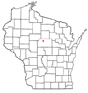
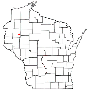
Rib Falls is a town in Marathon County, Wisconsin, United States. It is part of the Wausau, WI Metropolitan Statistical Area. The population was 993 at the 2010 census. The unincorporated community of Rib Falls is located in the town.

<span class="mw-page-title-main">Riverview, Wisconsin</span> Town in Wisconsin, United States

Riverview is a town in Oconto County, Wisconsin, United States. The population was 829 at the 2000 census.

<span class="mw-page-title-main">Deer Creek, Outagamie County, Wisconsin</span> Town in Wisconsin, United States

Deer Creek is a town in Outagamie County, Wisconsin, United States. The population was 682 at the 2000 census. Area of the village is 35.5 sq mi (92.0 km2)

<span class="mw-page-title-main">Martell, Wisconsin</span> Town in Wisconsin, United States

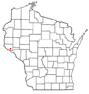
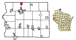
Martell is a town in Pierce County, Wisconsin, United States. The population was 1,070 at the 2000 census. The unincorporated communities of Martell and Morton Corner are located in the town. The unincorporated community of Lawton is also located partially in the town.

<span class="mw-page-title-main">Salem, Pierce County, Wisconsin</span> Town in Wisconsin, United States

Salem is a town in Pierce County, Wisconsin, United States. The population was 475 at the 2020 census. The unincorporated community of Ono is also located partially in the town.

<span class="mw-page-title-main">Poygan, Wisconsin</span> Town in Wisconsin, United States

Poygan is a town in Winnebago County, Wisconsin, United States. The population was 1,301 at the 2010 census.

Oakfield is a town in Fond du Lac County, Wisconsin, United States. The population was 767 at the 2000 census. The Village of Oakfield is located within the town. The unincorporated community of Oak Center is also located in the town.

The Town of Mount Hope is a town in Grant County, Wisconsin, United States. The population was 225 at the 2000 census. The village of Mount Hope and the unincorporated community of Shady Dell are located in the town.

<span class="mw-page-title-main">Star Prairie, Wisconsin</span> Village in Wisconsin, United States

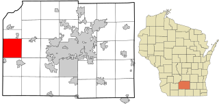
Star Prairie is a village in St. Croix County in the U.S. state of Wisconsin. The population was 561 at the 2010 census. The village is located along the Apple River on the boundary between the Town of Star Prairie and the Town of Stanton.

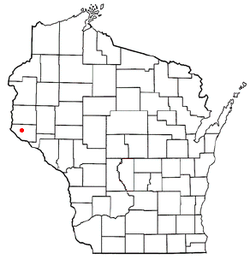
Star Prairie is a town in St. Croix County, Wisconsin, United States. The population was 2,944 at the 2000 census. The Village of Star Prairie is located on the eastern boundary of the town. The unincorporated communities of Huntington and Johannesburg are located in the town.

<span class="mw-page-title-main">Scandinavia, Wisconsin</span> Village in Wisconsin, United States

Scandinavia is a village in the Town of Scandinavia in Waupaca County, Wisconsin, United States. The population was 328 at the 2010 census.

References

  1. 1 2 "US Board on Geographic Names". United States Geological Survey. October 25, 2007. Retrieved January 31, 2008.
  2. 1 2 "U.S. Census website". United States Census Bureau . Retrieved January 31, 2008.
  3. 'Wisconsin Blue Book 1901,' Biographical Sketch of Harry J. Park, pg. 760
  4. 'Lloyd Tombleson Rites at Ellsworth,' Winona Republican-Herald, September 15, 1951, pg. 2

44°43′54″N92°34′48″W / 44.73167°N 92.58000°W / 44.73167; -92.58000