Sekani or Tse’khene are a First Nations people of the Athabaskan-speaking ethnolinguistic group in the Northern Interior of British Columbia. Their territory includes the Finlay and Parsnip River drainages of the Rocky Mountain Trench. The neighbours of the Sekani are the Babine to the west, Dakelh to the south, Dunneza (Beaver) to the east, and Kaska and Tahltan, to the north, all Athabaskan peoples. In addition, due to the westward spread of the Plains Cree in recent centuries, their neighbours to the east now include Cree communities.
Ingenika Airport is the old airfield of the Tsay Keh Dene First Nation, located near Ingenika Point at the head of Williston Lake in northern British Columbia. Tsay Keh Airport is the primary air strip for the community, but Ingenika Airport is maintained as an alternative since visibility is sometimes acceptable here when it is not at the primary air strip. Neither is equipped for instrument landings.
Sustut Provincial Park and Protected Area is a provincial park in British Columbia, Canada, located on the east side of the Sustut River and above the Bear River. Established by order-in-council in 2001, the park has an area of 75,037 ha. The park protects the Hogem Ranges and the Connelly Range and is in the traditional territories of the Tsay Keh Dene First Nation and the Gitxsan First Nation.

Northern Thunderbird Air Inc or NT Air is a Canadian charter airline and medevac service based in Prince George, British Columbia.
Tsay Keh Dene, meaning "people of the rocks" in the Sekani language, may mean:
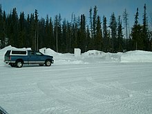
The Tsay Keh Dene First Nation is one of the Sekani bands of the Northern Interior of British Columbia. The territories, settlements, and reserves surround Williston Lake in the Omineca region of central British Columbia. The locations range from about 155 kilometres (96 mi) north of Prince George to 495 kilometres (308 mi) northwest of the city.