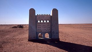
Tuat lies to the south of the Grand Erg Occidental, to the east of the Erg Chech and to the south west of the Tademaït plateau. It contains a string of small oases strung out along the eastern edge of the Wadi Messaoud, a continuation of the Wadi Saoura. The oases extend over a distance of 160km from the district of Bouda in the north to Reggane in the south. The largest town in the region is Adrar, 20km southeast of Bouda. Adrar was established by the French after their conquest in 1900 and had a population of 43,903 in 2002.[1] Associated with each oasis are small walled villages called ksour (singular ksar or gsar). There are also some forts (kasbahs), most of them abandoned.[2]
There is almost no rainfall in the region and agriculture depends on groundwater from an enormous aquifer in the Continental intercalaire, a layer of porous sandstone deposited between the Moscovian and the Cenomanian periods that extends over 600,000km2, an area that includes parts of Algeria, Libya and Tunisia. It forms the deeper of the two aquifers of the North Western Sahara Aquifer System (NWSAS).[3] Tuat is situated at the southwestern boundary of the Continental Intercalary where the aquifer lies only 2–6m below the surface.[4]
The oases contain 700,000-800,000 date palms (Phoenix dactylifera) in an area of 4,500hectares.[2] The palm groves are irrigated by a system of foggaras, traditional gravity catchment systems which consist of a tunnel constructed with a gentle uphill gradient from the low ground near the wadi into the aquifer under the nearby higher ground. Vertical access holes every 10–20m along the tunnel provide ventilation and facilitate construction and maintenance.[5] Many of the foggaras are over a kilometre in length. They typically provide flow rates of between 2L/s and 3L/s. In 1963 the region of Tuat contained 531 foggaras, of which only 358 were functioning.[2] The total combined flow rate was approximately 2000L/s. Foggaras are expensive to construct and to maintain. As they collapse they are often not repaired. Instead, water is obtained from vertical wells and electric pumps allowing grain to be grown using a center pivot irrigation system. A single well can provide 30L/s to 50L/s of water.[2]
In addition to water, the rock beneath Tuat contains pockets of natural gas. Sonatrach, the Algeria state-owned oil company, collaborates with foreign companies in joint ventures to exploit these gas reserves. Sonatrach and the China National Oil & Gas Exploration & Development Corporation (CNODC) have constructed a refinery near the village of Sbaa, 40km north of Adrar. This refinery began operating in 2006. Separate projects led by Gaz de France (GDF Suez) and Total are both scheduled to start supplying gas in 2013. A pipeline is being built to connect to Hassi R'Mel.[6]
To the north of Tuat is Gourara, a similar region also containing oases with date palms irrigated by foggaras. The largest town, Timimoun, is 162km north east of Adrar.
History
Saad asserts that Tuat may have been founded by the Malinke of the Mali Empire, based on information from Timbuktu traditionalists and the fact that Tuat always had settlers representing him in Timbuktu.[7]
The Tuat oases were important in the trans-Saharan trade because of their location at the northern end of the Tanezrouft route. Reggane is around 1150km north of the town of Gao and a similar distance from Timbuktu. Caravans from the Sudan would continue northwards to towns such as Sijilmasa or Tlemcen.
The oases are not mentioned by any of the early Arabic geographers,[8] but it appears that Jews lived in the oases at an early date as a tombstone discovered in a village of the Bouda region has an inscription in Hebrew with a date of 1329.[9][10]
The earliest written reference to Tuat is by Ibn Battuta. He visited Bouda in 1353 after crossing the Sahara from Takedda in present-day Niger, a distance of 1390km.[11] He travelled with a large caravan that included 600 slave girls. He wrote:
"Then we arrived at Būda, which is one of the biggest villages of the Tuwāt. Its land consists of sand and salt pans. It has many dates which are not good, but its people prefer them to the dates of Sijilmāsa. There is no cultivation there nor butter nor oil. Oil is only imported to it from the land of the Maghrib. The food of its people is dates and locusts. These are abundant with them; they store them as dates are stored and use them for food. They go out to hunt them before sunrise, for at that time they do not fly on account of the cold."[12]
Ibn Battuta stayed in Bouda for a few days and then continued on to Sijilmasa with a caravan.[13]
Bouda, as well as Sijilmasa, Timbuktu and Gao, are marked on the 1375 Catalan Atlas of Abraham Cresques.[10] At some point Bouda was abandoned and replaced by Tamentit as the main ksour of the region. Tamentit was more centrally situated and perhaps easier to defend.[14] The Arabic geographer and historian Ibn Khaldun (born Tunis 1332, died Egypt 1406) provides a description of Tuat, a place he had not visited himself, in his Kitab al-ibar:
One of their homelands lies three stages to the south of Sijilmāsa and is called Tuwāt. It consists of 200 qușūr strung out from west to east, of which the most easterly is called Tamanțīt, nowadays a flourishing place and a point of departure for merchants who pass to and fro between the Maghrib and the land of Māli of the Sūdān. ... The town of Būdā, the most westerly of these qușūr, used to be the point of departure for Wālātan, the outpost of the Mālī territory, but it was abandoned when the bedouin Arabs from the desert of the Sūs took to acts of brigandry on the highway and molesting the caravans. They left that place and followed the route to the land of the Sudān by way of Tamanțīt.[15]
Note that in reality Adrar is 540km southeast of Sijilmasa, considerably more than the three stages mentioned by Ibn Khaldun. Also, the oases are strung out from north-northwest to south-southeast rather than from west to east.
We learn more about Tuat from a letter written in Latin in 1447 by the Italian Antonio Malfante from 'Tueto' to a merchant in Genoa. Malfante describes a village which is believed to have been Tamentit: "This locality is a mart of the country of the Moors, to which merchants come to sell their goods: gold is carried hither, and bought by those who come up from the coast. This place is De Amament [Tamentit], and there are many rich men here. The generality, however, are very poor, for they do not sow, nor do they harvest anything, save the dates upon which they subsist. They eat no meat but that of castrated camels, which are scarce and very dear."[16] He also comments on the Jewish population: "There are many Jews, who lead a good life here, for they are under the protection of the several rulers, each of whom defends his own clients. Thus they enjoy very secure social standing. Trade is in their hands, and many of them are to be trusted with the greatest confidence."[16]
The Sultan of the Ziyyanid dynasty of Tlemcen, Abu Hammu II (1359-1389) took refuge in the Gourara region where he was well received. The sultan stayed there a while before reconquering Tlemcen from the Merinids in a ksar near a sebkha in Timimoun (dubbed «Capital of the Gourara»). The ksar in question still bears the sultan's name, Tal n Hammu. Through tribal alliances, the Ziyyanids had a certain influence over the Touat.[17][18]
From the start of the 15th century, political relations between the region were established with the Kingdom of Tlemcen. According to a Touati source, quoted by Alfred Georges Paul Martin, a French officer of the Legion of Honour, a text written by a certain al-Amuri recites a conflict in 1435 opposing a group of nomads (Ouled Ali Ibn Hariz) and the Jews of Tamantit. The nomads bought some dates on credit and refused to pay for them, the Jews of Tamantit called upon the sultan of Tlemcen, Abū l-‘Abbās Aḥmad al-‘Akil (1430-1466), the sultan sent a small expedition to end the conflict.[17][18]
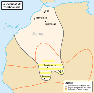
Following the expeditions of the tribes of Tafilalt in the Tuat region in 1578, the dignitaries of the oasis implored the intervention of the Beylerbey of Algiers. The Tuat-Gourara called upon the Beylerbey of Algiers since Tlemcen had been annexed by the Regency of Algiers.[21]Ottoman efforts to gain control over Tuat misfired in 1578, by the Turks of Algiers, and 1582, by the Turks of Tripoli.[22][23] Sometime between 1583 and 1588 the forces of the Moroccan Saadi Sultan Ahmad al-Mansur took control of the Tuat and the Gourara oases.[21] The Moroccan conquest of Tuat stopped Ottoman expansion into the Sahara, which had started with the occupation of the oasis of Ouargla in 1552 and the Fezzan in 1577, and secured the Moroccan advance toward the south.[23] The area remained politically dependent upon Morocco but the sovereignty of the Alawite sultans became almost nominal.[24]
The Alawite Sultan of Tafilalt, Sidi Muhammed ibn Sharif embarked on an eastern Saharan expedition and conquered Tuat first in 1645 and again in 1652, at which point he assigned his qaids to the oasis, who was then accepted as suzerain as far east as Aougrout.[25][26] Beginning in 1692, during the reign of Sultan Moulay Ismail, and for one hundred years after, Gourara-Tuat-Tidikelt was administered by a succession of Moroccan governors.[27] Faced with constant rebellion throughout his empire, Sultan Moulay Slimane recalled his governor from Gourara-Tuat-Tidikelt in 1796.[27]
In 1800, the Tuat population agreed to pay taxes when Moulay Slimane granted them local autonomy, preferring to entrust the administration of their territory to a local council of notables.[27][31] Prior to 1830, the Tuat population paid tribute to the Dey of Algiers, but stopped during the Algerian wars.[32] Prior to 1890, the Saharan oases were a part of what was known as the bled es-siba, regions that were nominally Moroccan but which had not submitted to the authority of the central government.[27]Sultan Moulay Hassan decided to reinstate the old Moroccan administration in Gourara-Tuat-Tidikelt. The first Moroccan envoys reached the Saharan oases in 1889 and in 1890. In 1891 Moulay Hassan called on the oasis peoples to begin paying taxes, thus formalizing the recognition of his suzerainty. That same year the Tuat and the oases which lay along the Oued Saoura were placed under the authority of the son of the Moroccan khalifa, who resided in the Tafilalt. Then, in 1892, a complete administrative organization was established in all of the Gourara-Tuat-Tidikelt.[27]
In the 1890s, the French administration and military called for the annexation of the Tuat, the Gourara and the Tidikelt,[33] a complex that had been part of the Moroccan Empire for many centuries prior to the arrival of the French in Algeria.[27] According to Alfred Le Chatelier, French soldier, ceramicist and Islamologist, Tuat, at any moment of history, had not been an integral part of Morocco. The inhabitants never depended from them more than a few years. On every occasion they would affirm their independence and free themselves of any religious vassalage.[34] In 1893, the French government authorized Jules Cambon to occupy the Gourara and the Tidikelt, letting him go so far as to gather his forces at El Golea, then only rescinded the order at the very last moment when his troops were about to depart.[27] The actual intervention in the Gourara-Tuat-Tidikelt did not take place until the very end of 1899. The military contingent escorting the mission quickly routed the Saharans and took advantage of the opportunity to occupy the oasis of In Salah.[27]
An armed conflict opposed the French 19th CorpsOran and Algiers divisions to the Aït Khabbash, a faction of the Aït Ounbgui khams of the Aït Atta confederation. The conflict ended by the annexation of the Touat-Gourara-Tidikelt complex to Algeria by France in 1901.[35][36]
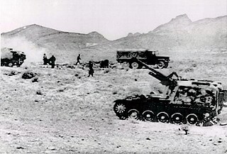
Under French rule, the area was known as the "Territoire des oasis sahariennes". During 1903, attacks on the lines of communication by local tribes caused the French troops to suffer serious losses. To punish the tribes the town of Figuig was bombarded by the French on 8 June. On the following 2 September a band of nomads attacked the escort of a convoy going to Taghit at a place called El Mungar. After maintaining the fight for over seven hours the French were reinforced and their attackers drew off. Out of 115 combatants the French lost 38 killed and 47 wounded. To consolidate their position the French authorities determined to connect the oases with the Algerian Sahara proper by carriage roads and railways.[37]
↑ Saad, Elias N. (1983). Social History of Timbuktu: The Role of Muslim Scholars and Notables 1400–1900. Cambridge University Press. pp.8–9. ISBN0-521-24603-2.
↑ Mercer, Patricia Ann (1974). Political and military developments within Morocco during the early Alawi Period (1659-1727). SOAS University of London. p.48.
↑ Claude Lefébure, Ayt Khebbach, impasse sud-est. L'involution d'une tribu marocaine exclue du SaharaArchived 2015-09-24 at the Wayback Machine , in: Revue de l'Occident musulman et de la Méditerranée, N°41-42, 1986. Désert et montagne au Maghreb. pp. 136-157: «les Divisions d'Oran et d'Alger du 19e Corps d'armée n'ont pu conquérir le Touat et le Gourara qu'au prix de durs combats menés contre les semi-nomades d'obédience marocaine qui, depuis plus d'un siècle, imposaient leur protection aux oasiens»
↑ One or more of the preceding sentencesincorporates text from a publication now in the public domain:Cana, Frank Richardson (1911). "Tuat". In Chisholm, Hugh (ed.). Encyclopædia Britannica. Vol.27 (11thed.). Cambridge University Press. p.353.
Related Research Articles
The Zenati languages are a branch of the Northern Berber language family of North Africa. They were named after the medieval Zenata Berber tribal confederation. They were first proposed in the works of French linguist Edmond Destaing (1915) (1920–23). Zenata dialects are distributed across the central Berber world (Maghreb), from northeastern Morocco to just west of Algiers, and the northern Sahara, from southwestern Algeria around Bechar to Zuwara in Libya. The most widely spoken Zenati languages are Tmazight of the Rif in northern Morocco and Tashawit Berber in northeastern Algeria, each of which have over 3 million speakers.
The Zenata are a group of Berber tribes, historically one of the largest Berber confederations along with the Sanhaja and Masmuda. Their lifestyle was either nomadic or semi-nomadic.
Taghaza is an abandoned salt-mining centre located in a salt pan in the desert region of northern Mali. It was an important source of rock salt for West Africa up to the end of the 16th century when it was abandoned and replaced by the salt-pan at Taoudenni which lies 150 km (93 mi) to the southeast. Salt from the Taghaza mines formed an important part of the long distance trans-Saharan trade. The salt pan is located 857 km (533 mi) south of Sijilmasa, 787 km (489 mi) north-northwest of Timbuktu and 731 km (454 mi) north-northeast of Oualata.
Reggane is a town and commune, and the capital of Reggane District, in Adrar Province, central Algeria. Reggane lies in the Sahara Desert near an oasis. According to the 2008 census it has a population of 20,402, up from 14,179 in 1998, with an annual growth rate of 3.8%. Berber tribes and people live in and around Reggane.
MawlayHassan bin Mohammed, known as Hassan I, born in 1836 in Fes and died on 9 June 1894 in Tadla, was a sultan of Morocco from 12 September 1873 to 7 June 1894, as a ruler of the 'Alawi dynasty. He was proclaimed sultan after the death of his father Mawlay Muhammad bin Abd al-Rahman. Mawlay Hassan was among the most successful sultans. He increased the power of the makhzen in Morocco and at a time when so much of the rest of Africa was falling under foreign control, he brought in military and administrative reforms to strengthen the regime within its own territory, and he carried out an active military and diplomatic program on the periphery. He died on 9 June 1894 and was succeeded by his son Abd al-Aziz.
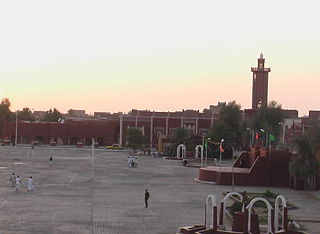
Adrar is the administrative capital of Adrar Province, the second largest province in Algeria. The commune is sited around an oasis in the Touat region of the Sahara Desert. According to a 2008 census, it has a population of 64,781, up from 43,903 in 1998, with an annual growth rate of 4.0%.
The Sand War was a border conflict between Algeria and Morocco fought from September 25 to October 30, 1963, although a formal peace treaty was not signed until February 20, 1964. It resulted largely from the Moroccan government's claim to portions of Algeria's Tindouf and Béchar provinces. The Sand War led to heightened tensions between the two countries for several decades.
Aoulef is a town and commune and capital of Aoulef District, in Adrar Province, south-central Algeria. According to the 2008 census it has a population of 21,723, up from 15,229 in 1998, with an annual growth rate of 3.7%.
Sahelian Jews historically known as Jews of the Bilad al-Sudan describes West African Jewish communities connected to known Jewish communities who migrated to West Africa as merchants for trading opportunities. Various historical records state that at one time, they were present in the Ghana Empire, the Mali Empire, the Mossi Kingdoms and the Songhai Empire, which was then called the Bilad al-Sudan "Land of the Blacks".
Akabli is a town and commune in Aoulef District, Adrar Province, in south-central Algeria. According to the 2008 census it has a population of 10,171, up from 7,513 in 1998, with an annual growth rate of 3.1%.
Bouda is a commune in Adrar District, Adrar Province, in south-central Algeria. According to the 2008 census it has a population of 9,938, up from 8,668 in 1998, with an annual growth rate of 1.4%.
Timokten is a town and commune in Aoulef District, Adrar Province, in south-central Algeria. According to the 2008 census it has a population of 18,598, up from 14,134 in 1998, with an annual growth rate of 2.8%.
The pacification of Algeria is the name given by the French to a series of military operations after the French conquest of the Regency of Algiers that aimed to put an end to various tribal rebellions and the resistance of the native Algerians to the French invasion.
The Pashalik of Timbuktu, also known as the Pashalik of Sudan, was a West African political entity that existed between the 16th and the 19th century. It was formed after the Battle of Tondibi, when a military expedition sent by Saadian sultan Ahmad al-Mansur of Morocco defeated the Songhai Empire and established control over a territory centered on Timbuktu. Following the decline of the Saadi Sultanate in the early 17th century, Morocco retained only nominal control of the Pashalik.
The Kingdom of Tlemcen or Zayyanid Kingdom of Tlemcen was a kingdom ruled by the Berber Zayyanid dynasty in what is now the northwest of Algeria. Its territory stretched from Tlemcen to the Chelif bend and Algiers, and at its zenith reached Sijilmasa and the Moulouya River in the west, Tuat to the south and the Soummam in the east.
Tit is a town and commune in Aoulef District, Adrar Province, south-central Algeria. According to the 2008 census it has a population of 4,417, up from 3,160 in 1998, with an annual growth rate of 3.5%.
The Battle of Taghit was the siege of a fort held by a contingent of the French Army of Africa against Moroccan tribesmen during the South-Oranese Campaign.
Conflicts between the Regency of Algiers and the Cherifian dynasties or Algerian-Sherifian conflicts opposed Morocco to the Ottoman Empire and its dependencies in a series of wars between the Regency of Algiers and its allied local sultanates and tribal confederations, and on the other hand, the Sharifian Saadian and Alawite dynasties that had ruled Morocco since the 16th century.
The Awlad Sidi Shaykh was a confederation of Arab tribes in the west and south of Algeria led by the descendants of the Sufi saint Sidi Shaykh. The Awlad had religious authority, and also owned agricultural settlements and engaged in trade. During the French occupation of Algeria they alternately cooperated with and opposed the colonialists.
The Algerian expedition to Tuat in 1579 was a military campaign by the Regency of Algiers against the tribes of Tuat, which resulted in Algiers gaining nominal control over the region.
References
Berger, P. (1903), "Une inscription juive du Touat", Comptes rendus des séances de l'Académie des Inscriptions et Belles-Lettres (in French), 47 (3): 235–239, doi:10.3406/crai.1903.19383.
Crone, G.R., ed. (1937), The Voyages of Cadamosto and other documents on Western Africa in the second half of the fifteenth century, London: Hakluyt Society.
Dunn, R.E. (1977), Resistance in the Desert: Moroccan responses to French Imperialism 1881-1912, London: Croom Helm, ISBN0-85664-453-6 . Google Preview.
Hunwick, J.O. (1985), "Al-Mahîlî and the Jews of Tuwât: the demise of a community", Studia Islamica, 61 (61): 155–183, doi:10.2307/1595412, JSTOR1595412 .
Hunwick, J.O. (2003), Timbuktu and the Songhay Empire: Al-Sadi's Tarikh al-Sudan down to 1613 and other contemporary documents, Leiden: Brill, ISBN978-90-04-12560-5 .
Hunwick, J.O. (2006), Jews of a Saharan oasis: elimination of the Tamantit community, Princeton NJ: Marcus Wiener, ISBN1-55876-346-5 . Google: Preview.
Levtzion, N.; Hopkins, J.F.P., eds. (2000), Corpus of Early Arabic Sources for West Africa, New York, NY: Marcus Weiner Press, ISBN1-55876-241-8 . First published in 1981.
Martin, A.G.P. (1923), Quatre siècle d'histoire marocaine, au Sahara de 1504 à 1902, au Maroc de 1894 à 1912. D'après archives et documentations indigènes (in French), Paris: F. Alcan.
Oliel, J. (1994), Les Juifs au Sahara: le Touat au Moyen Age (in French), Paris: CNRS Éditions.
Echallier, J.C. (1972), Villages désertés et structures agraires anciennes du Touat-Gourara (Sahara algérien) (in French), Paris: Arts et métiers graphiques.
This page is based on this Wikipedia article Text is available under the CC BY-SA 4.0 license; additional terms may apply. Images, videos and audio are available under their respective licenses.