
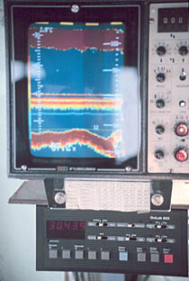
Sonar is a technique that uses sound propagation to navigate, communicate with or detect objects on or under the surface of the water, such as other vessels. Two types of technology share the name "sonar": passive sonar is essentially listening for the sound made by vessels; active sonar is emitting pulses of sounds and listening for echoes. Sonar may be used as a means of acoustic location and of measurement of the echo characteristics of "targets" in the water. Acoustic location in air was used before the introduction of radar. Sonar may also be used for robot navigation, and SODAR is used for atmospheric investigations. The term sonar is also used for the equipment used to generate and receive the sound. The acoustic frequencies used in sonar systems vary from very low (infrasonic) to extremely high (ultrasonic). The study of underwater sound is known as underwater acoustics or hydroacoustics.
A hydrophone is a microphone designed to be used underwater for recording or listening to underwater sound. Most hydrophones are based on a piezoelectric transducer that generates an electric potential when subjected to a pressure change, such as a sound wave. Some piezoelectric transducers can also serve as a sound projector, but not all have this capability, and some may be destroyed if used in such a manner.

Dynamic positioning (DP) is a computer-controlled system to automatically maintain a vessel's position and heading by using its own propellers and thrusters. Position reference sensors, combined with wind sensors, motion sensors and gyrocompasses, provide information to the computer pertaining to the vessel's position and the magnitude and direction of environmental forces affecting its position. Examples of vessel types that employ DP include, but are not limited to, ships and semi-submersible mobile offshore drilling units (MODU), oceanographic research vessels, cable layer ships and cruise ships.
Gee-H, sometimes written G-H or GEE-H, was a radio navigation system developed by Britain during World War II to aid RAF Bomber Command. The name refers to the system's use of the earlier Gee equipment, as well as its use of the "H principle" or "twin-range principle" of location determination. Its official name was AMES Type 100.
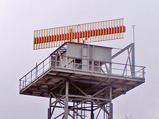
Secondary surveillance radar (SSR) is a radar system used in air traffic control (ATC), that not only detects and measures the position of aircraft, i.e. bearing and distance, but also requests additional information from the aircraft itself such as its identity and altitude. Unlike primary radar systems that measure the bearing and distance of targets using the detected reflections of radio signals, SSR relies on targets equipped with a radar transponder, that replies to each interrogation signal by transmitting a response containing encoded data. SSR is based on the military identification friend or foe (IFF) technology originally developed during World War II, therefore the two systems are still compatible. Monopulse secondary surveillance radar (MSSR), Mode S, TCAS and ADS-B are similar modern methods of secondary surveillance.
The air traffic control radar beacon system (ATCRBS) is a system used in air traffic control (ATC) to enhance surveillance radar monitoring and separation of air traffic. It consists of a rotating ground antenna and transponders in aircraft. The ground antenna sweeps a narrow vertical beam of microwaves around the airspace. When the beam strikes an aircraft, the transponder transmits a return signal back giving information such as the flight number designation and altitude of the aircraft. ATCRBS assists air traffic control (ATC) surveillance radars by acquiring information about the aircraft being monitored, and providing this information to the radar controllers. The controllers can use the information to identify radar returns from aircraft and to distinguish those returns from ground clutter.
An acoustic Doppler current profiler (ADCP) is a hydroacoustic current meter similar to a sonar, used to measure water current velocities over a depth range using the Doppler effect of sound waves scattered back from particles within the water column. The term ADCP is a generic term for all acoustic current profilers, although the abbreviation originates from an instrument series introduced by RD Instruments in the 1980s. The working frequencies range of ADCPs range from 38 kHz to several Megahertz. The device used in the air for wind speed profiling using sound is known as SODAR and works with the same underlying principles.
Multilateration is a navigation and surveillance technique based on the measurement of the times of arrival (TOAs) of energy waves having a known propagation speed. The time origin for the TOAs is arbitrary. For surveillance, a subject of interest – in cooperative surveillance, often a vehicle – transmits to multiple receiving stations having synchronized 'clocks'. For navigation, multiple synchronized stations transmit to a user receiver. To find the coordinates of a user in n dimensions, at least n + 1 TOAs must be measured. Multilateration systems are also called hyperbolic systems, for reasons discussed below.

Acoustic location is the use of sound to determine the distance and direction of its source or reflector. Location can be done actively or passively, and can take place in gases, liquids, and in solids.
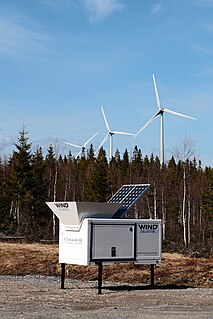
SODAR, also written as sodar, is a meteorological instrument used as a wind profiler to measure the scattering of sound waves by atmospheric turbulence. SODAR systems are used to measure wind speed at various heights above the ground, and the thermodynamic structure of the lower layer of the atmosphere.

Underwater acoustics is the study of the propagation of sound in water and the interaction of the mechanical waves that constitute sound with the water, its contents and its boundaries. The water may be in the ocean, a lake, a river or a tank. Typical frequencies associated with underwater acoustics are between 10 Hz and 1 MHz. The propagation of sound in the ocean at frequencies lower than 10 Hz is usually not possible without penetrating deep into the seabed, whereas frequencies above 1 MHz are rarely used because they are absorbed very quickly. Underwater acoustics is sometimes known as hydroacoustics.

Ultrasonic transducers or ultrasonic sensors are a type of acoustic sensor divided into three broad categories: transmitters, receivers and transceivers. Transmitters convert electrical signals into ultrasound, receivers convert ultrasound into electrical signals, and transceivers can both transmit and receive ultrasound.

The AN/FPS-16 is a highly accurate ground-based monopulse single object tracking radar (SOTR), used extensively by the NASA manned space program, the U.S. Air Force and the U.S. Army. The accuracy of Radar Set AN/FPS-16 is such that the position data obtained from point-source targets has azimuth and elevation angular errors of less than 0.1 milliradian and range errors of less than 5 yards (5 m) with a signal-to-noise ratio of 20 decibels or greater.
Fisheries acoustics includes a range of research and practical application topics using acoustical devices as sensors in aquatic environments. Acoustical techniques can be applied to sensing aquatic animals, zooplankton, and physical and biological habitat characteristics.
An underwater acoustic positioning system is a system for the tracking and navigation of underwater vehicles or divers by means of acoustic distance and/or direction measurements, and subsequent position triangulation. Underwater acoustic positioning systems are commonly used in a wide variety of underwater work, including oil and gas exploration, ocean sciences, salvage operations, marine archaeology, law enforcement and military activities.

A short baseline (SBL) acoustic positioning system is one of three broad classes of underwater acoustic positioning systems that are used to track underwater vehicles and divers. The other two classes are ultra short baseline systems (USBL) and long baseline systems (LBL). Like USBL systems, SBL systems do not require any seafloor mounted transponders or equipment and are thus suitable for tracking underwater targets from boats or ships that are either anchored or under way. However, unlike USBL systems, which offer a fixed accuracy, SBL positioning accuracy improves with transducer spacing. Thus, where space permits, such as when operating from larger vessels or a dock, the SBL system can achieve a precision and position robustness that is similar to that of sea floor mounted LBL systems, making the system suitable for high-accuracy survey work. When operating from a smaller vessel where transducer spacing is limited, the SBL system will exhibit reduced precision.

A long baseline (LBL) acoustic positioning system is one of three broad classes of underwater acoustic positioning systems that are used to track underwater vehicles and divers. The other two classes are ultra short baseline systems (USBL) and short baseline systems (SBL). LBL systems are unique in that they use networks of sea-floor mounted baseline transponders as reference points for navigation. These are generally deployed around the perimeter of a work site. The LBL technique results in very high positioning accuracy and position stability that is independent of water depth. It is generally better than 1-meter and can reach a few centimeters accuracy. LBL systems are generally employed for precision underwater survey work where the accuracy or position stability of ship-based positioning systems does not suffice.
Note: This page refers to the device used to measure the speed of sound in water for use in hydrography


