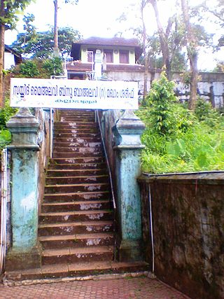
Attingal is a municipality in Thiruvananthapuram metropolitan area in Thiruvananthapuram district of Kerala state, India. It was the location of the Attingal kingdom, under Travancore. It is the headquarters of Chirayinkeezhu Taluk, and the important government institutions of the taluk such as the Taluk office, court complex, office of the deputy superintendent of Police, civil station, and treasuries are situated in Attingal. It is one of the oldest municipalities of Kerala which was constituted prior to its independence in 1924. In 1914 itself Attingal Town Improvement Authority (TIA) was formed which was the term used before the municipality regulation act of 1922. Attingal Town is located 25 kilometres (16 mi) north of Thiruvananthapuram. Attingal is the 3rd densely populated municipality in the district.

Gopalganj is one of the administrative districts in the Indian state of Bihar. The district headquarters is the town of Gopalganj, and the district is part of Saran Division. Major languages spoken are Hindi and Bhojpuri.
Padiyoor is a small town in Kannur district of Kerala state, India. Padiyoor village is part of Padiyoor-Kalliad Grama Panchayat in Iritty taluk.

Peravoor is a town and Grama Panchayat in Kannur district of Kerala state in India. It is located 50 km (31 mi) east of Kannur and 40 km (25 mi) north east of Thalassery. And Iritty, the nearest municipality is 14 km (8.7 mi) north of Peravoor. Peravoor is situated in the Western Ghats mountain range.

Kottarakkara, also transliterated as Kottarakara, is a town and municipality in the Kollam district of the Kerala, India. Kottarakkara lies 27 kilometres (17 mi) to the east of Kollam city centre.

Kalliasseri is a census town in Kannur district in the Indian state of Kerala. Kalliaseri Panchayat comprises two villages: Kalliasseri and Irinave.

Panniyannur is a census town in Thalassery taluk of Kannur district in the Indian state of Kerala. It is part of Greater Mahé Region.

Mayyil is a Census Town and Grama Panchayat in Kannur District of Kerala State. Mayyil Panchayat established in 1962 by merging the villages of Kayaralam, Mayyil and Kandakkai.

Vakkom Majeed was an Indian freedom fighter, politician and a former member of the Travancore-Cochin State Assembly. He was born into one of the most prominent aristocratic Muslim families in Travancore. Influenced by the works of his uncle, Vakkom Moulavi, he became involved in social and political reform movements. Majeed was one of the early architects of the Indian National Congress in Travancore, eventually becoming the Member of the Legislative Assembly for Attingal constituency (1948–1952). Regarded as one of the great Indian nationalists of 20th century, Majeed belonged to a tradition of politics that was intrinsically value-based, secular and humanistic.
Pangode is an Indian village and a Grama Panchayat located in the Trivandrum district in the state of Kerala. The village is known for its participation in the Indian Independence Movement, through the Kallara-Pangode Struggle. It is situated in the foothills of Western Ghats.

Aralam is a village and Grama Panchayat in Kannur district in the Indian state of Kerala.
Ayyankunnu is a village in Kannur district in the Indian state of Kerala.The name ayyankunnu came from the five hills "Anchu Kunnu".

Ezhome is a census town in Kannur district in the Indian state of Kerala.

Kanichar is a village and Grama Panchayat in Kannur district in the Indian state of Kerala.

Karivellur is a census town and Gram Panchayat in Kannur district of Kerala state, India.

Kurumathur is a census town in Taliparamba taluk of Kannur district in Kerala state, India. Kurumathur is located 8 km (5.0 mi) east of Taliparamba town in SH 36.
Mokeri is a census town in Mokeri panchayat of Kannur district in the Indian state of Kerala.

Payyavoor is a small town in Kannur district in the Indian state of Kerala. It's the headquarters of Payyavoor Grama Panchayat.
Thimiri is a village in Kannur district in the Indian state of Kerala. An ancient Shiva temple called Thimiri Sree Shiva Kshethra is situated here.

Kadakkavoor is a developing special grade town consisting central government postal office, railway station, sub treasury, police station, electricity board, telecom office and banks; Thiruvananthapuram district in the state of Kerala, India.


