
Soldano is a town and comune in the province of Imperia, Liguria (Italy).
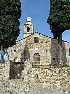
Costarainera is a comune (municipality) in the Province of Imperia in the Italian region Liguria, located about 100 kilometres (62 mi) southwest of Genoa and about 9 kilometres (6 mi) southwest of Imperia. As of 31 December 2004, it had a population of 775 and an area of 2.4 square kilometres (0.93 sq mi).

Diano Arentino is a comune (municipality) in the Province of Imperia in the Italian region Liguria, located about 90 kilometres (56 mi) southwest of Genoa and about 7 kilometres (4 mi) north of Imperia. As of 31 December 2004, it had a population of 648 and an area of 8.3 square kilometres (3.2 sq mi).
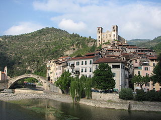
Dolceacqua is a comune (municipality) in the Province of Imperia in the Italian region Liguria, located about 120 kilometres (75 mi) southwest of Genoa and about 35 kilometres (22 mi) west of Imperia, on the border with France. As of 31 December 2014, it had a population of 2,078 and an area of 20.2 square kilometres (7.8 sq mi).

Lucinasco is a comune (municipality) in the Province of Imperia in the Italian region Liguria, located about 90 kilometres (56 mi) southwest of Genoa and about 11 kilometres (7 mi) northwest of Imperia. As of 31 December 2004, it had a population of 268 and an area of 8.2 square kilometres (3.2 sq mi).

Mendatica is a comune (municipality) in the Province of Imperia in the Italian region Liguria, located about 100 kilometres (62 mi) southwest of Genoa and about 30 kilometres (19 mi) northwest of Imperia.

Olivetta San Michele is a comune (municipality) in the Province of Imperia in the Italian region Liguria, located about 130 kilometres (81 mi) southwest of Genoa and about 40 kilometres (25 mi) west of Imperia, on the border with France. As of 31 December 2004, it had a population of 245 and an area of 13.8 square kilometres (5.3 sq mi).

Ospedaletti is a comune (municipality) in the Province of Imperia in the Italian region of Liguria, located about 120 kilometres (75 mi) southwest of Genoa and about 25 kilometres (16 mi) southwest of Imperia.

Pontedassio is a comune (municipality) in the Province of Imperia in the Italian region Liguria. Which is located about 90 kilometres (56 mi) southwest of Genoa and about 6 kilometres (4 mi) north of Imperia. As of December 31, 2004, it has a population of 2,159 and an area of 14.5 square kilometres (5.6 sq mi).

San Bartolomeo al Mare is a comune (municipality) in the Province of Imperia in the Italian region Liguria, located about 90 kilometres (56 mi) southwest of Genoa and about 7 kilometres (4 mi) northeast of Imperia.

San Lorenzo al Mare is a comune (municipality) in the Province of Imperia in the Italian region Liguria, located about 100 kilometres southwest of Genoa and about 10 km (6 mi) west of Imperia. As of 31 December 2004, it had a population of 1,409 and an area of 1.3 square kilometres (0.5 sq mi).
Santo Stefano al Mare is a comune (municipality) in the Province of Imperia in the Italian region Liguria, located about 100 kilometres (62 mi) southwest of Genoa and about 9 kilometres (6 mi) southwest of Imperia. As of 31 December 2004, it had a population of 2,260 and an area of 2.7 square kilometres (1.0 sq mi).

Terzorio is a comune (municipality) in the Province of Imperia in the Italian region Liguria, located about 100 kilometres (62 mi) southwest of Genoa and about 11 kilometres (7 mi) southwest of Imperia. The municipality has an area of 1.9 square kilometres (0.73 sq mi).
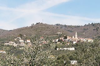
Villa Faraldi is a comune (municipality) in the Province of Imperia in the Italian region Liguria, located about 80 kilometres (50 mi) southwest of Genoa and about 10 kilometres (6 mi) northeast of Imperia. As of 31 December 2004, it had a population of 466 and an area of 9.6 square kilometres (3.7 sq mi).

The Oratory of Saint Bartholomew is a religious building in the centre of old Bordighera in the Riviera, Province of Imperia. The building is close to the Church of Saint Mary Magdalen.

Sasso di Bordighera is a frazione of the municipality of Bordighera, in Liguria, northern Italy.

Borghetto San Nicolò is a frazione of the municipality of Bordighera, in Liguria, northern Italy.


