
Jefferson County is located in the north central portion of the U.S. Commonwealth of Kentucky. As of the 2010 census, the population was 741,096. It is the most populous county in the commonwealth.

Berryville is an incorporated town in and the county seat of Clarke County, Virginia, United States. The population was 4,185 at the 2010 census, up from 2,963 at the 2000 census.

Middletown is a town in Frederick County, Virginia, United States, in the northern Shenandoah Valley. The population was 1,265 at the 2010 census, up from 1,015 at the 2000 census.

Mount Gay-Shamrock is a census-designated place (CDP) in Logan County, West Virginia, United States. The population was 1,779 at the 2010 census. The CDP includes the unincorporated communities of Mount Gay, Shamrock, Black Bottom, Whites Addition, Lintz Addition, Thompson Town, Hedgeview, Ridgeview, Logan Heights, Cora, and Whitman Junction.

The Shenandoah Valley is a geographic valley and cultural region of western Virginia and the Eastern Panhandle of West Virginia in the United States. The valley is bounded to the east by the Blue Ridge Mountains, to the west by the eastern front of the Ridge-and-Valley Appalachians, to the north by the Potomac River and to the south by the James River. The cultural region covers a larger area that includes all of the valley plus the Virginia highlands to the west, and the Roanoke Valley to the south. It is physiographically located within the Ridge and Valley province and is a portion of the Great Appalachian Valley.

The Battle of New Market was fought on May 15, 1864, in Virginia during the Valley Campaigns of 1864 in the American Civil War. A makeshift Confederate army of 4,100 men, which included cadets from the Virginia Military Institute (VMI), defeated Union Major General Franz Sigel and his Army of the Shenandoah. The cadets were integral to the Confederate victory at New Market and this event marks the only time in U.S. history wherein the student body of a functioning and operating college fought as an organized unit in pitched combat in battle. This event and battle was the 14th time VMI cadets were called into action during the Civil War. As a result of this defeat, Sigel was relieved of his command and replaced by Maj. Gen. David Hunter, who later burned VMI in retaliation for New Market.

A manor house was historically the main residence of the lord of the manor. The house formed the administrative centre of a manor in the European feudal system; within its great hall were held the lord's manorial courts, communal meals with manorial tenants and great banquets. The term is today loosely applied to various country houses, frequently dating from the late medieval era, which formerly housed the landed gentry.

West Drayton is a suburban town in the London Borough of Hillingdon. It was an ancient parish in the county of Middlesex and from 1929 was part of the Yiewsley and West Drayton Urban District, which became part of Greater London in 1965. The settlement is near the Colne Valley Regional Park and its centre lies 1.9 miles (3 km) north of Heathrow Airport.
Bathurst Manor is a neighbourhood located in the North York district of Toronto, Ontario, Canada. It sits on a plateau bounded on the north by Finch Avenue West, on the west by Dufferin Street, on the east by the Don River, and on the south by Sheppard Avenue West. The area is also regarded as part of the Downsview postal area as designated by Canada Post. It is part of the former City of North York, which merged with five other municipalities and a regional government to form the new "City of Toronto" in 1998. It is part of the federal and provincial electoral district York Centre, and Toronto electoral ward 10: York Centre (East). In 2006, it had a population of 14,615.

Natural Bridge is an unincorporated community in Rockbridge County, Virginia, United States. The community is the site of Natural Bridge, a natural arch which gives the town its name. Natural Bridge is located at the junction of U.S. Route 11 and State Route 130. Natural Bridge has a post office with ZIP code 24578, which opened on June 1, 1800.
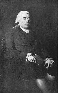
Thomas Fairfax, 6th Lord Fairfax of Cameron was a Scottish peer. He was the son of Thomas Fairfax, 5th Lord Fairfax of Cameron, and Catherine Colepeper, daughter of Thomas Colepeper, 2nd Baron Colepeper.

White Post is an unincorporated community in Clarke County, Virginia. White Post is located at the crossroads of White Post Road and Berrys Ferry Road off Lord Fairfax Highway.
The West Virginia Department of Transportation is the state agency responsible for transportation in West Virginia. The Department of Transportation serves an umbrella organization for seven subsidiary agencies which are directly responsible for different areas of the state's infrastructure.

Court Manor is an early Greek Revival plantation house and estate in Rockingham County, Virginia, located 4 miles (6.4 km) south of the town of New Market. With its stately manor house and prime location in the heart of the Shenandoah Valley, Court Manor has long been regarded as "one of the finest estates in the Valley of Virginia." The estate is situated on U.S. Route 11, which follows the route of the historic Great Wagon Road, a colonial thoroughfare connecting Philadelphia, Pennsylvania to Savannah, Georgia. The estate's landholdings include some 2,000 acres of land, extending from the base of the Massanutten Mountain Ridge to about one-half mile (0.80 km) west of U.S. Route 11. The manor house, with its impressive Greek Revival portico, can be easily seen from the tree-lined stretch of U.S. Route 11 that passes through the heart of the estate.

Belle Grove Plantation is a late-18th-century plantation house and estate in the northern Shenandoah Valley of Virginia, USA. It is situated in Frederick County, about a mile southwest of Middletown.

Valley View is a mid-19th-century Greek Revival residence and farm overlooking the South Branch Potomac River northwest of Romney, West Virginia. The house is atop a promontory where Depot Valley joins the South Branch Potomac River valley.
Valley was a populated place and post office on the South Branch line of the Baltimore and Ohio Railroad in the U.S. state of West Virginia. It was centered near the intersection of West Sioux Lane and Depot Valley Road, now located within the present-day corporate boundaries of Romney. Valley developed in 1884 following the completion of the South Branch line when the rail line's original southern terminus and corresponding Romney Depot were built there. The United States Post Office Department established a post office at Valley on May 19, 1928, remaining in operation until its disestablishment on June 15, 1937. Following the closure of Valley's post office, its mail was routed through the post office in Romney.


