Vallouise-Pelvoux | |
---|---|
Coordinates: 44°51′54″N6°29′20″E / 44.865°N 6.489°E Coordinates: 44°51′54″N6°29′20″E / 44.865°N 6.489°E | |
Country | France |
Region | Provence-Alpes-Côte d'Azur |
Department | Hautes-Alpes |
Arrondissement | Briançon |
Canton | L'Argentière-la-Bessée |
Intercommunality | Pays des Écrins |
Area 1 | 144.81 km2 (55.91 sq mi) |
Population | 1,154 |
• Density | 8.0/km2 (21/sq mi) |
Time zone | UTC+01:00 (CET) |
• Summer (DST) | UTC+02:00 (CEST) |
INSEE/Postal code | 05101 /05290, 05340 |
1 French Land Register data, which excludes lakes, ponds, glaciers > 1 km2 (0.386 sq mi or 247 acres) and river estuaries. |
Vallouise-Pelvoux is a commune in the department of Hautes-Alpes, southeastern France. The municipality was established on 1 January 2017 by merger of the former communes of Pelvoux (the seat) and Vallouise. [2]
The commune is located in the Alps and contains part of the Écrins National Park.
It is a popular destination for mountaineering and mountain sports in all seasons.
Vallouise-Pelvoux has a humid continental climate (Köppen climate classification Dfb). The average annual temperature in Vallouise-Pelvoux is 7.8 °C (46.0 °F). The average annual rainfall is 970.5 mm (38.21 in) with October as the wettest month. The temperatures are highest on average in July, at around 17.1 °C (62.8 °F), and lowest in January, at around −1.1 °C (30.0 °F). The highest temperature ever recorded in Vallouise-Pelvoux was 35.7 °C (96.3 °F) on 27 June 2019; the coldest temperature ever recorded was −21.8 °C (−7.2 °F) on 7 March 1971.
Climate data for Pelvoux, Vallouise-Pelvoux (1981–2010 averages, extremes 1961−present) | |||||||||||||
---|---|---|---|---|---|---|---|---|---|---|---|---|---|
Month | Jan | Feb | Mar | Apr | May | Jun | Jul | Aug | Sep | Oct | Nov | Dec | Year |
Record high °C (°F) | 18.1 (64.6) | 21.2 (70.2) | 23.3 (73.9) | 26.4 (79.5) | 29.2 (84.6) | 35.7 (96.3) | 34.0 (93.2) | 34.1 (93.4) | 32.9 (91.2) | 27.7 (81.9) | 21.6 (70.9) | 17.1 (62.8) | 35.7 (96.3) |
Average high °C (°F) | 3.8 (38.8) | 6.2 (43.2) | 10.0 (50.0) | 12.6 (54.7) | 18.0 (64.4) | 22.6 (72.7) | 25.7 (78.3) | 25.3 (77.5) | 20.4 (68.7) | 14.7 (58.5) | 7.9 (46.2) | 3.7 (38.7) | 14.3 (57.7) |
Daily mean °C (°F) | −1.1 (30.0) | 0.2 (32.4) | 3.5 (38.3) | 6.4 (43.5) | 11.3 (52.3) | 14.9 (58.8) | 17.1 (62.8) | 16.9 (62.4) | 13.0 (55.4) | 8.6 (47.5) | 2.8 (37.0) | −0.7 (30.7) | 7.8 (46.0) |
Average low °C (°F) | −6.1 (21.0) | −5.7 (21.7) | −3.1 (26.4) | 0.1 (32.2) | 4.6 (40.3) | 7.1 (44.8) | 8.6 (47.5) | 8.5 (47.3) | 5.5 (41.9) | 2.5 (36.5) | −2.2 (28.0) | −5.2 (22.6) | 1.3 (34.3) |
Record low °C (°F) | −19.0 (−2.2) | −18.0 (−0.4) | −21.8 (−7.2) | −10.2 (13.6) | −4.5 (23.9) | −1.6 (29.1) | 0.0 (32.0) | 0.0 (32.0) | −3.0 (26.6) | −9.0 (15.8) | −15.0 (5.0) | −18.0 (−0.4) | −21.8 (−7.2) |
Average precipitation mm (inches) | 82.7 (3.26) | 63.0 (2.48) | 70.1 (2.76) | 91.5 (3.60) | 81.0 (3.19) | 71.9 (2.83) | 48.9 (1.93) | 54.8 (2.16) | 86.9 (3.42) | 115.4 (4.54) | 100.2 (3.94) | 104.1 (4.10) | 970.5 (38.21) |
Average precipitation days (≥ 1.0 mm) | 7.5 | 6.3 | 7.5 | 8.7 | 10.2 | 9.0 | 7.0 | 7.2 | 7.2 | 9.4 | 7.7 | 8.3 | 96.1 |
Source: Meteociel [3] |
Pelvoux is a former commune in the Hautes-Alpes department in the Provence-Alpes-Côte d'Azur region in southeastern France. On 1 January 2017, it was merged into the new commune Vallouise-Pelvoux.
Saint-Véran is a commune in the Hautes-Alpes department in southeastern France in the Queyras Regional Natural Park.
Lunas is a commune in the Hérault department in southern France.
Petite-Île is a commune on the French island and department of Réunion. The commune is bordered by the communes of Saint-Joseph to the east and Saint-Pierre to the west. The commune gets its name from the uninhabited islet off of its coast, the only such islet near Réunion that has vegetation. The commune was established in 1935.
Saint-Firmin is a commune in the Hautes-Alpes department in southeastern France.
La Faurie is a commune in the Hautes-Alpes department in southeastern France.
La Chapelle-en-Valgaudémar is a commune in the Hautes-Alpes department in southeastern France.
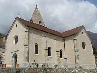
Ceillac is a commune in the Hautes-Alpes department in southeastern France.
Névache is a commune in the Hautes-Alpes department in southeastern France.
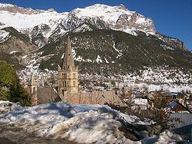
Le Monêtier-les-Bains is a commune in the Hautes-Alpes department in southeastern France.
Laragne-Montéglin is a commune in the Hautes-Alpes department in southeastern France.
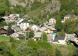
Villar-Loubière is a commune in the Hautes-Alpes department in southeastern France.
Saint-Étienne-le-Laus is a commune in the Hautes-Alpes department in southeastern France.
Saint-Bonnet-en-Champsaur is a commune in the Hautes-Alpes department in southeastern France. In January 2013 it merged with the former communes of Bénévent-et-Charbillac and Les Infournas.
Ribiers is a former commune in the Hautes-Alpes department in southeastern France. On 1 January 2016, it was merged into the new commune Val Buëch-Méouge.
Les Orres is a commune in the Hautes-Alpes department in southeastern France.
Pietralba is a commune in the Haute-Corse department of France on the island of Corsica.
Ventiseri is a commune in the Haute-Corse department of France on the island of Corsica.
Moulès-et-Baucels is a commune in the Hérault department in the Occitanie region in southern France.
Val Buëch-Méouge is a commune in the Hautes-Alpes department of southeastern France. The municipality was established on 1 January 2016 and consists of the former communes of Ribiers, Châteauneuf-de-Chabre and Antonaves.
Wikimedia Commons has media related to Vallouise-Pelvoux . |