Tributaries
The river Vellar has six named tributaries. They are Anaimaduvu, Swethanadhi, Kallar, Chinnar, Manimukthanadhi, and Gomukhi.

The Gomukhi River is a river in Tamil Nadu. It is a tributary of the Vellar
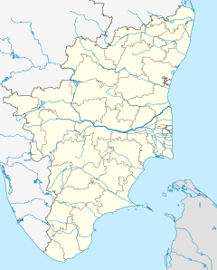
A portion of Dharmapuri, Salem, Namakkal, Perambalur, Trichy, Villupuram and Cuddalore districts fall within the Vellar river basin. Manimukthanadhi, which is the major tributary, also originates from Kalrayan hills in Villupuram district, traverses about 111 kilometres (69 mi) and joins Vellar near Srimushnam in Chidambararm taluk of Cuddalore District. Upper Vellar drains the water from the southern slopes of the Kalrayan hills on the northern boundary of Attur Taluk of Salem district. It originates at an elevation of 1,266 metres (4,154 ft) above mean sea level. At its starting point, it is known as Anaimaduvu River and flows southwards for 23 kilometres (14 mi) and then south-east.
One reservoir constructed across Anaimaduvu River is called Anaimaduvu reservoir. Just 3 kilometres (1.9 mi) below this point another tributary known as Thumbal River, formed by two drainages viz., Karyakoil river and Ammapalayam river flowing southwards from Kottaipatti pass on the Kalrayan hills, joins on the left flank. Another stream called Periyar originating in Jalluthu Reserve forest just 8 kilometres (5 mi) east of Salem taluk joins this stream. As Periyar River approaches Salem - Attur road it bends eastwards and receives on the south, the Singipuram River. Vasistanadi then flows towards southeast for about 26 kilometres (16 mi) along with boundary between Attur and Perambalur Taluk of Perambalur district on the one aide and Vridhachalam taluk of Cuddalore district on the other.
Near Peraiyur in the Perambalur taluk, it is joined by Swetanadhi 4 kilometres (2.5 mi) to the west of the Chennai–Trichy National Highway near Tholudur in Cuddalore district. In the reach between the confluence points of Singipuram and Swetanadhi with Vasistanadhi, the tributaries Kallar and Saval Odai join the main river: on the left flank and Chittar, Koraiyar, Manjani Odai and Ellar Odai on the flank join the Vasistanadhi. The drainage area up to the confluence with the Swetanadhi is 1,772 square kilometres (684 sq mi). An area of 10,572 hectares (26,120 acres) is irrigated through 70 tanks and 79 anicuts.

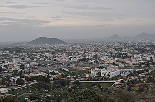
Attur or Aaththur is a town, municipality and headquarters of Attur taluk in the Salem district in the state of Tamil Nadu, India. As of 2011 census, the town had a population of 61,793.
Karkathar is a Forward caste in the Indian state of Tamil Nadu. It is a sub-caste of the greater Vellalar community of India. Karkathar are also known as Karalar.

Perambalur is an administrative district in the state of Tamil Nadu, India. The district headquarters is located at Perambalur. The district occupies an area of 1,752 km² and had a population of 565,223 with a sex-ratio of 1,003 females for every 1,000 males in 2011.

The Vaigai is a river in the Tamil Nadu state of southern India; it passes through the towns of Theni, Andipatti and Madurai. It originates in Varusanadu Hills, the Periyar Plateau of the Western Ghats range, and flows northeast through the Kambam Valley, which lies between the Palni Hills to the north and the Varushanad Hills to the south. The Vattaparai Falls are located on this river. As it rounds the eastern corner of the Varushanad Hills, the river turns southeast, running through the region of Pandya Nadu. Madurai, the largest city in the Pandya Nadu region and its ancient capital, lies on the Vaigai. The river empties into the Palk Strait near Uchipuli, close to Pamban bridge in Ramanathapuram District.
Periyar is the longest river and the river with the largest discharge potential in the Indian state of Kerala. It is one of the few perennial rivers in the region and provides drinking water for several major towns. The Periyar is of utmost significance to the economy of Kerala. It generates a significant proportion of Kerala's electrical power via the Idukki Dam and flows along a region of industrial and commercial activity. The river also provides water for irrigation and domestic use throughout its course besides supporting a rich fishery. Due to these reasons, the river has been named the "Lifeline of Kerala". Kochi city, in the vicinity of the river mouth draws its water supply from Aluva, an upstream site sufficiently free of seawater intrusion. Twenty five percent of Kerala's industries are along the banks of river Periyar. These are mostly crowded within a stretch of 5 kilometres (3 mi) in the Eloor-Edayar region (Udhyogamandal), about 10 kilometres (6 mi) north of Kochi harbor.

Namakkal District is an administrative district in the state of Tamil Nadu, India. The district was bifurcated from Salem District with Namakkal town as headquarters on 25 July 1996 and started to function independently from 1 January 1997. The district has seven taluks (subdivisions): Tiruchengode, Namakkal, Rasipuram, Paramathi-Velur, Sendamangalam, Komarapalayam, Kolli Hills and Mohanur. It has two revenue divisions: Namakkal and Tiruchengode. As of 2011 census, Namakkal district had a population of 1,726,601 with a sex-ratio of 986 females for every 1,000 males. Namakkal district is geographically affiliated to Kongu Nadu region. to The district is famous for its large poultry industry, egg production and lorry body-building industry, for which it is often referred to as "Egg City" and "Transport City".
Vasishta Nadi, named after the Hindu sage Vasishtha, originates from Salem district, flows through Kurchi, Belur, Yethapur,Pethanaickenpalayam, Attur, Kattukottai, Manivizhundhan North between South, Deviyakurichi, Pattuthurai, Thalaivasal, Aragalur, Sitheri and Cuddalore district. This river flows in Tiruchirapalli and joins Sweata Nadi before flowing into the Bay of Bengal. Dams on the river are located at Attur and Periyeri. Check dams are constructed at Attur, Thalivasal and Periyeri/Aragalur.

Thammampatti Town Panchayat is a special-grade town with panchayat status in the Salem District, in the state of Tamil Nadu. Thammampatti is situated between the Pachamalai and the Kolli Hills. The River Swetha flows through this town and joins the River Vasista to form the River Vellar, which empties into the Bay of Bengal at Parangipettai.
Thalaivasal is a developed village small town, block headquarters and state assembly seat in Kallakurichi district, Tamil Nadu - India.
The Pachaimalai Hills,, also known as the Pachais, are low mountain range in the Eastern Ghats System. They are located in Tamil Nadu state, southeastern India.
Puthanampatti is a village located in Thuraiyur Taluk, Tiruchirappalli district of Tamil Nadu, India. Puthanampatti village is located approximately 35km from Tiruchirappalli. The main economy is based on agriculture.
Attur Taluk is one of the taluks, or administrative division of Salem District in the state of Tamil Nadu, India. The division's headquarters is Attur town.

Viluppuram(pronunciation ) is a Municipality and the administrative headquarters of Viluppuram district, the largest district in the state of Tamil Nadu, India.
Cuddalore is connected to other parts of Tamil Nadu through a very good rail and road network. Frequent buses run to nearby towns like Pondicherry (Puducherry), Chidambaram, Panruti, Tindivanam and Viluppuram. Buses to major cities of Tamil Nadu such as Chennai, Tiruchirapalli, Coimbatore, Salem, Madurai Tiruvannamalai, Nagerkoil, Palani, Tanjore, Kumbakonam are also available from Cuddalore.
Veppur Taluk is a newly formed taluk in Cuddalore district which is fiburcated from Vriddhachalam and Tittagudi taluks and is located in the western tip of the district. Since National highway NH45 passes through the town, people can go to anywhere at anytime. Frequent bus facilities or available to Chennai, Trichy, Cuddalore, Salem, Virudhachalam. Nearest Railway Junction is Vriddhachalam railway junction which is about 20kms from the town

Manimuktha is a river flowing through the districts kallakurichi and Cuddalore of the Indian state of Tamil Nadu. kalrayan hills - sankarapuram - sulankurichi dam -veerasolapuram - vridhachalam - vellar river The Virudhagireeswarar temple located in the banks of this river.
Wellington Lake is a lake situated in the Keelachiruvoi Village,(Near Ivanur) Tittakudi taluk of the Cuddalore district in the Indian state of Tamil Nadu. It is the second-largest lake in Tamil Nadu after the Veeranam Lake, which also is situated in the Cuddalore district.
Kallakurichi is one of the 37 districts which belong to Tamil Nadu state situated on the southern tip of India. The district headquarters is located at Kallakurichi. Kallakurichi district came into existence on 8 January 2019 when it was carved out of Villupuram district.