
Kozhikode, formerly known as Calicut, is a city along the Malabar Coast in the state of Kerala in India. Known as the City of Spices, Kozhikode is listed among the UNESCO's Cities of Literature.

Adyar is a large neighbourhood in south Chennai, Tamil Nadu, India. It is among the most upscale neighborhoods in Chennai.

Juhu is a suburb of Mumbai. It is known for the sprawling Juhu Beach. It is surrounded by the Arabian Sea to the west, Versova to the north, Vile Parle to the east and Santacruz to the south. Juhu is among the most expensive and affluent areas of the metropolitan area and home to many Bollywood celebrities. The nearest railway stations are Santacruz, Andheri and Vile Parle on the Western Line and Harbour Line of the Mumbai Suburban Railway. The nearest metro stations are D. N. Nagar and Andheri West. There are two minor B.E.S.T bus depots in Juhu.

Kasturba Mohandas Gandhi was an Indian political activist who was involved in the Indian independence movement during British India. She was married to Mohandas Karamchand Gandhi, commonly known as Mahatma Gandhi. National Safe Motherhood Day is observed in India annually on April 11, coinciding with Kasturba's birthday.
Eranhipalam is a suburb of Kozhikode City, in the Kozhikode district of the state of Kerala, South India. It is where the Civil Station and the Passport Office are located. It is located on Mini Bypass Road. Zonal Office of State Bank of Travancore is situated there.

Adambakkam is a neighbourhood of Chennai, India. It is primarily a residential locality situated in South Chennai. Adambakkam area comes under Velachery taluk and Alandur taluk, Chennai District of Chennai Corporation. Adambakkam is surrounded by areas namely, Alandur in the North-West, Nanganallur in the West, Madipakkam in the South, Velachery in the East and Guindy in the North. Earlier, one part of Adambakkam was under the direct governance of Chennai Corporation. From October 2011 onwards, the entire area was merged with the Chennai Corporation. Upon completion of the MRTS extension line, the neighbourhood will be served by Adambakkam railway station. Its Proximity to commercial localities like Velachery, accessible railway stations, Metro Stations and road transport routes makes Adambakkam an ideal choice of location to live.

Greater Cochin Development Authority (GCDA) is the statutory body overseeing the development of the city of Kochi in the state of Kerala, India. Headquartered at Kadavanthra, GCDA oversees the development of the major part of Greater Cochin area which consists of the Kochi Municipal Corporation, surrounding municipalities and 21 intervening panchayats covering an area of 632 km2.

Pantheerankavu or Pantheerankavu is a town near Kozhikode city in India.It is located 9 km (5.6 mi) away from Kozhikode city.It is a part of Kunnamangalam assembly constituency.

Sardar Patel Road is an arterial road in Chennai, India, which runs from Mount Road eastwards through Guindy and Adyar for 3.2-kilometre (2.0 mi) up to the sea coast where it turns north and crosses the Adyar River to Raja Annamalaipuram.

Thenhipalam is a census town and a panchayat in Tirurangadi taluk in Malappuram district of Kerala, India, with a population of 27,273 as per 2001 census, consisting of 13,293 males and 13,980 females. Tenhipalam forms a portion of the Malappuram metropolitan area as of 2011 Census. University of Calicut, the first university in the Malabar region, is located north-west part of the Panchayat. 'Chelari' is the main commercial place in Tenhipalam panchayat while 'Panambra' is considered the headquarters of the panchayat. The small town between Chelari and the university is called Kohinoor.
Elathur is a part of Calicut corporation in Kozhikode district in the Indian state of Kerala. It is located about 12 km north of Kozhikode city on the National Highway 66. It is bounded by the Arabian Sea at the west and Korapuzha River at the north. The Elathur River is generally considered to be the boundary between the North Malabar and South Malabar in the erstwhile district of Malabar.

Kozhikode Beach is a beach on the western side of Kozhikode, situated on the Malabar Coast of India. Kozhikode beach is most crowded beach in kerala. The beach is accessible through four road overbridges in the city. The beach has paved stones and illumination. There is one Lions Park for the children and an aquarium. Kozhikode beach has always been a prominent place for conducting public meetings. The beach road was renamed 'Gandhi Road' in 1934 after Gandhi visited Kozhikode in 1934.
Nadakkavu is a commercial and residential locality of Kozhikode city. Among the locals, they usually refer and divide Nadakkavu into two, East Nadakkavu and West Nadakkavu. It is about three to four kilometers from the city center. Areas like Chakkorath Kulam, Vandipettah, and Bilathikkulam are part of Nadakkavu. The suburb of Nadakkavu is further connected to West Hill area with the government guest house, Government Engineering College Kozhikode and the Government polytechnic situated inside the locality. There is a helipad in Vikram Maidhan West Hill and the road to the beach is called Bhatt Road. The road to the north takes you to Puthiyangadi, Pavangad, Kozhikode, Elathur and Koyilandy.
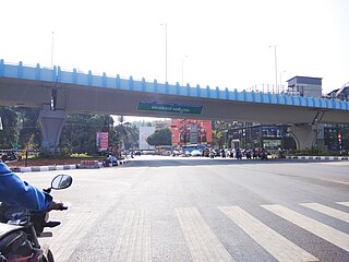
Thondayad Junction is an important intersection of Kozhikode city, India. This junction connects the city to the eastern town of Kozhikode District so the traffic is heavy. The junction also connects to the northern and southern cities of Kerala by National highway 66

Kozhikode South is an outgrowth of Kozhikode city in Kerala, India. Kozhikode South refers to areas like Beypore, Feroke, Areekkad, Nallalam, Cheruvannur, Ramanattukara, Kadalundi and Pantheerankavu. Suburbs like Beypore are famous for boat making.

Kozhikode North is a city suburb in the Kozhikode district in Kerala, India. It includes suburbs on the northern side of the city up to Koyilandy town.

Airport Road, Kozhikode is an important road in Kozhikode, India. It extends from Thondayad Junction to Calicut Airport, about 20 km away. The road passes through Palazhi, Pantheeramkavu, Ramanattukara and Kondotty Thurakkal before reaching the airport.

