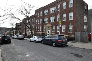
The Dillaway School is an historic school at 16-20 Kenilworth Street in Boston, Massachusetts. The school was built in 1882 to a design by George Albert Clough, the city's first official architect, and is his only surviving school design in the city. The building was listed on the National Register of Historic Places in 1980, and included in the Roxbury Highlands Historic District in 1989. The building has been converted to residential use.

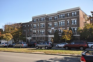
The Nazing Court Apartments are an historic site at 224-236 Seaver Street and 1-8 Nazing Court in the Roxbury neighborhood of Boston, Massachusetts. It consists of two large Colonial Revival apartment blocks designed by Boston architect Sumner Schein and built in 1929. One houses 53 units, the other 98; they stand on a parcel overlooking Franklin Park. They were built to provide housing for Roxbury's burgeoning working-class Jewish community, and are a rare residential work of Schein, who did mostly commercial work.

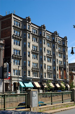
The Riviera is an historic apartment building at 270 Huntington Avenue in Boston, Massachusetts. Built in 1923, it is a seven-story brick and concrete structure developed by Coleman & Gilbert and designed by Fred A. Norcross. Norcross was a prolific builder of apartment and tenement blocks for the city's burgeoning immigrant population. The building has an asymmetrical facade, divided into four similarly styled sections, each of which has a band of three sash windows on the left and a projecting polygonal bay on the right. A few of the three-window groups have shallow balconies with low balustrades in front of them.

The Memorial Drive Apartments Historic District is a historic district encompassing four apartment houses on Memorial Drive in Cambridge, Massachusetts. They are located between the Anderson Memorial Bridge and the Eliot Bridge with street numbers ranging from 983 to 993 Memorial Drive. All four buildings were built between 1916 and 1924, not long after Memorial Drive had been laid out, and were, despite significant similarities of style, designed by three different architects. All provide good views of the Charles River. The district was listed on the National Register of Historic Places in 1986.

Hammond Pond Parkway is a historic parkway in Chestnut Hill, Massachusetts. The road, built in 1932, extends 2 miles (3.2 km) from Hobart Road in Newton to Horace James Circle in Brookline, where it joins the West Roxbury Parkway. It was designed by Charles Eliot and the Olmsted Brothers to provide a parkway setting that provided access from Brookline, Newton, and the western portions of Boston to the southern parks of the Emerald Necklace. The parkway was listed on the National Register of Historic Places in 2004.

The Hotel Kempsford is a historic apartment house at 72 Walnut Street in Brookline, Massachusetts. The four story brick building was designed by Brookline architect Obed Smith and built in 1875 for Eben Wright, a real estate developer who also built the nearby Hotel Adelaide. This building is a high-quality local example of Victorian Gothic architecture in brick. The apartment units inside are also in a distinctive two-story plan, one of the earliest examples of the type.

The Francis Street–Fenwood Road Historic District encompasses a small but cohesive early 20th-century residential area and streetcar suburb in the Longwood area of Boston, Massachusetts. Bounded by Huntington Avenue, Francis Street, Vining Avenue, Fenwood Road, and St. Albans Road, it includes a collection of two and three-family houses, as well as two apartment houses, a school, and one commercial building, all of which predate the large medical complexes that dominate the Longwood area. The district was listed on the National Register of Historic Places in 2016.

The Governor Shirley Square Historic District encompasses a cluster of civic, residential, and religious buildings at the junction of Dudley, Hampden, and Dunmore Streets in the Roxbury neighborhood of Boston, Massachusetts. Named for colonial governor William Shirley in 1913, the square was developed in the 1870s and 1880s as a major locus of civic development after the city of Roxbury was annexed to Boston in 1868. The district was listed on the National Register of Historic Places in 2016.

The Columbia Road–Devon Street Historic District encompasses a collection of brick residential apartment houses on Columbia Road in the Dorchester neighborhood of Boston, Massachusetts. Arrayed on the southeast side of the road near its junction with Devon Street are seven multistory buildings, constructed in the first two decades of the 20th century, when the area was developed as a streetcar suburb. An eighth building from the same period is located on the northwest side at the junction with Stanwood Street. These apartment blocks are typical of the speculative housing built at the time, with most of them built out of red brick laid in Flemish bond, with cast stone trim.

The Columbia Road–Bellevue Street Historic District encompasses a collection of brick residential apartment houses on Columbia Road and Bellevue Street in the Dorchester neighborhood of Boston, Massachusetts. Arrayed mainly on Columbia Road between Wheelock Avenue and Bodwell Street, south of the Uphams Corner commercial area, area collection of primarily late 19th and early 20th-century multiunit residential buildings, built when the area was developed as a streetcar suburb. Most of these are Colonial Revival masonry or frame buildings three and four stories in height, although some exhibit Queen Anne features. There are a few older Greek Revival buildings in the district, and a number of apartment blocks built in the 1920s during a second phase of development.

The Columbia Road–Strathcona Road Historic District encompasses a collection of brick residential apartment houses on Columbia and Strathcona Roads in the Roxbury neighborhood of Boston, Massachusetts. Arrayed on the southeast side of Columbia Road between Washington and Brinsley Streets are several multistory buildings with well-preserved Colonial Revival features. They were constructed in the first two decades of the 20th century, when the area was developed as a streetcar suburb. These were built mainly by Jewish developers Saul E. Moffie and Samuel Levy to serve a growing Jewish population in the area.

The Intervale Street-Columbia Road Historic District is a historic district encompassing a small residential area in the Dorchester neighborhood of Boston, Massachusetts. Centered on a stretch of Intervale Street, the area was developed in the early 20th century during a major Jewish migration, and includes a fine sample of Colonial Revival architecture. The district was listed on the National Register of Historic Places in 2019.

The Cartoof & Sherman Apartments are a group of three historic apartment houses at 31-35 Wales Street in the Dorchester neighborhood of Boston, Massachusetts. Built in 1925, they are well-preserved examples of Colonial Revival architecture, built during a period of growth fueled by the city's expanding streetcar network. The apartments were listed on the National Register of Historic Places in 2020.

The Intervale Street-Blue Hill Avenue Historic District is a historic district encompassing a densely built residential area in the Dorchester neighborhood of Boston, Massachusetts. Centered on a stretch of Intervale Street near Blue Hill Avenue, the area was developed in the late 19th and early 20th centuries during a major Jewish migration, and includes a fine sample of Colonial Revival architecture. The district was listed on the National Register of Historic Places in 2020.

The Elm Hill Park Historic District is a historic district encompassing a small residential area in the Roxbury neighborhood of Boston, Massachusetts. It encompasses a residential development created in the early 20th century, including fine examples of Colonial Revival and Queen Anne wood-frame construction, as well as a series of brick Romanesque apartment houses. The district was listed on the National Register of Historic Places in 2021.

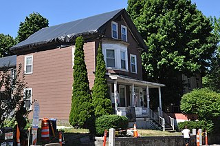
The Malcolm X—Ella Little-Collins House is a historic house at 72 Dale Street in the Roxbury section of Boston, Massachusetts. Built in 1874, it was for many years home to Ella Little-Collins, a prominent local civil rights activist, and was home to her younger brother Malcolm X during his later teenage years. During this period Malcolm X was exposed to Islam, beginning his path to involvement in the Nation of Islam. The house was listed on the National Register of Historic Places in 2021, at which time it was still owned by the Collins family.

The Lawrence Avenue Historic District is a historic district encompassing a small residential area in the Dorchester neighborhood of Boston, Massachusetts. Centered on Lawrence Avenue, the area was developed in the late 19th and early 20th century during a major Jewish migration, and includes a fine sample of Colonial Revival and Queen Anne architecture. The district was listed on the National Register of Historic Places in 2021.

The Humboldt Avenue Historic District is a historic district encompassing a cluster of multifamily brick buildings in the Dorchester neighborhood of Boston, Massachusetts. Centered on the junction of Humboldt Avenue and Hutchings Street, the area was developed in 1915-16 during a major Jewish migration, and includes a fine sample of Colonial Revival architecture. The district was listed on the National Register of Historic Places in 2021.

The Camden Street Development Historic District is a historic district encompassing a cluster of municipally owned residential apartment blocks in the Roxbury neighborhood of Boston, Massachusetts. It consists of three nearly identical buildings centered on Shawmut Avenue between Camden Street and Brannon Harris Way. The blocks were built in 1949 by the city to provide housing to low-income African-American veterans, and have had only minimal alteration since then. The district was listed on the National Register of Historic Places in 2022.

The Dudley Terrace–Dudley Street Historic District is a historic district encompassing a cluster of four multifamily brick buildings in the Dorchester neighborhood of Boston, Massachusetts. Centered on the junction of Dudley Street and Virginia Avenue, the area was developed in the mid-1890s, and includes good examples of Queen Anne and Renaissance Revival architecture. The district was listed on the National Register of Historic Places in 2022.


