Warren | |
|---|---|
Township | |
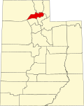
 Warren Location of Warren in Utah  Warren Warren (the United States) | |
| Coordinates: 41°17′01″N112°07′20″W / 41.28361°N 112.12222°W | |
| Country | United States |
| State | Utah |
| County | Weber |
| Settled | 1870 |
| Named after | Lewis Warren Shurtliff |
| Elevation | 4,219 ft (1,286 m) |
| ZIP code | 84404 |
| Area codes | 385, 801 |
| GNIS feature ID | 1447187 [1] |
Warren is a township and unincorporated community in Weber County, Utah, United States. Originally settled in 1870 under the name of Salt Creek, it was renamed in 1896 in honor of Lewis Warren Shurtliff, the local stake president of the Church of Jesus Christ of Latter-day Saints. [2] [3]
| Census | Pop. | Note | %± |
|---|---|---|---|
| 1900 | 276 | — | |
| 1910 | 433 | 56.9% | |
| 1920 | 233 | −46.2% | |
| 1930 | 293 | 25.8% | |
| 1940 | 451 | 53.9% | |
| 1950 | 303 | −32.8% | |
| Source: U.S. Census Bureau [4] | |||