West Haven, Utah

Last updated

West Haven, Utah
2007-1019-WestHaven.jpg
West Haven city hall
Weber County Utah incorporated and unincorporated areas West Haven highlighted.svg
Location in Weber County and the state of Utah
Coordinates: 41°12′10″N112°3′31″W / 41.20278°N 112.05861°W / 41.20278; -112.05861
Country United States
State Utah
County Weber
Settled1854
IncorporatedJuly 1, 1991
Government
  MayorRob Vanderwood
  City CouncilCarrie Call, Kim Dixon, Nina Morse, Ryan Saunders, Ryan Swapp
Area
[1]
  Total10.64 sq mi (27.56 km2)
  Land10.64 sq mi (27.55 km2)
  Water0.00 sq mi (0.01 km2)
Elevation
4,272 ft (1,302 m)
Population
 (2010)
  Total10,272
  Estimate 
(2019) [2]
16,109
  Density1,514.57/sq mi (584.77/km2)
Time zone UTC-7 (MST)
  Summer (DST) UTC-6 (MDT)
ZIP code
84401
Area code(s) 385, 801
FIPS code 49-82930 [3]
GNIS feature ID1455859 [4]
Website City of West Haven

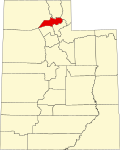
West Haven is a city in Weber County, Utah, United States. The population was 10,272 at the 2010 census. It was incorporated on July 1, 1991, combining the unincorporated communities of Kanesville and Wilson.

Contents

West Haven is located approximately 35 miles (56 km) north of Salt Lake City, west of the Wasatch Mountains in northern Utah. The confluence of the Weber and Ogden Rivers is located inside the northeastern portion of the city. The city is bordered on the east by Ogden, on the south by Roy, on the west by Hooper, and on the north by Marriott-Slaterville. It is part of the Ogden–Clearfield, Utah Metropolitan Statistical Area.

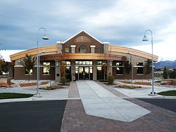
West Haven has a city park which includes a historical monument. Plans provide for a River Parkway Trail that would include a fishing bridge, a pedestrian tunnel under 21st Street, picnic tables, places to rest and points of historical interest. Plans have this trail connect with the Weber County Centennial Trail. The current mayor is Rob Vanderwood who started his term on January 1, 2022.

Geography

According to the United States Census Bureau, the city has a total area of 10.2 square miles (26.3 km2), all land.

History

Kanesville

The first settlers in what would become Kanesville arrived in 1868. At the time the area was known as Northwest Hooper. Kanesville was named for Thomas L. Kane. [5] The name Kanesville was adopted when an LDS Ward was first organized there in 1882. The first bishop was Peter B. Peterson.

The name is retained by Kanesville School, a K-6 school in West Haven. [6] Until October 2010 the Stake of The Church of Jesus Christ of Latter-day Saints in the city was the Kanesville Utah Stake. On October 17, 2010, the Kanesville Utah Stake was divided and a new stake, the West Haven Utah Stake, was formed. The old stake retained the Kanesville name. [7]

Wilson

Wilson, Utah was formed in 1854. It was named after the four Wilson brothers who began farming in the area in 1854. An irrigation company was formed in 1879 and an LDS Ward was organized in 1882. The first bishop was Brigham Heber Bingham. The first settler to live in the area that became Wilson was John Martin. He moved from Ogden and was the frist to move west of the Weber River in 1856. The Wilson Brothers started farming in the area west of the Weber River in 1854, but lived in Ogden. (History from the book, "Mormon John Martin" Utah Pooneer Family History copyright 1969 by Drucilla H. McFarkand. Carr Printing.)

City of West Haven

West Haven installed a citywide sewer system in 2002. In 1994 the city purchased 40 acres for a park which was then developed with playground equipment and sports fields. There is also a historical marker in the park. [8]

Demographics

Historical population
CensusPop.Note
1990 2,172
2000 3,97683.1%
2010 10,272158.4%
2019 (est.)16,109 [2] 56.8%
U.S. Decennial Census [9]

As of the census [3] of 2000, there were 3,976 people, 1,131 households, and 995 families residing in the city. The population density was 391.0 people per square mile (150.9/km2). There were 1,220 housing units at an average density of 120.0 per square mile (46.3/km2). The racial makeup of the city was 94.06% White, 0.48% African American, 0.48% Native American, 0.83% Asian, 0.08% Pacific Islander, 2.29% from other races, and 1.79% from two or more races. Hispanic or Latino of any race were 4.85% of the population.

There were 1,131 households, out of which 52.3% had children under the age of 18 living with them, 79.1% were married couples living together, 6.1% had a female householder with no husband present, and 12.0% were non-families. 9.5% of all households were made up of individuals, and 3.9% had someone living alone who was 65 years of age or older. The average household size was 3.52 and the average family size was 3.77.

In the city, the population was spread out, with 36.9% under the age of 18, 10.0% from 18 to 24, 28.6% from 25 to 44, 18.6% from 45 to 64, and 5.8% who were 65 years of age or older. The median age was 28 years. For every 100 females, there were 103.7 males. For every 100 females age 18 and over, there were 99.8 males.

The median income for a household in the city was $57,120, and the median income for a family was $62,188. Males had a median income of $40,264 versus $30,428 for females. The per capita income for the city was $18,089. About 1.3% of families and 1.8% of the population were below the poverty line, including 1.8% of those under age 18 and 2.0% of those age 65 or over.

A newsletter from the city's mayor in 2009 noted that West Haven was the fastest growing city in Utah in 2008. Much of the city is zoned for commercial development, particularly along the state highway on 1900 West (directly north of the larger community of Roy, Utah, for which 1900 West is the primary north–south main street), and around the 21st Street/Wilson Lane I-15 exit for Ogden and West Haven. A growing number of businesses are located in the commercial areas (including Wilson Lane and part of Midland Drive) from small shops, larger stores, vehicle sales, repair and service businesses, to small manufacturing operations to substantial enterprises such as steel fabrication. In general, the size and scope of new development projects has tended to increase since the city's founding.

The predominant single-family home nature of the residential areas - many of which have been created as developments of various sizes - is being joined by more multi-story multi-family dwellings and condominiums. Some of the old rural nature survives in patches, including farm homes dating back well into the 19th Century, and there are still some working farms raising both crops and animals.

Related Research Articles

<span class="mw-page-title-main">Weber County, Utah</span> County in Utah, United States

Weber County is a county in the U.S. state of Utah. As of the 2020 census, the population was 262,223, making it Utah's fourth-most populous county. Its county seat and largest city is Ogden, the home of Weber State University. The county was named after a fur trapper John Weber.

<span class="mw-page-title-main">Honeyville, Utah</span> City in Utah, United States

Honeyville is a city near the eastern edge of Box Elder County, Utah, United States. The population was 1,606 as of the 2020 census.

<span class="mw-page-title-main">Perry, Utah</span> City in Utah, United States

Perry is a city in Box Elder County, Utah, United States. The population was 4,512 at the 2010 census.

<span class="mw-page-title-main">Centerville, Utah</span> City in Utah, United States

Centerville is a city in southeastern Davis County, Utah, United States. Centerville is part of the Ogden-Clearfield Metropolitan Statistical Area. The population was 15,335 at the 2010 census. It is located adjacent to the easternmost part of the Great Salt Lake.

<span class="mw-page-title-main">Fruit Heights, Utah</span> City in Utah, United States

Fruit Heights is a city in eastern Davis County, Utah, United States. It is part of the Ogden–Clearfield, Utah Metropolitan Statistical Area. It lies along the Wasatch Front adjacent to the larger cities of Farmington and Kaysville. Its population was 4,987 at the 2010 census, with an estimated population of 6,234 in 2018.

<span class="mw-page-title-main">Fillmore, Utah</span> City in Utah, United States

Fillmore is a city and the county seat of Millard County, Utah, United States. The population was 2,592 at the 2020 United States Census. It is named for the thirteenth U.S. President Millard Fillmore, who was in office when Millard County was created by the Utah Territorial legislature.

<span class="mw-page-title-main">Morgan, Utah</span> City and county seat in Utah, United States

Morgan is a city in the U.S. state of Utah and the county seat of Morgan County. It is part of the Ogden-Clearfield metropolitan area. It is named after Jedediah Morgan Grant, a leader in the Church of Jesus Christ of Latter-day Saints who served as an apostle and as a member of the LDS First Presidency under Brigham Young in the mid-1850s. As of the 2010 census, the city population was 3,687 people and estimated at 4,260 in 2018. Morgan is also a location where some of the movie Troll 2 was filmed in 1989.

<span class="mw-page-title-main">Ephraim, Utah</span> City in Utah, United States

Ephraim is a city in Sanpete County, Utah, United States. The population was 5,611 at the 2020 census, making it the largest city in Sanpete County. It is the location of Snow College and is located along U.S. Route 89.

<span class="mw-page-title-main">Farr West, Utah</span> City in Utah, United States

Farr West is a city on the northern edge of Weber County, Utah. The population was 5,928 at the time of the 2010 census. It is part of the Ogden–Clearfield metropolitan area. As of 2022, the mayor is Ken Phippen.

<span class="mw-page-title-main">Harrisville, Utah</span> City in Utah, United States

Harrisville is a city in Weber County, Utah, United States. The population was 5,567 at the 2010 census. It is part of the Ogden–Clearfield, Utah Metropolitan Statistical Area. The current mayor is Michelle Tait.

<span class="mw-page-title-main">Hooper, Utah</span> City in Utah, United States

Hooper is a city in Weber County, Utah, United States, first called Muskrat Springs and later Hooperville for Captain William Henry Hooper, an early Utah delegate to Congress. The population was 9,087 at the 2020 census, up from the 2010 figure of 6,932. Prior to the city's incorporation on November 30, 2000, Hooper was an unincorporated census-designated place (CDP).

<span class="mw-page-title-main">Huntsville, Utah</span> Town in the state of Utah, United States

Huntsville is a town in Weber County, Utah, United States. The population was 608 at the 2010 census. It is located in Ogden Valley. It is part of the Ogden–Clearfield, Utah Metropolitan Statistical Area, as well as the Ogden Valley census county division.

<span class="mw-page-title-main">Marriott-Slaterville, Utah</span> City in Utah, United States

Marriott-Slaterville is a city in Weber County, Utah, United States. The population was 1,701 at the 2010 census. It is part of the Ogden–Clearfield, Utah Metropolitan Statistical Area. The city was incorporated in July 1999, in a merger of the previously unincorporated communities of Marriott and Slaterville.

<span class="mw-page-title-main">North Ogden, Utah</span> City in Utah, United States

North Ogden is a city in Weber County, Utah, United States. The population was 20,916 at the 2020 census. North Ogden is on SR-235, three miles north of Ogden. It is a suburb of that city and is part of the Ogden-Clearfield, Utah Metropolitan Statistical Area.

<span class="mw-page-title-main">Plain City, Utah</span> City in Utah, United States

Plain City is a city in Weber County, Utah, United States. The population was 5,476 at the 2010 census. It is part of the Ogden–Clearfield, Utah Metropolitan Statistical Area. The current mayor is Jon Beesley.

<span class="mw-page-title-main">Pleasant View, Utah</span> City in Utah, United States

Pleasant View is a city on the northern edge of Weber County, Utah, United States. The population was 7,979 at the 2010 census. It is part of the Ogden–Clearfield, Utah Metropolitan Statistical Area. It is a suburban community of Ogden.

<span class="mw-page-title-main">Riverdale, Utah</span> City in Utah, United States

Riverdale is a city in southern Weber County, Utah, United States. The population was 8,426 at the 2010 census. It is part of the Ogden–Clearfield, Utah Metropolitan Statistical Area.

<span class="mw-page-title-main">Roy, Utah</span> City in Utah, United States

Roy is a city in Weber County, Utah, United States, on the west side of Interstate 15. The population estimate in 2019 was 39,613, an increase of 5.8% from 36,884 at the 2010 census. Roy is part of the Ogden−Clearfield Metropolitan Statistical Area, and is considered a suburb of nearby Ogden, although some small businesses are present in Roy.

<span class="mw-page-title-main">South Ogden, Utah</span> City in Utah, United States

South Ogden is a city in Weber County, Utah, United States with 17,199 residents. The population was 16,532 at the 2010 census. It is part of the Ogden–Clearfield, Utah Metropolitan Statistical Area. The current mayor is Russell L. Porter.

<span class="mw-page-title-main">Uintah, Utah</span> City in Utah, United States

Uintah is a city in Weber County, Utah, United States. The population was 1,322 at the 2010 census. It is part of the Ogden–Clearfield, Utah Metropolitan Statistical Area. Although Uintah was a town in 2000, it has since been classified as a fifth-class city by state law.

References

  1. "2019 U.S. Gazetteer Files". United States Census Bureau. Retrieved August 7, 2020.
  2. 1 2 "Population and Housing Unit Estimates". United States Census Bureau. May 24, 2020. Retrieved May 27, 2020.
  3. 1 2 "U.S. Census website". United States Census Bureau . Retrieved January 31, 2008.
  4. "US Board on Geographic Names". United States Geological Survey. October 25, 2007. Retrieved January 31, 2008.
  5. epodunk article on Kanesville
  6. Public School Review listing for Kanesville School
  7. "New stake presidents", Church News , October 30, 2010.
  8. West Haven city post on the city's development
  9. "Census of Population and Housing". Census.gov. Retrieved June 4, 2015.