North Ogden, Utah Opecarry | |
---|---|
![]() City hall | |
![]() Location in Weber County and the state of Utah | |
Coordinates: 41°18′44″N111°57′30″W / 41.31222°N 111.95833°W | |
Country | United States |
State | Utah |
County | Weber |
Settled | 1850 |
Incorporated | 1934 |
Named for | Peter Skene Ogden |
Area | |
• Total | 7.51 sq mi (19.44 km2) |
• Land | 7.50 sq mi (19.44 km2) |
• Water | 0.00 sq mi (0.01 km2) |
Elevation | 4,613 ft (1,406 m) |
Population | |
• Total | 20,916 |
• Density | 2,788.8/sq mi (1,075.9/km2) |
Time zone | UTC-7 (Mountain (MST)) |
• Summer (DST) | UTC-6 (MDT) |
ZIP codes | 84404, 84414 |
Area code(s) | 385, 801 |
FIPS code | 49-55100 [4] |
GNIS feature ID | 2411275 [2] |
Website | www |
North Ogden is a city in Weber County, Utah, United States. The population was 20,916 at the 2020 census. [3] North Ogden is on SR-235, three miles north of Ogden. It is a suburb of that city and is part of the Ogden-Clearfield, Utah Metropolitan Statistical Area.
Among the first people to dwell in the North Ogden area were the Shoshone. The Shoshoni name for the area is “Opecarry,” which translates to “stick in the head.” [5]
North Ogden was settled by European-American settlers during the winter of 1850 by two sets of cattle ranchers from Ogden. The Campbells and the Riddles had been warned by Brigham Young not to venture from the fort in Ogden due to the troubles with the local Shoshone. After a few months wintering their cattle, they were forced to return to Ogden in fear of Shoshone reprisals. The following year, after the trouble with the Shoshone had been partially settled, Jonathan Campbell returned with a number of other families to permanently settle the spot. [6] [7]
One important early industry in the mid to late 19th century was the sugar beet industry, and a processing and canning plant was built in the town for this. The owner of the canning plant during its operation was David Ephriam Randall. North Ogden also built a spur from the Union Pacific Station in Ogden, called the "Dummy Line". Large fruit orchards were developed and their harvest became an economic staple for the community, with the establishment of the North Ogden Fruit Exchange in 1924. This became the region's first fruit cooperative, using the railroad to sell fruit on the interstate market. [8]
In the 1930s, increasing demand for water led the city to officially incorporate on February 1, 1934. [9] David Gilbert Randall was elected the first mayor. He served in this position for ten years. That same decade saw the creation of the Cherry Days celebration on July 4. As North Ogden grew after World War II, it became a primary suburb for Ogden and other larger cities. Its industries flagged, and most agricultural areas began to be parcelled out for homes. [10]
On November 3, 2018, after taking special leave from his mayoral position to serve in Afghanistan with the National Guard, Brent R. Taylor was shot and killed on duty by an Afghan commando. [11] Every year a large American flag is suspended in the air above Coldwater Canyon to honor him and the Veterans of the United States Armed Forces.
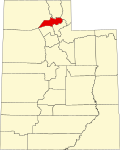
According to the United States Census Bureau, the city has a total area of 6.5 square miles (17 km2), all land.
North Ogden is situated at the base of Ben Lomond Peak, a prominent mountain on the Wasatch Front, visible from the Salt Lake Airport.
Census | Pop. | Note | %± |
---|---|---|---|
1870 | 683 | — | |
1880 | 956 | 40.0% | |
1890 | 758 | −20.7% | |
1900 | 850 | 12.1% | |
1910 | 579 | −31.9% | |
1920 | 1,004 | 73.4% | |
1930 | 1,045 | 4.1% | |
1940 | 687 | −34.3% | |
1950 | 1,105 | 60.8% | |
1960 | 2,621 | 137.2% | |
1970 | 5,257 | 100.6% | |
1980 | 9,309 | 77.1% | |
1990 | 11,668 | 25.3% | |
2000 | 15,026 | 28.8% | |
2010 | 17,357 | 15.5% | |
2020 | 20,916 | 20.5% | |
U.S. Decennial Census [12] [3] |
As of the census [4] of 2010, there were 17,357 people, 5,569 households, and 4,633 families residing in the city. The population density was 2,310.4 people per square mile (892.1 people/km2). There were 5,799 housing units at an average density of 701.5 units per square mile (270.9 units/km2). The racial makeup of the city was 94.3% White, 0.5% African American, 0.4% Native American, 0.9% Asian, 0.2% Pacific Islander, 1.8% from other races, and 1.9% from two or more races. Hispanic or Latino of any race were 5.4% of the population.
There were 5,569 households, out of which 39.6% had children under the age of 18 living with them, 71.2% were married couples living together, 8.6% had a female householder with no husband present, and 16.8% were non-families. 14.8% of all households were made up of individuals, and 5.0% had someone living alone who was 65 years of age or older. The average household size was 3.40 and the average family size was 3.68.
In the city, the population was spread out, with 31.4% under the age of 18, 8.7% from 18 to 24, 24.5% from 25 to 44, 24.2% from 45 to 64, and 11.2% who were 65 years of age or older. The median age was 32.9 years. For every 100 females, there were 101.2 males. For every 100 females age 18 and over, there were 98.8 males.
The median income for a household in the city was $59,556, and the median income for a family was $63,252. Males had a median income of $43,712 versus $28,180 for females. The per capita income for the city was $20,625. About 3.1% of families and 3.6% of the population were below the poverty line, including 3.9% of those under age 18 and 3.1% of those age 65 or over.
North Ogden is located in Utah's First Congressional District For the 118th United States Congress, Utah's First Congressional District is represented by Blake Moore (R Salt Lake City) [13]
Weber County is a county in the U.S. state of Utah. As of the 2020 census, the population was 262,223, making it Utah's fourth-most populous county. Its county seat and largest city is Ogden, the home of Weber State University. The county was named after a fur trapper John Weber.
Shoshone Countyshə-SHOHN is a county in the U.S. state of Idaho. As of the 2020 census, the population was 13,169. The county seat is Wallace and the largest city is Kellogg. The county was established in 1864, named for the Native American Shoshone tribe.
Shoshone is the county seat and largest city of Lincoln County, Idaho, United States. The population was 1,653 at the 2020 census. In contrast to the Shoshone Native American tribe for which it is named, the city's name is correctly pronounced "Show-shown", with a silent "e".
Washburn is a city in southern McLean County, North Dakota, United States. Located along the upper Missouri River, it is the county seat of McLean County. The population was 1,300 at the 2020 census.
Corinne is a city in Box Elder County, Utah, United States. The population was 809 at the 2020 census, up from the 2010 figure of 685.
Willard is a city in Box Elder County, Utah, United States. The population was 1,978 at the 2020 census.
North Logan is a city in Cache County, Utah, United States. The population was 10,986 at the 2020 census. It is included in the Logan, Utah-Idaho (partial) Metropolitan Statistical Area. The city is mainly composed of residential sub-divisions and is a suburb of the county seat, Logan. The city has an annual event every year in October called the Pumpkin Walk.
Providence is a city in Cache County, Utah, United States. The population was 8,218 at the 2020 census. It is included in the Logan, Utah-Idaho Metropolitan Statistical Area.
Fruit Heights is a city in eastern Davis County, Utah, United States. It is part of the Ogden–Clearfield, Utah Metropolitan Statistical Area. It lies along the Wasatch Front adjacent to the larger cities of Farmington and Kaysville. Its population was 4,987 at the 2010 census, with an estimated population of 6,234 in 2018.
Kaysville is a city in Davis County, Utah. It is part of the Ogden–Clearfield metropolitan area. The population was 32,945 at the time of the 2020 census.
Morgan is a city in the U.S. state of Utah and the county seat of Morgan County. It is part of the Ogden-Clearfield metropolitan area. It is named after Jedediah Morgan Grant, a leader in the Church of Jesus Christ of Latter-day Saints who served as an apostle and as a member of the LDS First Presidency under Brigham Young in the mid-1850s. As of the 2020 census, the city population was 4,071 people. Morgan is also a location where some of the movie Troll 2 was filmed in 1989.
Farr West is a city on the northern edge of Weber County, Utah. The population was 7,691 at the 2020 census, up from 5,928 at the 2010 census. It is part of the Ogden–Clearfield metropolitan area. As of 2022, the mayor is Ken Phippen.
Harrisville is a city in Weber County, Utah, United States. The population was 5,567 at the 2010 census. It is part of the Ogden–Clearfield, Utah Metropolitan Statistical Area.
Hooper is a city in Weber County, Utah, United States, first called Muskrat Springs and later Hooperville for Captain William Henry Hooper, an early Utah delegate to Congress. The population was 9,087 at the 2020 census, up from the 2010 figure of 6,932. Prior to the city's incorporation on November 30, 2000, Hooper was an unincorporated census-designated place (CDP).
Plain City is a city in Weber County, Utah, United States. The population was 5,476 at the 2010 census. It is part of the Ogden–Clearfield, Utah Metropolitan Statistical Area.
Pleasant View is a city on the northern edge of Weber County, Utah, United States. The population was 7,979 at the 2010 census. It is part of the Ogden–Clearfield, Utah Metropolitan Statistical Area. It is a suburban community of Ogden.
South Ogden is a city in Weber County, Utah, United States with 17,199 residents. The population was 16,532 at the 2010 census. It is part of the Ogden–Clearfield, Utah Metropolitan Statistical Area. The current mayor is Russell L. Porter.
Uintah is a city in Weber County, Utah, United States. The population was 1,322 at the 2010 census. It is part of the Ogden–Clearfield, Utah Metropolitan Statistical Area. Although Uintah was a town in 2000, it has since been classified as a fifth-class city by state law.
West Haven is a city in Weber County, Utah, United States. The population was estimated at 24,014 as of 2023. It was incorporated on July 1, 1991, combining the unincorporated communities of Kanesville and Wilson.
Fort Washakie is a census-designated place (CDP) in Fremont County, Wyoming, United States, within the Wind River Indian Reservation and along U.S. Route 287. The population was 1,759 at the 2010 census. The headquarters for the Eastern Shoshone Tribe is located in Fort Washakie, as well as the Bureau of Indian Affairs agency for the Wind River Indian Reservation.