
Tompkins County is a county located in the U.S. state of New York. As of the 2020 census, the population was 105,740. The county seat is Ithaca. The name is in honor of Daniel D. Tompkins, who served as Governor of New York and Vice President of the United States. The county is part of the Southern Tier region of the state.

Summerhill is a town in Cayuga County, New York, United States. The population was 1,217 at the 2010 census. The town name is that of a location in Ireland. Summerhill is in the southeastern corner of the county and is northeast of Ithaca.
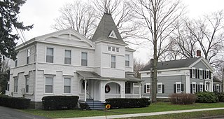
Danby is a town in Tompkins County, New York, United States. The population was 3,457 at the 2020 census. The town is in the southern part of the county and is south of the city of Ithaca.
East Ithaca is a suburban community in Tompkins County, New York, United States. The population was 2,231 at the 2010 census.

Forest Home is a census-designated place (CDP) in the town of Ithaca, New York, United States. The population was 572 at the 2010 census. It is located immediately east of the Cornell University campus.
Newfield is a town in Tompkins County, New York, United States. The population was 5,184 at the 2020 census. The town's name is derived from the many unoccupied tracts of land that were once in the town.
Newfield is a census-designated place (CDP) in Tompkins County, New York, United States. The population was 759 at the 2010 census.

South Hill is a census-designated place (CDP) in Tompkins County, New York, United States. The population was 7,245 at the 2020 census.
Spencer is a town in Tioga County, New York, United States. The population was 2,976 at the 2020 census. The town and its primary village are named after Ambrose Spencer. It lies on the western border of the county and is south of Ithaca. Inside the town is the Village of Spencer. The village of Candor borders the town to the east and southeast, with Waverly to the southwest and Van Etten to the west, while Danby is to the north.

New York State Route 13 (NY 13) is a state highway that runs mainly north–south for 152.30 miles (245.10 km) between NY 14 in Horseheads and NY 3 west of Pulaski in Central New York in the United States. In between, NY 13 intersects with Interstate 81 (I-81) in Cortland and Pulaski and meets the New York State Thruway (I-90) in Canastota. NY 13 is co-signed with several routes along its routing, most notably NY 34 and NY 96 between Newfield and Ithaca; NY 80 between DeRuyter and Cazenovia; and NY 5 between Chittenango and Canastota.

The Ithaca City School District (ICSD) is a public school district centered in Ithaca, Caroline, Danby, and Enfield. Approximately 600 teachers work in the district, along with 300 other professional staff members, 275 paraprofessionals, and 40 administrators, including principals.

Varna is a hamlet located in Tompkins County, New York, United States. It is within the Town of Dryden.
South Lansing is a census-designated place (CDP) in the town of Lansing, Tompkins County, New York, United States. The CDP includes the hamlets of South Lansing, Terpening Corners, and Asbury. The area was first listed as a CDP prior to the 2020 census.
Dryden is a town in Tompkins County, New York, United States. The population was 14,435 at the 2010 census. The town administers an area that includes two villages, one also named Dryden and one named Freeville, as well as a number of hamlets. The town is on the county's eastern border, east of Ithaca, in the Finger Lakes region.
Ithaca is a town in Tompkins County, New York, United States. The town's population was 22,283 at the 2020 census. The town is in the central part of the county, in the Finger Lakes–Southern Tier region of New York, and is part of the Ithaca Metropolitan Statistical Area. The Town of Ithaca is a horseshoe-shaped portion of the metropolitan area of Ithaca, New York, surrounding the City of Ithaca and being the city's only border. Ithaca College is located in the South Hill section of the town.
Lansing is a town in Tompkins County, New York, United States. The population was 11,565 at the 2020 census.

Brooktondale is a hamlet in Tompkins County, New York, United States. The community is 7 miles (11 km) southeast of Ithaca. Brooktondale has a post office with ZIP code 14817, which opened on July 30, 1832.
Jacksonville is a hamlet in Tompkins County, New York, United States. The community is located within the Town of Ulysses, along New York State Route 96. It is 3.5 miles (5.6 km) southeast of Trumansburg. Jacksonville has a post office with ZIP code 14854, which opened on February 25, 1820.
Slaterville Springs is a hamlet in Tompkins County, New York, United States. The community is located along New York State Route 79 8.4 miles (13.5 km) east-southeast of Ithaca, in the town of Caroline. Slaterville Springs has a post office with ZIP code 14881, which opened on August 8, 1823.
Danby is the primary hamlet and a census-designated place (CDP) in the town of Danby, Tompkins County, New York, United States. It was first listed as a CDP prior to the 2020 census.


