
Department of Cundinamarca is one of the departments of Colombia. Its area covers 22,623 square kilometres (8,735 sq mi) and it has a population of 2,598,245 as of 2013. It was created on August 5, 1886 under the constitutional terms presented on the same year. Cundinamarca is located in the center of Colombia.
Western Province or West Province may refer to:

The Bogotá River is a major river of the Cundinamarca department of Colombia, crossing the region from the northeast to the southwest and passing along the western limits of Bogotá. The large population and major industrial base in its watershed have resulted in extremely severe pollution problems for the river.

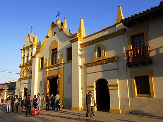
Madrid is a town and municipality in the Western Savanna Province, part of the department of Cundinamarca, Colombia. The city is located at 21 kilometres (13 mi) from the capital Bogotá. The city's main and biggest industry is the growing of flowers, especially roses which are mostly exported to the United States and Japan. Madrid borders Bojacá, El Rosal, Facatativá, Funza, Mosquera, Sibaté, Soacha, Subachoque, Tabio and Tenjo.
Bojacá is a municipality and town of the Western Savanna Province, Colombia in the department of Cundinamarca. The urban centre is situated at an altitude of 2,598 metres (8,524 ft) on the Bogotá savanna at 40 kilometres (25 mi) from the capital Bogotá. The municipality borders Zipacón, Madrid and Facatativá in the north, Madrid and Mosquera in the east, Soacha and San Antonio del Tequendama in the south and Tena, La Mesa and Zipacón in the west.

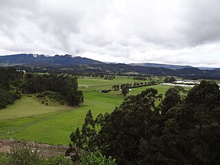
Cota is a municipality and town of Colombia in the Central Savanna Province of the department of Cundinamarca. Cota is part of the metropolitan area of Colombian capital Bogotá which centre is 26 kilometres (16 mi) away. The urban centre of Cota is located at an altitude of 2,566 metres (8,419 ft) and the municipality borders Chía in the north, Funza in the south, Suba, part of Bogotá in the east and Tenjo in the west.

Funza is a municipality and town of Colombia in the Western Savanna Province, of the department of Cundinamarca. Funza is situated on the Bogotá savanna, the southwestern part of the Altiplano Cundiboyacense with the urban centre at an altitude of 2,548 metres (8,360 ft). In Funza the La Florida wetland, part of the wetlands of Bogotá, remains to exist, a remnant of the Pleistocene Lake Humboldt. The town is part of the Metropolitan Area of Bogotá and borders Madrid and Tenjo in the north, Mosquera in the south, Madrid in the west and Cota and the locality Engativá of the capital Bogotá in the east. The eastern boundary is formed by the Bogotá River. Funza is the site of the former main settlement Bacatá of the Muisca Confederation. Modern Funza was founded by Gonzalo Jiménez de Quesada during the Spanish conquest of the Muisca on April 20, 1537.

Gachancipá is a municipality and town of Colombia in the Central Savanna Province, part of the department of Cundinamarca. The urban centre is located on the Altiplano Cundiboyacense at 42 kilometres (26 mi) from the capital Bogotá. The municipality borders Guatavita and Tocancipá in the south, Sesquilé in the east, Zipaquirá in the west and Nemocón in the north.

Mosquera is a municipality of Colombia in the Western Savanna Province, part of the department of Cundinamarca. Mosquera is close to the capital Bogotá and is part of its metropolitan area. The urban centre of Mosquera is situated at an altitude of 2,516 metres (8,255 ft) on the Bogotá savanna. The municipality borders the localities Bosa and Fontibón of Bogotá in the east, Soacha in the south, Madrid and Funza in the north and Bojacá in the west.

Sibaté is a municipality and town of Colombia in the Soacha Province, part of the department of Cundinamarca. Sibaté is located on the Bogotá savanna with the urban centre at an altitude of 2,700 metres (8,900 ft) and a distance of 27 kilometres (17 mi) from the capital Bogotá. It forms part of the metropolitan area of the capital. Sibaté borders Soacha in the north, Pasca and Fusagasugá in the south, Soacha in the east and Silvania and Granada in the west.

Subachoque is a municipality and town of Colombia in the Western Savanna Province, part of the department of Cundinamarca. The municipality is situated on the Bogotá savanna with the urban centre at an altitude of 2,663 metres (8,737 ft) at a distance of 45 kilometres (28 mi) from the capital Bogotá. Subachoque is part of the Metropolitan Area of Bogotá and borders Tabio and Tenjo in the east, Zipaquirá in the north, San Francisco, Pacho and Supatá in the west and Madrid and El Rosal in the south.

Tenjo is a municipality and town of Colombia in the Central Savanna Province, part of the department of Cundinamarca. The urban centre is located at an altitude of 2,587 metres (8,488 ft) on the Bogotá savanna. Tenjo is part of the Metropolitan Area of Bogotá and borders Chía, Madrid, Tabio, Funza, Subachoque and Cota.

Zipacón is a municipality and town of Colombia in the Western Savanna Province, part of the department of Cundinamarca. The urban centre of Zipacón is situated at an altitude of 2,550 metres (8,370 ft) on the Bogotá savanna, the southern flatlands of the Altiplano Cundiboyacense in the Eastern Ranges of the Colombian Andes. Zipacón borders Anolaima, Facatativá, La Mesa and Bojacá.
Central Savanna Province is one of the fifteen provinces of Cundinamarca, in the country of Colombia. It is located in the central area of the department, and has 11 municipalities. The province capital is the city of Zipaquirá.

El Rosal is a municipality and town of Colombia in the Western Savanna Province, part of the department of Cundinamarca. El Rosal is situated on the Bogotá savanna with its urban centre at an altitude of 2,685 metres (8,809 ft) and a distance of 20 kilometres (12 mi) from the capital Bogotá. It is part of the Metropolitan Area of Bogotá. El Rosal borders Subachoque in the northeast, San Francisco in the northwest, Madrid in the southeast and Facatativá in the southwest.

Almeidas Province is one of the 15 provinces in the Cundinamarca Department, Colombia. Almeidas borders to the east with the Boyacá Department to the north with the Ubaté Province, to the west with the Central Savanna Province and to the south with the Guavio Province.
Gualivá Province is one of the 15 provinces in the Cundinamarca Department, Colombia. Gualivá borders the Lower Magdalena Province to the west, to the north the Rionegro Province, to the east and southeast the Western Savanna Province, to the south slightly the Tequendama Province and to the southwest the Central Magdalena Province.

The Guavio Province is one of the 15 provinces in the Cundinamarca department, Colombia. Guavio borders the Capital District of Bogotá and the Central Savanna Province to the west, to the north the Almeidas Province, to the east the Boyacá Department and Medina Province and to the south the Meta Department and the Eastern Province. The Alberto Lleras Dam is also located in this area. The eastern municipalities Gachalá and Ubalá are rich in emeralds.

Piedras del Tunjo is an important archaeological park established on a natural rock shelter 40 kilometres (25 mi) west of Bogotá in the city of Facatativá.

The Bojacá River is a river on the Bogotá savanna and a right tributary of the Bogotá River.


