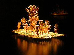
The Museum of Gold is an archaeology museum located in Bogotá, Colombia. It is one of the most visited touristic highlights in the country. The museum receives around 500,000 tourists per year.

The Archaeology Museum of Pasca is an archaeological museum located in Pasca, Colombia. It houses a great collection of Pre-Columbian objects and human remains, including Muisca mummies. It has a replica of the famous golden raft, Balsa Muisca, found near this town that represents the El Dorado rite. The museum hosts a piece of Muisca textile from Belén, Boyacá. The total collection numbers 2500 pieces. Apart from the Muisca artifacts, the museum hosts material from the Tairona, Calima, Quimbaya, Sinú, San Agustín and Tierradentro, among others.
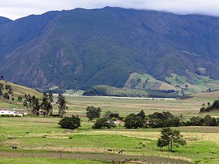
The Altiplano Cundiboyacense is a high plateau located in the Eastern Cordillera of the Colombian Andes covering parts of the departments of Cundinamarca and Boyacá. The altiplano corresponds to the ancient territory of the Muisca. The Altiplano Cundiboyacense comprises three distinctive flat regions; the Bogotá savanna, the valleys of Ubaté and Chiquinquirá, and the valleys of Duitama and Sogamoso. The average altitude of the altiplano is about 2,600 metres (8,500 ft) above sea level but ranges from roughly 2,500 metres (8,200 ft) to 4,000 metres (13,000 ft).
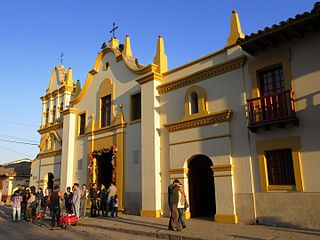
Bojacá is a municipality and town of the Western Savanna Province, Colombia in the department of Cundinamarca. The urban centre is situated at an altitude of 2,598 metres (8,524 ft) on the Bogotá savanna at 40 kilometres (25 mi) from the capital Bogotá. The municipality borders Zipacón, Madrid and Facatativá in the north, Madrid and Mosquera in the east, Soacha and San Antonio del Tequendama in the south and Tena, La Mesa and Zipacón in the west.

Nemocón is a municipality and town of Colombia in the Central Savanna Province, part of the department of Cundinamarca. Nemocón, famous for its salt mine, was an important village in the Muisca Confederation, the country in the central Colombian Andes before the arrival of the Spanish. The municipality is situated in the northern part of the Bogotá savanna, part of the Altiplano Cundiboyacense with its urban centre at an altitude of 2,585 metres (8,481 ft) and 65 kilometres (40 mi) from the capital Bogotá. Nemocón is the northeasternmost municipality of the Metropolitan Area of Bogotá and the Bogotá River originates close to Nemocón. The median temperature of Nemocón is 12.8 °C. The municipality borders Tausa in the north, Suesca and Gachancipá in the east, Tocancipá and Zipaquirá in the south and in the west the rivers Checua and Neusa and the municipality of Cogua.

The Spanish conquest of New Granada refers to the conquest by the Spanish monarchy of the Chibcha language-speaking nations of modern day Colombia and Panama, mainly the Muisca and Tairona that inhabited present-day Colombia, beginning the Spanish colonization of the Americas. It is estimated that around 5 to 8 million people died as a result of Spanish Conquest, either by disease or direct conflict, this is roughly around 80-90% of the Pre-Columbian population of Colombia.

The Bogotá savanna is a montane savanna, located in the southwestern part of the Altiplano Cundiboyacense in the center of Colombia. The Bogotá savanna has an extent of 4,251.6 square kilometres (1,641.6 sq mi) and an average altitude of 2,650 metres (8,690 ft). The savanna is situated in the Eastern Ranges of the Colombian Andes.

Bacatá is the name given to the main settlement of the Muisca Confederation on the Bogotá savanna. It mostly refers to an area, rather than an individual village, although the name is also found in texts referring to the modern settlement of Funza, in the centre of the savanna. Bacatá was the main seat of the zipa, the ruler of the Bogotá savanna and adjacent areas. The name of the Colombian capital, Bogotá, is derived from Bacatá, but founded as Santafe de Bogotá in the western foothills of the Eastern Hills in a different location than the original settlement Bacatá, west of the Bogotá River, eventually named after Bacatá as well.

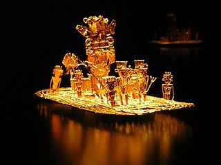
The Muisca raft, sometimes referred to as the Golden Raft of El Dorado, is a pre-Columbian votive piece created by the Muisca, an indigenous people of Colombia in the Eastern Ranges of the Colombian Andes. The piece probably refers to the gold offering ceremony described in the legend of El Dorado, which occasionally took place at Lake Guatavita. In this ritual, the new chief (zipa), who was aboard a raft and covered with gold dust, tossed gold objects into the lake as offerings to the gods, before immersing himself into the lake. The figure was created between 1295 and 1410 AD by lost-wax casting in an alloy of gold with silver and copper. The raft was part of an offering that was placed in a cave in the municipality of Pasca. Since its discovery in 1969, the Muisca raft has become a national emblem for Colombia and has been depicted on postage stamps. The piece is exhibited at the Gold Museum in Bogotá.
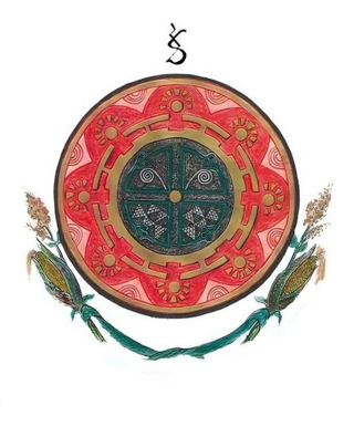
The Muisca Confederation was a loose confederation of different Muisca rulers in the central Andean highlands of what is today Colombia before the Spanish conquest of northern South America. The area, presently called Altiplano Cundiboyacense, comprised the current departments of Boyacá, Cundinamarca and minor parts of Santander.

Liborio Zerda was a Colombian physician and Muisca scholar. Zerda has been important in the natural sciences of the late 19th and early 20th century in Colombia, publishing many articles about various topics, from medicine to chemical analysis, radioactivity and the popular drink chicha.
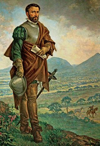
The Spanish conquest of the Muisca took place from 1537 to 1540. The Muisca were the inhabitants of the central Andean highlands of Colombia before the arrival of the Spanish conquistadors. They were organised in a loose confederation of different rulers; the psihipqua of Muyquytá, with his headquarters in Funza, the hoa of Hunza, the iraca of the sacred City of the Sun Sugamuxi, the Tundama of Tundama, and several other independent caciques. The most important rulers at the time of the conquest were psihipqua Tisquesusa, hoa Eucaneme, iraca Sugamuxi and Tundama in the northernmost portion of their territories. The Muisca were organised in small communities of circular enclosures, with a central square where the bohío of the cacique was located. They were called "Salt People" because of their extraction of salt in various locations throughout their territories, mainly in Zipaquirá, Nemocón, and Tausa. For the main part self-sufficient in their well-organised economy, the Muisca traded with the European conquistadors valuable products as gold, tumbaga, and emeralds with their neighbouring indigenous groups. In the Tenza Valley, to the east of the Altiplano Cundiboyacense where the majority of the Muisca lived, they extracted emeralds in Chivor and Somondoco. The economy of the Muisca was rooted in their agriculture with main products maize, yuca, potatoes, and various other cultivations elaborated on elevated fields. Agriculture had started around 3000 BCE on the Altiplano, following the preceramic Herrera Period and a long epoch of hunter-gatherers since the late Pleistocene. The earliest archaeological evidence of inhabitation in Colombia, and one of the oldest in South America, has been found in El Abra, dating to around 12,500 years BP.
This article describes the warfare of the Muisca. The Muisca inhabited the Tenza and Ubaque valleys and the Altiplano Cundiboyacense, the high plateau of the Colombian Eastern Ranges of the Andes in the time before the Spanish conquest. Their society was mainly egalitarian with little difference between the elite class (caciques) and the general people. The Muisca economy was based on agriculture and trading raw materials like cotton, coca, feathers, sea snails and gold with their neighbours. Called "Salt People", they extracted salt from brines in Zipaquirá, Nemocón and Tausa to use for their cuisine and as trading material.

This article describes the art produced by the Muisca. The Muisca established one of the four grand civilisations of the pre-Columbian Americas on the Altiplano Cundiboyacense in present-day central Colombia. Their various forms of art have been described in detail and include pottery, textiles, body art, hieroglyphs and rock art. While their architecture was modest compared to the Inca, Aztec and Maya civilisations, the Muisca are best known for their skilled goldworking. The Museo del Oro in the Colombian capital Bogotá houses the biggest collection of golden objects in the world, from various Colombian cultures including the Muisca.
Juan (Francisco) de Céspedes Ruiz was a Spanish conquistador who is known as the founder of the town of Pasca, Cundinamarca, in the south of the Bogotá savanna, Colombia. De Céspedes arrived in the Americas in 1521 and participated in the conquest of the Tairona and the foundation of Santa Marta under Rodrigo de Bastidas. From 1542 to 1543 and in 1546 he served as mayor of Bogotá and after that until 1570 as lieutenant general of the first president of Colombia. Juan de Céspedes married Isabel Romero, one of the first Spanish women who arrived at Colombian territories and had two legitimate sons and one daughter. His date of death is uncertain; in late 1573 or 1576.
Baltasar Maldonado, also written as Baltazar Maldonado, was a Spanish conquistador who first served under Gonzalo Jiménez de Quesada, and later in the army of Hernán Pérez de Quesada in the Spanish conquest of the Muisca.

The Eastern Hills are a chain of hills forming the eastern natural boundary of the Colombian capital Bogotá. They are part of the Altiplano Cundiboyacense, the high plateau of the Eastern Ranges of the Colombian Andes. The Eastern Hills are bordered by the Chingaza National Natural Park to the east, the Bogotá savanna to the west and north, and the Sumapaz Páramo to the south. The north-northeast to south-southwest trending mountain chain is 52 kilometres (32 mi) long and its width varies from 0.4 to 8 kilometres. The highest hilltops rise to 3,600 metres (11,800 ft) over the western flatlands at 2,600 metres (8,500 ft). The Torca River at the border with Chía in the north, the boquerón Chipaque to the south and the valley of the Teusacá River to the east are the hydrographic limits of the Eastern Hills.

The Battle of Tocarema was fought between an alliance of the troops of Spanish conquistador Gonzalo Jiménez de Quesada and zipa of the Muisca Sagipa of the southern Muisca Confederation and the indigenous Panche. The battle took place on the afternoon of August 19 and the morning of August 20, 1538 in the vereda Tocarema of Cachipay, Cundinamarca, Colombia and resulted in a victory for the Spanish and Muisca, when captains Juan de Céspedes and Juan de Sanct Martín commanded two flanks of the conquistadors.
Juan Tafur was a Spanish conquistador who participated in the Spanish conquest of the Muisca people. He was a cousin of fellow conquistadors Martín Yañéz Tafur, Hernán Venegas Carrillo and Pedro Fernández de Valenzuela. Juan Tafur was five times encomendero (mayor) of Santa Fe de Bogotá. He also received the encomiendas of Pasca, Chipaque and Usaquén. The encomienda of Suesca was shared between Tafur and Gonzalo García Zorro.


