
The Feast of Corpus Christi, also known as the Solemnity of the Most Holy Body and Blood of Christ, is a liturgical solemnity celebrating the real presence of Christ in the Eucharist; the feast is observed by the Latin Church, in addition to certain Western Orthodox, Lutheran, and Anglican churches. Two months earlier, the institution of the Eucharist at the Last Supper is observed on Maundy Thursday in a sombre atmosphere leading to Good Friday. The liturgy on that day also commemorates Christ's washing of the disciples' feet, the institution of the priesthood, and the agony in the Garden of Gethsemane.

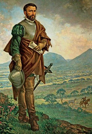
Gonzalo Jiménez de Quesada y Rivera, also spelled as Ximénez and De Quezada, was a Spanish explorer and conquistador in northern South America, territories currently known as Colombia. He explored the territory named by him New Kingdom of Granada, and founded its capital, Santafé de Bogotá. As a well-educated lawyer he was one of the intellectuals of the Spanish conquest. He was an effective organizer and leader, designed the first legislation for the government of the area, and was its historian. He was governor of Cartagena between 1556 and 1557, and after 1569 he undertook explorations toward the east, searching for the elusive El Dorado. The campaign didn't succeed and Jiménez then returned to New Granada in 1573. He has been suggested as a possible model for Cervantes' Don Quixote.

Chía is a city and municipality in the department of Cundinamarca in Colombia, located 10 km north of Bogotá on the main road to Zipaquira. Due to its proximity to Bogotá, Chía has effectively become a suburb of the capital.
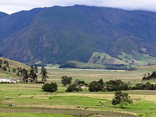
The Altiplano Cundiboyacense is a high plateau located in the Eastern Cordillera of the Colombian Andes covering parts of the departments of Cundinamarca and Boyacá. The altiplano corresponds to the ancient territory of the Muisca. The Altiplano Cundiboyacense comprises three distinctive flat regions; the Bogotá savanna, the valleys of Ubaté and Chiquinquirá, and the valleys of Duitama and Sogamoso. The average altitude of the altiplano is about 2,600 metres (8,500 ft) above sea level but ranges from roughly 2,500 metres (8,200 ft) to 4,000 metres (13,000 ft).

Cachipay is a municipality and town of Colombia in the Tequendama Province, part of the department of Cundinamarca. Cachipay borders Quipile in the west, Zipacón in the east, Anolaima in the north and La Mesa in the south. The urban centre is located 53 kilometres (33 mi) east of Bogotá.

Bosa is the 7th locality of the Capital District of the Colombian capital, Bogotá. Bosa is located in the southwest of Bogotá and is the 8th largest locality and 9th most populated. This district is inhabited by working-class residents.

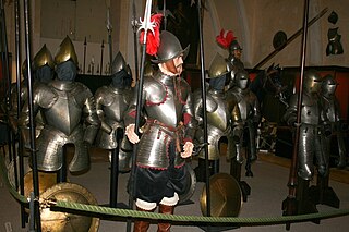
The Spanish conquest of New Granada refers to the conquest by the Spanish monarchy of the Chibcha language-speaking nations of modern day Colombia and Panama, mainly the Muisca and Tairona that inhabited present-day Colombia, beginning the Spanish colonization of the Americas. It is estimated that around 5 to 8 million people died as a result of Spanish Conquest, either by disease or direct conflict, this is roughly around 80-90% of the Pre-Columbian population of Colombia.
The Muisca Confederation was a loose confederation of different Muisca rulers in the central Andean highlands of what is today Colombia before the Spanish conquest of northern South America. The area, presently called Altiplano Cundiboyacense, comprised the current departments of Boyacá, Cundinamarca and minor parts of Santander.
The Spanish conquest of the Muisca took place from 1537 to 1540. The Muisca were the inhabitants of the central Andean highlands of Colombia before the arrival of the Spanish conquistadors. They were organised in a loose confederation of different rulers; the psihipqua of Muyquytá, with his headquarters in Funza, the hoa of Hunza, the iraca of the sacred City of the Sun Sugamuxi, the Tundama of Tundama, and several other independent caciques. The most important rulers at the time of the conquest were psihipqua Tisquesusa, hoa Eucaneme, iraca Sugamuxi and Tundama in the northernmost portion of their territories. The Muisca were organised in small communities of circular enclosures, with a central square where the bohío of the cacique was located. They were called "Salt People" because of their extraction of salt in various locations throughout their territories, mainly in Zipaquirá, Nemocón, and Tausa. For the main part self-sufficient in their well-organised economy, the Muisca traded with the European conquistadors valuable products as gold, tumbaga, and emeralds with their neighbouring indigenous groups. In the Tenza Valley, to the east of the Altiplano Cundiboyacense where the majority of the Muisca lived, they extracted emeralds in Chivor and Somondoco. The economy of the Muisca was rooted in their agriculture with main products maize, yuca, potatoes, and various other cultivations elaborated on elevated fields. Agriculture had started around 3000 BCE on the Altiplano, following the preceramic Herrera Period and a long epoch of hunter-gatherers since the late Pleistocene. The earliest archaeological evidence of inhabitation in Colombia, and one of the oldest in South America, has been found in El Abra, dating to around 12,500 years BP.
Hernán Pérez de Quesada, sometimes spelled as Quezada, was a Spanish conquistador. Second in command of the army of his elder brother, Gonzalo Jiménez de Quesada, Hernán was part of the first European expedition towards the inner highlands of the Colombian Andes. The harsh journey, taking almost a year and many deaths, led through the modern departments Magdalena, Cesar, Santander, Boyacá, Cundinamarca and Huila of present-day Colombia between 1536 and 1539 and, without him, Meta, Caquetá and Putumayo of Colombia and northern Peru and Ecuador between 1540 and 1542.
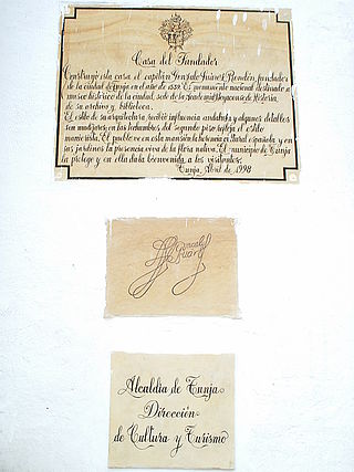
Gonzalo Suárez Rendón was a Spanish crusader and conquistador, known as the founder of the capital of Boyacá; Tunja, second city of the New Kingdom of Granada. A veteran of the Italian Wars, he also fought at the Conquest of Tunis, Germany, Austria and Hungary, before taking part in the Spanish conquest of the Muisca people led by Gonzalo Jiménez de Quesada, and later by his brother Hernán Pérez de Quesada. On August 6, 1539, he founded Tunja on the site of the former seat of the hoa (ruler) of the Hunza.
Juan (Francisco) de Céspedes Ruiz was a Spanish conquistador who is known as the founder of the town of Pasca, Cundinamarca, in the south of the Bogotá savanna, Colombia. De Céspedes arrived in the Americas in 1521 and participated in the conquest of the Tairona and the foundation of Santa Marta under Rodrigo de Bastidas. From 1542 to 1543 and in 1546 he served as mayor of Bogotá and after that until 1570 as lieutenant general of the first president of Colombia. Juan de Céspedes married Isabel Romero, one of the first Spanish women who arrived at Colombian territories and had two legitimate sons and one daughter. His date of death is uncertain; in late 1573 or 1576.

The Battle of Tocarema was fought between an alliance of the troops of Spanish conquistador Gonzalo Jiménez de Quesada and zipa of the Muisca Sagipa of the southern Muisca Confederation and the indigenous Panche. The battle took place on the afternoon of August 19 and the morning of August 20, 1538 in the vereda Tocarema of Cachipay, Cundinamarca, Colombia and resulted in a victory for the Spanish and Muisca, when captains Juan de Céspedes and Juan de Sanct Martín commanded two flanks of the conquistadors.
Juan de(l) Junco was a Spanish conquistador who participated in the Spanish conquest of the Muisca people. Del Junco started his career as a conquistador in the 1526 expedition led by Sebastian Cabot exploring the Río de la Plata in present-day Argentina. In 1535, he arrived in Santa Marta on the Colombian Caribbean coast from where the expedition in search of El Dorado set off in April 1536.
Juan Tafur was a Spanish conquistador who participated in the Spanish conquest of the Muisca people. He was a cousin of fellow conquistadors Martín Yañéz Tafur, Hernán Venegas Carrillo and Pedro Fernández de Valenzuela. Juan Tafur was five times encomendero (mayor) of Santa Fe de Bogotá. He also received the encomiendas of Pasca, Chipaque and Usaquén. The encomienda of Suesca was shared between Tafur and Gonzalo García Zorro.
Gonzalo García Zorro was a Spanish conquistador who participated in the Spanish conquest of the Muisca people. García Zorro was encomendero (mayor) of Santa Fe de Bogotá for seven terms, and received the encomiendas of Fusagasugá and Fosca.
Antonio Díaz de Cardoso was a Portuguese conquistador who participated in the Spanish conquest of the Muisca people.
Juan de Albarracín was a Spanish conquistador who participated in the Spanish conquest of the Muisca and Panche people. He was captain of the brigs which sailed up the Magdalena River from the Caribbean coast in 1536 and later discovered the high quality salt that lead the Spanish conquistadors along the Camino de la Sal up the slopes of the eastern ranges of the Colombian Andes towards the Muisca Confederation.
Antonio de Lebrija (1507–1540) was a Spanish conquistador who participated in the Spanish conquest of the Muisca and the Chimila peoples. He was the treasurer of the conquest expedition which left Santa Marta in April 1536 following the high quality salt trail, the Camino de la Sal, along the Suárez River up the slopes of the Eastern Ranges of the Colombian Andes towards the Muisca Confederation.

The Torres Gonzalo Jiménez de Quesada is a residential complex composed of five towers of equal height in the centre of the Colombian capital Bogotá. The buildings are situated in the neighbourhood (barrio) Las Aguas, in the northeast of La Candelaria.


