Wetaskiwin Regional Airport | |||||||||||
|---|---|---|---|---|---|---|---|---|---|---|---|
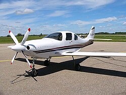 A Lancair IV-P at Wetaskiwin Airport | |||||||||||
| Summary | |||||||||||
| Airport type | Public | ||||||||||
| Operator | City of Wetaskiwin | ||||||||||
| Serves | Wetaskiwin, Alberta | ||||||||||
| Time zone | MST (UTC−07:00) | ||||||||||
| • Summer (DST) | MDT (UTC−06:00) | ||||||||||
| Elevation AMSL | 2,508 ft / 764 m | ||||||||||
| Coordinates | 52°57′55″N113°24′42″W / 52.96528°N 113.41167°W | ||||||||||
| Website | City of Wetaskiwin website | ||||||||||
| Map | |||||||||||
 CEX3 Location in Alberta | |||||||||||
| Runways | |||||||||||
| |||||||||||
| Source: Canada Flight Supplement [1] | |||||||||||
Wetaskiwin Regional Airport( TC LID : CEX3) is located within the city of Wetaskiwin, Alberta, Canada.