
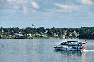
Windmill Hill is a village in the civil parish of Herstmonceux, in the Wealden district of East Sussex, England. In 2020 it had an estimated population of 585. [1]
Windmill Hill is a village in the civil parish of Herstmonceux, in the Wealden district of East Sussex, England. In 2020 it had an estimated population of 585. [1]

Sterling City is the county seat of Sterling County, Texas, United States. Its population was 1,121 at the 2020 census.

Edgewood is a city in Pierce County, Washington, United States. The population was 12,327 at the 2020 census. Neighboring towns include Fife to the west, Milton to the northwest, Federal Way to the north, Sumner to the east, and Puyallup to the south.
Morristown is a town in St. Lawrence County, New York, United States. The population was 1,974 at the 2010 census. The town is named after Gouverneur Morris, a signer of the United States Declaration of Independence and landowner in New York.

Highdown Hill is a hill in the South Downs, with a height of 81 metres (266 ft). The summit of the hill and its western slopes lie in the parish of Ferring in the Arun district, while its eastern slopes lie in the borough of Worthing. It is a popular spot for picnickers, dog-walkers and local riders. It overlooks Littlehampton, Angmering, Ferring and Worthing with views, when the weather is good, east as far as the Seven Sisters and west to the Isle of Wight. It is the property of the National Trust. To the north the ancient hill forts of Cissbury Ring and Chanctonbury Ring can be seen, and the remains of an ancient hill fort exist on the summit of Highdown Hill. Highdown Hill is the traditional burial-place of the kings of Sussex.

The smock mill is a type of windmill that consists of a sloping, horizontally weatherboarded, thatched, or shingled tower, usually with six or eight sides. It is topped with a roof or cap that rotates to bring the sails into the wind. This type of windmill got its name from its resemblance to smocks worn by farmers in an earlier period.

Gajendragad is a town and a sub-district place in Gadag District, Karnataka, India. This place is known for its hill station and hill strip. Highest populated city after Gadag in the district. It is about 55 kilometers from the district head quarter Gadag, 110 kilometers from Hubballi, 200 kilometers from Belagavi and 450 kilometers from state capital Bengaluru.

Walton and Ivythorn Hills is a 34.9 hectares biological Site of Special Scientific Interest near Street at the south-eastern end of the Polden Hills in the English county of Somerset. Walton Hill is south of the village of Walton, and Ivythorn Hill is south of Street. Notified in 1953, the site is now owned and managed by the National Trust who acquired the freehold in 1988.

Herencia is a municipality located in the Province of Ciudad Real, in the autonomous community of Castilla-La Mancha, Spain. It has a population of 8,500. The postal code is 13640. It's located 150 km away from the south of Madrid.

Cobstone Mill was built around 1816 on Turville Hill in Buckinghamshire, England, and overlooks the village of Turville. It is a smock mill that replaced the original mill that had stood there since the 16th century. The machinery was previously used in another mill in the village of Lacey Green.

The River Stour has been used for centuries as a source of power. Many different processes were performed by the use of water power:- Corn milling, fulling, paper making and electricity generation. Many of the mills survive today as house conversions, with two of them still working commercially.

Windmill Hill Mill is a grade II* listed post mill at Herstmonceux, Sussex, England which has been restored and now operates as a working mill. The mill is open to the public on most Sundays from Easter until October.

Bocking Windmill or Bocking Churchstreet Windmill is a grade I listed post mill at Bocking, Essex, England which has been restored.

Windmill Hill is a chalk hill running alongside the A3(M) in the East Hampshire district of Hampshire, England, overlooking Chalton to the east, and Clanfield to the west. It measures 193 metres above sea level and is named so because of Chalton Windmill which sits upon its summit. This windmill is a Grade II listed building which lay derelict until the late 1970s, when it was restored and converted into a private residence.
Brixton Hill ward is an administrative division of the London Borough of Lambeth, England. It contains most of the road known as Brixton Hill and part of Acre Lane. It contains Brixton Prison, Lambeth Town Hall, Ashby's Mill and the adjacent Windmill live music venue, Electric Brixton and the Brixton centre of Lambeth College. The population of the Ward at the 2011 Census was 15,842.

Mere is a sub-municipality of Erpe-Mere in Flanders. It is located on the Molenbeek-Ter Erpenbeek in the Denderstreek in the southeast of East Flanders and belongs to Arrondissement of Aalst. It is bordered by the sub-municipalities of Erpe, Ottergem, Bambrugge and Aaigem and the municipalities Haaltert and Aalst. Mere has 5033 inhabitants as of 1 January 2003 and an area of 5.77 km. The population density is 873 inhabitants / km ².

Windmill Hill or Windmill Hill Flats is one of a pair of plateaux, known collectively as the Southern Plateaux, at the southern end of the British Overseas Territory of Gibraltar. It is located just to the south of the Rock of Gibraltar, which descends steeply to the plateau. Windmill Hill slopes down gently to the south with a height varying from 120 metres (390 ft) at the north end to 90 metres (300 ft) at the south end. It covers an area of about 19 hectares, though about 6 hectares at the north end is built over. The plateau is ringed to the south and east with a line of cliffs which descend to the second of the Southern Plateaux, Europa Flats, which is itself ringed by sea cliffs. Both plateaux are the product of marine erosion during the Quaternary period and subsequent tectonic uplift. Windmill Hill was originally on the shoreline and its cliffs were cut by the action of waves, before the ground was uplifted and the shoreline moved further out to the edge of what is now Europa Flats.

Turville Hill is a 22.4 hectare biological Site of Special Scientific Interest in Turville in Buckinghamshire. It is in the Chilterns Area of Outstanding Natural Beauty. Cobstone Windmill, also known as Turville Windmill, is located at the top.

Beacon Hill is an 18.6-hectare (46-acre) Local Nature Reserve in Rottingdean, on the eastern outskirts of Brighton in East Sussex. It is owned and managed by Brighton and Hove Council.

Punnett's Town is a village in the Wealden district of East Sussex. The main street is Battle road, which is part of the B2096 road. Blackdown Mill is a grade II listed smock mill which has been restored.
Coordinates: 50°53′11″N0°20′26″E / 50.88641°N 0.34044°E
| | This East Sussex-location article is a stub. You can help Wikipedia by expanding it. |