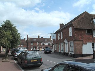
Wadhurst is a market town in East Sussex, England. It is the centre of the civil parish of Wadhurst, which also includes the hamlets of Cousley Wood and Tidebrook. Wadhurst is twinned with Aubers in France.

Wealden is a local government district in East Sussex, England. Its council is based in Hailsham, the district's second largest town. The district also includes the towns of Crowborough, Polegate and Uckfield, along with numerous villages and surrounding rural areas. The district's name comes from the Weald, the landscape and ancient woodland which occupies much of the centre and north of the area.

Polegate is a town and civil parish in the Wealden District of East Sussex, England, United Kingdom. It is located five miles (8 km) north of the seaside resort of Eastbourne and is part of the greater area of that town. Although once a railway settlement, its rail links were closed as part of the Beeching cuts. The 2011 census put the civil parish of Polegate at a population of 8,586, with 41.2% aged 65 and over.

Isfield is a small village and civil parish in the Wealden District of East Sussex in England, located north-east of Lewes.

Hailsham is a town, a civil parish and the administrative centre of the Wealden district of East Sussex, England. It is mentioned in the Domesday Book, where it is called Hamelesham. In one part yet, mentioned in other part of the same book as ‘’’Tilux’’’, the land of Ricard de Tunbrige. The town of Hailsham has a history of industry and agriculture.

Withyham is a village and large civil parish in the Wealden district of East Sussex, England. The village is situated 7 miles south west of Royal Tunbridge Wells and 3.5 miles (5.6 km) from Crowborough; the parish covers approximately 7,500 acres (30 km2).

Wealden was a constituency in East Sussex in the House of Commons of the UK Parliament. It was represented by members of the Conservative Party since its creation in 1983. Its final MP from 2015 to 2024, Nus Ghani, is the first Muslim woman to be elected as a Conservative member of Parliament.

Heathfield is a market town and former civil parish, now in the parish of Heathfield and Waldron, in the Wealden District of East Sussex, England. The town had a population of 7,732 in 2011.

Buxted is a village and civil parish in the Wealden district of East Sussex in England. The parish is situated on the Weald, north of Uckfield; the settlements of Five Ash Down, Heron's Ghyll and High Hurstwood are included within its boundaries. At one time its importance lay in the Wealden iron industry, and later it became commercially important in the poultry and egg industry.

The Cuckoo Trail is a 14-mile (23 km) footpath and cycleway which runs from Hampden Park to Heathfield in East Sussex. It passes through the towns of Polegate and Hailsham, as well as the villages of Hellingly and Horam.

Rotherfield is a village and civil parish in the Wealden District of East Sussex, England. It is one of the largest parishes in East Sussex. There are three villages in the parish: Rotherfield, Mark Cross and Eridge. The River Rother, which drains much of the county and discharges at Rye Harbour, has its source on the south side of the hill on which Rotherfield village is built.

Mayfield and Five Ashes is a civil parish in the High Weald of East Sussex, England. The two villages making up the principal part of the parish lie on the A267 road between Royal Tunbridge Wells and Eastbourne: Mayfield, the larger of the two villages is ten miles (16 km) south of Royal Tunbridge Wells; with Five Ashes being 2.5 miles (4 km) further south. On 1 April 1999 the parish was renamed from "Mayfield" to "Mayfield & Five Ashes".

Heathfield and Waldron is a civil parish within the Wealden District of East Sussex, England. Heathfield is surrounded by the High Weald Area of Outstanding Natural Beauty. The parish was formed on 1 April 1999 from "Heathfield" and "Waldron" parishes.

Frant is a village and civil parish in the Wealden District of East Sussex, England, on the Kentish border about three miles (5 km) south of Royal Tunbridge Wells.
The Cuckoo Line is an informal name for the now defunct railway service which linked Polegate and Eridge in East Sussex, England, from 1880 to 1968. It was nicknamed the Cuckoo Line by drivers, from a tradition observed at the annual fair at Heathfield, a station on the route. At the fair, which was held each April, a lady would release a cuckoo from a basket, it being supposedly the 'first cuckoo of spring'. The railway line served the following Sussex communities: Polegate, Hailsham, Hellingly, Horam for Waldron, Heathfield, Mayfield, Rotherfield and Eridge. Services continued through Eridge and onward via Groombridge to Tunbridge Wells.

Horam railway station was on the Cuckoo Line between Hellingly and Heathfield, serving the village of Horam.

St Wilfrid's Church is a Roman Catholic church serving the town of Hailsham in the Wealden district of East Sussex, England. The present building was completed in 2015 and is the third church to serve the town; it stands between its predecessors, a small hall opened in 1922 and a larger church of 1955, on a site which had belonged to a Catholic family since the 19th century. The Hailsham area was historically supportive of Protestant Nonconformist beliefs and had few Catholics, and for many years worshippers had to attend Mass in basic premises: rooms in private houses and, from 1917, a subdivided loft in the stables of a brewery. Numbers grew rapidly after the first permanent church opened, and after six decades of being served from Our Lady of Ransom Church, Eastbourne, Hailsham became an independent parish in 1957. The town's rapid postwar growth and an increasing Catholic population prompted the construction of the larger new church.


