Hellingly

Last updated

Hellingly
Village, civil parish, and district ward
Hellingly Parish Church of St Peter and St Paul.jpg
Aerial view of Hellingly village centre
East Sussex UK location map.svg
Red pog.svg
Hellingly
Location within East Sussex
Area19.6 km2 (7.6 sq mi)  [1]
Population1,820 (2011) [2]
  Density 205/sq mi (79/km2)
OS grid reference TQ581122
  London 45 miles (72 km) NNW
District
Shire county
Region
Country England
Sovereign state United Kingdom
Post town HAILSHAM
Postcode district BN27
Post townHEATHFIELD
Postcode district TN21
Dialling code 01323
01435
Police Sussex
Fire East Sussex
Ambulance South East Coast
UK Parliament
Website http://www.hellingly-pc.org.uk/
List of places
UK
England
East Sussex
50°53′N0°15′E / 50.89°N 0.25°E / 50.89; 0.25

Hellingly (pronounced 'Helling-lye') is a village, and can also refer to a civil parish, and to a district ward, in the Wealden District of East Sussex, England.

Contents

Geography

Hellingly contains the confluence of the River Cuckmere and one of its tributaries, the Bull River, close to the centre of the historic Hellingly village. The parish stands on the lower southern slopes of the gentle uplands forming the Weald.

The geographic centre of the parish is southeast of Old North Street and northwest of Church Lane, 2 miles (3.2 km) north of the town centre of Hailsham.

The village of Hellingly, the village of Lower Dicker, the village of Lower Horsebridge, the hamlet of Grove Hill , the suburbs of Roebuck Park and Carters Corner, are all entirely within the boundaries of the parish of Hellingly.

Liminal areas to the north of the village of Upper Dicker , to the east of the hamlet of Gun Hill, and to the south of the hamlet of North Corner, also fall within the boundaries of the parish of Hellingly.

History

The villages and settlements in the parish, like many others on the Weald, were involved in the Wealden iron industry.

The watermill in the village of Hellingly connected with the industry is no longer in operation. The mill building is a Grade II* listed building [3] and the associated miller's house is Grade II. [4] Horselunges Manor is a moated Tudor manor house, originally built for the Devenish family and restored by Walter Godfrey in the 1930s, and is Grade I listed. [5]

Hospitals

There are two NHS mental health sites within the parish of Hellingly, one is the Amberstone Hospital, a specialist rehabilitation unit to help people recover from long-term mental health issues, and the other site is the Hellingly Centre, a medium secure unit for people between the ages of 18 and 65 who have mental health problems and who have become involved with the criminal justice system. Both sites are managed by Sussex Partnership NHS Foundation Trust.

Hellingly Hospital once dominated the area east of the village and was the principal mental hospital for East Sussex. Opened in 1903 it remained in use until 1994. The buildings maintenance were under-invested before being sold by the NHS and demolished to be replaced by a housing estate, named by the developer as Roebuck Park.

Sport

The main sports clubs in the village are Hellingly Rugby Club and Hellingly cricket club, which are both at Horsebridge recreation ground.

Governance

Hellingly civil parish is administered at the lowest level of local government by Hellingly Parish Council.

Hellingly civil parish forms part of the larger Hellingly district ward, which also includes the village of Magham Down and the settlement of Ginger’s Green, in the Wealden District, with Wealden District Council being the middle level of local government for Hellingly.

Hellingly district ward forms part of the even larger Arlington, East Hoathly & Hellingly county electoral division for East Sussex, with East Sussex County Council being the highest level of local government for Hellingly.

The population of this ward at the 2011 census was 5,940. [6]

Hellingly is in the Wealden parliamentary constituency, the MP since 2015 has been Nus Ghani, Conservative.

Religion

The tower of the parish church HellinglyChurch.jpg
The tower of the parish church

The 13th-14th century parish church is dedicated to St Peter and St Paul. It is the only remaining example of a church built on a Saxon ciric, a circular mound, in the county. [7] The chancel dates from about 1200, and the shafts with annulets round the windows and the band of palmettes under them are substantially original.

There is stained glass in the east lancet windows by Morris & Co. The church is Grade I listed. [8] Zoar Strict Baptist Chapel was founded in 1837 at Lower Dicker. [9]

Transport

The Cuckoo Trail is a 14-mile (23 km) footpath and cycleway that passes through the parish.

This parish had a railway station on the Polegate to Eridge line which closed in 1968.

The parish is served by buses run by Stagecoach [10] and by Seaford & District Buses [11]

Notable people

Horselunges Manor, Hellingly Horselunges Manor.jpg
Horselunges Manor, Hellingly

Related Research Articles

<span class="mw-page-title-main">Wadhurst</span> Town in East Sussex, England

Wadhurst is a market town in East Sussex, England. It is the centre of the civil parish of Wadhurst, which also includes the hamlets of Cousley Wood and Tidebrook. Wadhurst is twinned with Aubers in France.

<span class="mw-page-title-main">Polegate</span> Town in East Sussex, England

Polegate is a town and civil parish in the Wealden District of East Sussex, England, United Kingdom. It is located five miles (8 km) north of the seaside resort of Eastbourne and is part of the greater area of that town. Although once a railway settlement, its rail links were closed as part of the Beeching cuts. The 2011 census put the civil parish of Polegate at a population of 8,586, with 41.2% aged 65 and over.

<span class="mw-page-title-main">Hartfield</span> Village in East Sussex, England

Hartfield is a village and civil parish in the Wealden district of East Sussex, England. The parish also includes the settlements of Colemans Hatch, Hammerwood and Holtye, all lying on the northern edge of Ashdown Forest.

<span class="mw-page-title-main">Hailsham</span> Town in East Sussex, England

Hailsham is a town, a civil parish and the administrative centre of the Wealden district of East Sussex, England. It is mentioned in the Domesday Book, where it is called Hamelesham. In one part yet, mentioned in other part of the same book as ‘’’Tilux’’’, the land of Ricard de Tunbrige. The town of Hailsham has a history of industry and agriculture.

<span class="mw-page-title-main">Burwash</span> Village in East Sussex, England

Burwash, archaically known as Burghersh, is a rural village and civil parish in the Rother district of East Sussex, England. Situated in the High Weald of Sussex some 15 miles (24 km) inland from the port of Hastings, it is located five miles (8 km) south-west of Hurst Green, on the A265 road, and on the River Dudwell, a tributary of the River Rother. In an area steeped in history, some nine miles (14 km) to the south-east lies Battle Abbey and eight miles (13 km) to the east is Bodiam Castle.

<span class="mw-page-title-main">Wealden (UK Parliament constituency)</span>

Wealden is a constituency represented in the House of Commons of the UK Parliament since 2015 by Nus Ghani, a Conservative. Ghani is the first Muslim woman to be elected as a Conservative member of Parliament.

<span class="mw-page-title-main">Buxted</span> Village in Sussex, England

Buxted is a village and civil parish in the Wealden district of East Sussex in England. The parish is situated on the Weald, north of Uckfield; the settlements of Five Ash Down, Heron's Ghyll and High Hurstwood are included within its boundaries. At one time its importance lay in the Wealden iron industry, and later it became commercially important in the poultry and egg industry.

Chiddingly is an English village and civil parish in the Wealden District of the administrative county of East Sussex, within historic Sussex, some five miles (8 km) northwest of Hailsham.

<span class="mw-page-title-main">Mayfield and Five Ashes</span> Parish in East Sussex, England

Mayfield and Five Ashes is a civil parish in the High Weald of East Sussex, England. The two villages making up the principal part of the parish lie on the A267 road between Royal Tunbridge Wells and Eastbourne: Mayfield, the larger of the two villages is ten miles (16 km) south of Royal Tunbridge Wells; with Five Ashes being 2.5 miles (4 km) further south. On 1 April 1999 the parish was renamed from "Mayfield" to "Mayfield & Five Ashes".

<span class="mw-page-title-main">Frant</span> Village in East Sussex, England

Frant is a village and civil parish in the Wealden District of East Sussex, England, on the Kentish border about three miles (5 km) south of Royal Tunbridge Wells.

<span class="mw-page-title-main">Selmeston</span> Village in East Sussex, England

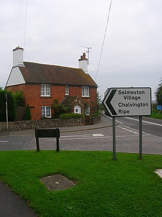
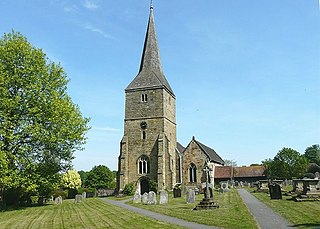
Selmeston is a village and civil parish in the Wealden District of East Sussex, England. It is located eight miles (13 km) east of Lewes, to the north of the A27 road between there and Polegate.

<span class="mw-page-title-main">Warbleton</span> Village in East Sussex, England

Warbleton is a village and civil parish in the Wealden district of East Sussex, England. Within its bounds are three other settlements. It is located south-east of Heathfield on the slopes of the Weald.

<span class="mw-page-title-main">Wivelsfield</span> Village in East Sussex, England

Wivelsfield village and the larger adjacent village of Wivelsfield Green are the core of the civil parish of Wivelsfield in the Lewes District of East Sussex, England. The villages are 9.3 miles (15.0 km) north of the city of Brighton and Hove.

<span class="mw-page-title-main">Twineham</span> Village in England

Twineham is a village and civil parish in the Mid Sussex District of West Sussex, England. It is located eight kilometres to the west of Burgess Hill. The civil parish covers an area of 784 hectares In the 2001 census 271 people lived in 100 households, of whom 139 were economically active. The 2011 Census population was 306.

<span class="mw-page-title-main">Zoar Strict Baptist Chapel</span> Church in East Sussex , United Kingdom

Zoar Strict Baptist Chapel is a Strict Baptist place of worship in the hamlet of Lower Dicker in the English county of East Sussex. Founded in 1837 and originally known as The Dicker Chapel, the "large and impressive" Classical/Georgian-style building stands back from a main road in a rural part of East Sussex. The 800-capacity building included a schoolroom and stables when built, and various links exist between people and pastors associated with the chapel and other Strict Baptist and Calvinistic causes in the county, which is "particularly well endowed with [such] chapels".

<span class="mw-page-title-main">Rushlake Green</span> Village in East Sussex, England

Rushlake Green is a small village in the civil parish of Warbleton in the Wealden district of East Sussex, England. Rushlake Green is situated on the slopes of the Weald between Heathfield 4 miles (6.4 km) north-west, Battle 9 miles (14 km) south-west and Hailsham 7 miles (11 km) south.

<span class="mw-page-title-main">St Wilfrid's Church, Hailsham</span> Church in East Sussex, England

St Wilfrid's Church is a Roman Catholic church serving the town of Hailsham in the Wealden district of East Sussex, England. The present building was completed in 2015 and is the third church to serve the town; it stands between its predecessors, a small hall opened in 1922 and a larger church of 1955, on a site which had belonged to a Catholic family since the 19th century. The Hailsham area was historically supportive of Protestant Nonconformist beliefs and had few Catholics, and for many years worshippers had to attend Mass in basic premises: rooms in private houses and, from 1917, a subdivided loft in the stables of a brewery. Numbers grew rapidly after the first permanent church opened, and after six decades of being served from Our Lady of Ransom Church, Eastbourne, Hailsham became an independent parish in 1957. The town's rapid postwar growth and an increasing Catholic population prompted the construction of the larger new church.

<span class="mw-page-title-main">Horselunges Manor</span> Listed house in Hellingly, East Sussex

Horselunges Manor is a 15th-century manor house in Hellingly, East Sussex, that was restored in the 20th century. The house was previously owned by Peter Grant, the manager of Led Zeppelin, and featured in the film The Song Remains the Same about the band. Horselunges Manor is a Grade I listed building.

References

  1. "East Sussex in Figures". East Sussex County Council. Retrieved 26 April 2008.
  2. "Civil Parish population 2011" . Retrieved 9 October 2015.
  3. Historic England (13 October 1952). "The mill building at the old water mill (Grade II*) (1180390)". National Heritage List for England .
  4. Historic England (12 August 1981). "The house at the old water mill (Grade II) (1043194)". National Heritage List for England .
  5. Historic England (13 October 1952). "Horselunges Manor (Grade I) (1285385)". National Heritage List for England .
  6. "Ward population 2011" . Retrieved 9 October 2015.
  7. "St Peter & St Paul". A Church Near You. Retrieved 28 November 2021.
  8. Historic England (30 August 1966). "Parish Church of St Peter and St Paul (Grade I) (1043186)". National Heritage List for England .
  9. Smith, Lez (2003). A History of the Dicker: Two Sussex Villages. Hailsham: Lez Smith. p. 13. ISBN   0-9546322-0-6.
  10. Stagecoach bus services
  11. Seaford & District bus services

Commons-logo.svg Media related to Hellingly at Wikimedia Commons