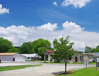
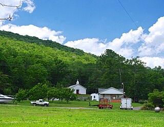
Range is an unincorporated community in Conecuh County, Alabama, United States. Range is located along Alabama State Route 41, 6.7 miles (10.8 km) south of Repton. Range has a post office with ZIP code 36473.
Goodway is an unincorporated community in Monroe County, Alabama, United States. Goodway is located along the Alabama and Gulf Coast Railway, 6.8 miles (10.9 km) south of Frisco City. Goodway had a post office until it closed on December 31, 1988; it still has its own ZIP code, 36449.
Frankville is an unincorporated community in Washington County, Alabama, United States, located on County Route 31, 9.8 miles (15.8 km) east of Millry. Frankville has a post office with ZIP code 36538.
Skipperville is an unincorporated community in Dale County, Alabama, United States. Skipperville is located on Alabama State Route 105, 8.8 miles (14.2 km) northeast of Ozark. Skipperville has a post office with ZIP code 36374, which opened on November 10, 1853.This community also consists of G.W. Long School, which has won a 2a state championship for baseball in many previous years. This school also has other sports teams with state wide victories.
Shorterville is an unincorporated community in Henry County, Alabama, United States. Shorterville is located on Alabama State Route 10, 8.8 miles (14.2 km) east of Abbeville. Shorterville has a post office with ZIP code 36373.

Highland Home is an unincorporated community in Crenshaw County, Alabama, United States. Highland Home is located on U.S. Route 331, 16.6 miles (26.7 km) north of Luverne. Highland Home has a post office with ZIP code 36041, which opened on July 15, 1837. Located mostly on highway 331 that also runs to Luverne, Alabama.

Estillfork is an unincorporated community in Jackson County, Alabama, United States. It is located in a rugged area at the head of the Paint Rock Valley in northern Jackson County. Just south of the community, the stream with which it shares its name, Estill Fork, joins Hurricane Creek to form the Paint Rock River. The Cumberland Plateau rises immediately to the east, and the Alabama-Tennessee state line passes a few miles to the north.

Hollytree is an unincorporated community in Jackson County, Alabama, United States. It is located on Alabama State Route 65, 9.7 miles (15.6 km) northeast of Gurley in the Paint Rock Valley. Hollytree has a post office with ZIP code 35751.

Princeton is an unincorporated community in Jackson County, Alabama, United States. Princeton is located on Alabama State Route 65 in the upper Paint Rock Valley. Skyline lies just over 7 miles (11 km) miles to the east atop the Cumberland Plateau, and the Alabama–Tennessee state line passes several miles to the north. Princeton has a post office with ZIP code 35766.

Trenton is an unincorporated community in Jackson County, Alabama, United States. It is located on Alabama State Route 65, 7.7 miles (12.4 km) east-northeast of Gurley in the Paint Rock Valley. Trenton had a post office until it closed on November 5, 2011; it still has its own ZIP code, 35774.
DeArmanville is an unincorporated community in Calhoun County, Alabama, United States, located on the southeast boundary of Anniston. DeArmanville has a post office with ZIP code 36257.

Clinton is an unincorporated community in Greene County, Alabama, United States. Clinton is located at the junction of Alabama routes 14 and 39, 7.9 miles (12.7 km) northwest of Eutaw. Clinton has a post office with ZIP code 35448.
Duncanville is an unincorporated community in Tuscaloosa County, Alabama, United States. Duncanville is located along U.S. Route 82, 12.5 miles (20.1 km) southeast of Tuscaloosa. Duncanville has a post office with ZIP code 35456, which opened on August 22, 1898. Duncanville was named in honor of either William M. Duncan, a local property owner, or W. Butler Duncan, an official with the Gulf, Mobile, and Northern Railroad.
Echola is an unincorporated community in Tuscaloosa County, Alabama, United States. Echola is 15.8 miles (25.4 km) northwest of Tuscaloosa. Echola has a post office with ZIP code 35457. Echola was previously known as Elbert. Due to possible confusion with Elberta, Alabama, the postmaster, Golden Mayfield, created the name Echola by combining "echo" and "Alabama".
Fosters is an unincorporated community in Tuscaloosa County, Alabama, United States. Fosters is located along U.S. Route 11 and U.S. Route 43, 10.4 miles (16.7 km) southwest of Tuscaloosa. Fosters has a post office with ZIP code 35463. Fosters is named in honor of the family of James Foster, who settled in the area in 1818.
Samantha is an unincorporated community in Tuscaloosa County, Alabama, United States. Samantha is located along U.S. Route 43, 14.8 miles (23.8 km) north of Tuscaloosa. Samantha has a post office with ZIP code 35482. Samantha was named in honor of the wife of the first postmaster, Sylvester Monroe Cowden.
Cecil is an unincorporated community in Montgomery County, Alabama, United States. Cecil is located on Alabama State Route 110, 17.6 miles (28.3 km) east-southeast of Montgomery. Cecil had a post office until it closed on May 20, 1986; it still has its own ZIP code, 36013.
Kent is an unincorporated community in Elmore County, Alabama, United States, located on Alabama State Route 229, 6.6 miles (10.6 km) north-northwest of Tallassee. Kent had a post office from November 29, 1913, until August 20, 1988; it still has its own ZIP code, 36045.
Maylene is an unincorporated community in Shelby County, Alabama, United States. While the community was once unincorporated, it is now part of southern Alabaster. Maylene has a post office with ZIP code 35114. One site in Maylene, the Meredith-McLaughlin House, is listed on the Alabama Register of Landmarks and Heritage.
Sayre is an unincorporated community in Jefferson County, Alabama, United States. Sayre is 16.5 miles (26.6 km) northwest of downtown Birmingham. Sayre had a post office from October 4, 1904, to November 5, 2011; it still has its own ZIP code, 35139.


