Woodstock, Alabama

Last updated

Woodstock
Town of Woodstock [1]
WoodstockAlabama.jpg
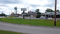
Business at the commercial center of Woodstock
Bibb County and Tuscaloosa County Alabama Incorporated and Unincorporated areas Woodstock Highlighted 0183640.svg
Location of Woodstock in Bibb County and Tuscaloosa County, Alabama.
Coordinates: 33°12′04″N87°09′01″W / 33.201248°N 87.150242°W / 33.201248; -87.150242
Country United States
State Alabama
County Bibb
Government
  MayorJeff Dodson
Area
[2]
  Total7.23 sq mi (18.72 km2)
  Land7.08 sq mi (18.34 km2)
  Water0.15 sq mi (0.38 km2)
Elevation
571 ft (174 m)
Population
 (2020)
  Total1,472
  Density207.85/sq mi (80.25/km2)
Time zone UTC-6 (Central (CST))
  Summer (DST) UTC-5 (CDT)
ZIP code
35188
Area code(s) 205, 659
FIPS code 01-83640
GNIS feature ID2406913 [3]
Website www.townofwoodstockal.com

Woodstock is a town in Bibb and Tuscaloosa counties in the U.S. state of Alabama. Formerly known as North Bibb, by referendum in August 2000, the town adopted the name of a long-established local unincorporated community and, as of October 1, 2000, is now known officially as "Woodstock". As of the 2010 census, the population of the town was 1,428. [4]

Contents

The Bibb County portion of Woodstock is part of the Birmingham metropolitan area, while the Tuscaloosa County portion is part of the Tuscaloosa metropolitan area.

History

Bibb County, founded as Cahawba County in 1818, played an important role in the early industrial history of Alabama. Ironworks and foundries produced goods from the brown iron ore found on Roupes Creek. Woodstock, known as North Bibb until 2000, is a small town on the northern boundary of Bibb County. This community was once the center of a thriving railroad business.

Woodstock was first settled in the 1820s, with a formal land grant to William Houston on February 27, 1826. The settlement was established along the old Tuscaloosa to Huntsville stagecoach line. Woodstock got its name when Dr. J.U. Ray named it after the home of his ancestors, Woodstock, England. Ray's ancestors arrived in America from England at Jamestown, Virginia. In 1870, Ray built the first depot for the newly constructed Alabama-Chattanooga Railroad. After the Alabama Great Southern Railroad came the Louisville and Nashville Railroad. Each operated a depot in the area. In 1872, a line was installed down to West Blocton to ship the large abundance of coal found in the area. Woodstock became a break and storage yard for coal, red and brown iron ore and cotton. After the Civil War, rich iron ore deposits were mined. In 1872, Giles Edwards relocated to Woodstock from Tannehill and built a blast furnace to manufacture pig iron.

Edwards was later joined in the business by his son-in-law, James W. McQueen, who went on to become the president of Sloss-Sheffield Iron Company in Birmingham. In addition to the iron ore mining, coal mining, and farming, a jug factory was built to take advantage of the large deposits of fire clay that was in the area. The clay was used to make bricks, jugs, pots, and churns. As many as eight trains per day stopped in Woodstock, carrying away its riches, six of them carrying mail. On June 18, 1919, Jim McMillan was lynched by a White mob.

Woodstock was also the roots of a newspaper business in the 1800s. This publication moved to Six Mile and then to Birmingham where it became The Birmingham News . Woodstock was incorporated in 1996 as the Town of North Bibb, with Carl Jones as mayor. Woodstock changed its name back to Woodstock by Ordinance 2008-08-03, effective October 1, 2000, S.B. Albert Hutchens, Mayor.

Geography

Woodstock is located in northern Bibb County at 33°12′4″N87°9′1″W / 33.20111°N 87.15028°W / 33.20111; -87.15028 (33.201248, -87.150242). [5] A portion of the town extends to the northwest into Tuscaloosa County. U.S. Route 11 passes northwest of the town center, leading northeast 31 miles (50 km) to downtown Birmingham and west 26 miles (42 km) to Tuscaloosa. Interstate 59 passes northwest of Woodstock, with the closest access via Exit 97 north of town.

According to the U.S. Census Bureau, the town has a total area of 7.2 square miles (18.7 km2), of which 7.1 square miles (18.3 km2) is land and 0.15 square miles (0.4 km2), or 2.11%, is water. [4]

Demographics

Historical population
CensusPop.Note
2000 986
2010 1,42844.8%
2020 1,4723.1%
U.S. Decennial Census [6]
2013 Estimate [7]

2020 census

Woodstock racial composition [8]
RaceNum.Perc.
White (non-Hispanic)1,33290.49%
Black or African American (non-Hispanic)382.58%
Native American 30.2%
Asian 20.14%
Pacific Islander 10.07%
Other/Mixed 422.85%
Hispanic or Latino 543.67%

As of the 2020 United States census, there were 1,472 people, 565 households, and 391 families residing in the town.

2010 census

As of the census [9] of 2010, there were 1,428 people, 507 households, and 395 families residing in the town. The population density was 202 inhabitants per square mile (78/km2). There were 549 housing units at an average density of 76.3 per square mile (29.5/km2). The racial makeup of the town was 93% White, 3.4% Black, and 1.0% from two or more races. 2.1% of the population were Hispanic or Latino of any race.

There were 507 households, out of which 34.3% had children under the age of 18 living with them, 61.9% were married couples living together, 10.3% had a female householder with no husband present, and 22.1% were non-families. 16.8% of all households were made up of individuals, and 5.5% had someone living alone who was 65 years of age or older. The average household size was 2.79 and the average family size was 3.13.

In the town, the population was spread out, with 26.9% under the age of 18, 8.3% from 18 to 24, 29.3% from 25 to 44, 25.4% from 45 to 64, and 10.1% who were 65 years of age or older. The median age was 35.7 years. For every 100 females, there were 100.6 males. For every 100 females age 18 and over, there were 100.4 males.

The median income for a household in the town was $48,750, and the median income for a family was $52,417. Males had a median income of $42,500 versus $32,885 for females. The per capita income for the town was $20,855. About 8.0% of families and 9.2% of the population were below the poverty line, including 8.7% of those under age 18 and 5.9% of those age 65 or over.

Notable persons

Culture

The podcast S-Town , from This American Life , is set and recorded in Woodstock.

Related Research Articles

<span class="mw-page-title-main">Bibb County, Alabama</span> County in Alabama, United States

Bibb County is a county in the central portion of the U.S. state of Alabama. The county is included in the ARC's definition of Appalachia. As of the 24th decennial 2020 census, its population was 22,293. The county seat is Centreville. The county is named in honor of William W. Bibb (1781–1820), the Governor of Alabama Territory (1817–1819) and the first Governor of Alabama. He is also the namesake for Bibb County, Georgia, where he began his political career. It is a "prohibition" or dry county; however, a few towns have become "wet" by allowing the sale of alcoholic beverages: Woodstock, West Blocton, Centreville, and Brent. The Bibb County Courthouse is located in the county seat of Centreville.

<span class="mw-page-title-main">Shelby County, Alabama</span> County in Alabama, United States

Shelby County is located in the central portion of the U.S. state of Alabama. As of the 2020 census the population was 223,024, making it the sixth-most populous county in Alabama. The county seat is Columbiana. Its largest city is Alabaster. The county is named in honor of Isaac Shelby, Governor of Kentucky from 1792 to 1796 and again from 1812 to 1816. Shelby County is included in the Birmingham–Hoover, AL Metropolitan Statistical Area.

<span class="mw-page-title-main">Tuscaloosa County, Alabama</span> County in Alabama, United States

Tuscaloosa County is a county in the northwest-central portion of the U.S. state of Alabama and is the center of commerce, education, industry, health care, and entertainment for the region.

<span class="mw-page-title-main">Billingsley, Alabama</span> Village in Alabama, United States

Billingsley is a village in Autauga County, Alabama, United States. At the 2020 census, the population was 125. It is part of the Montgomery Metropolitan Statistical Area.

<span class="mw-page-title-main">Brent, Alabama</span> City in Alabama, United States

Brent is a city in Bibb County, Alabama, United States. At the 2020 census, the population was 2,972.

<span class="mw-page-title-main">Centreville, Alabama</span> City in and county seat of Bibb County, Alabama

Centreville is a city in Bibb County, Alabama, United States. At the 2020 census, the population was 2,800. The city is the county seat of Bibb County.

<span class="mw-page-title-main">Vance, Alabama</span> Town in Alabama, United States

Vance is a town in Tuscaloosa and Bibb counties in the U.S. state of Alabama. As of the 2010 census it had a population of 1,529. It is most famous for the Mercedes-Benz U.S. International plant, currently the only one in North America. The current mayor of Vance is Brenda Morrison.

<span class="mw-page-title-main">West Blocton, Alabama</span> Town in Alabama, United States

West Blocton is a town in Bibb County, Alabama, United States. At the 2020 census, the population was 1,217. The current mayor is Daniel Sims.

<span class="mw-page-title-main">Calera, Alabama</span> City in Alabama, United States

Calera is a city in Shelby and Chilton counties in the U.S. state of Alabama. It is the location of the Shelby County Airport.

<span class="mw-page-title-main">Maplesville, Alabama</span> Town in Alabama, United States

Maplesville is a town in Chilton County, Alabama, United States. At the 2020 census, the population was 637. It is located approximately halfway between Tuscaloosa and Montgomery on U.S. Route 82.

<span class="mw-page-title-main">Coosada, Alabama</span> Town in Elmore County, Alabama, United States

Coosada is a town in Elmore County, Alabama, United States. At the 2020 census, the population was 1,217. It is part of the Montgomery Metropolitan Statistical Area.

<span class="mw-page-title-main">Moundville, Alabama</span> Town in Alabama, United States

Moundville is a town in Hale and Tuscaloosa counties in the U.S. state of Alabama. It was incorporated on December 22, 1908. From its incorporation until the 1970 census, it was wholly within Hale County. At the 2010 census the population was 2,427, up from 1,809 at the 2000 census. It is part of the Tuscaloosa Metropolitan Statistical Area. Within the town is Moundville Archaeological Site, the location of a prehistoric Mississippian culture political and ceremonial center.

<span class="mw-page-title-main">Bessemer, Alabama</span> City in Alabama, United States

Bessemer is a city in Jefferson County, Alabama, United States and a southwestern suburb of Birmingham. The population was 26,019 at the 2020 census. It is within the Birmingham-Hoover, AL Metropolitan Statistical Area, of which Jefferson County is the center. It developed rapidly as an industrial city in the late 19th and early 20th centuries.

<span class="mw-page-title-main">Brighton, Alabama</span> City in Alabama, United States

Brighton is a city near Birmingham, Alabama, United States and located just east of Hueytown. At the 2020 census, the population was 2,337. It is part of the Birmingham-Hoover Metropolitan Statistical Area, which in 2010 had a population of about 1,128,047, approximately one-quarter of Alabama's population.

<span class="mw-page-title-main">Edgewater, Alabama</span> CDP in Alabama, United States

Edgewater is a census-designated place in Jefferson County, Alabama, United States. It is northeast from the Birmingham suburb of Pleasant Grove. Its population was 883 at the 2010 census. This area was damaged by tornadoes on April 15, 1956 and April 8, 1998. The 1998 tornado was rated F5 on the Fujita scale.

<span class="mw-page-title-main">Mulga, Alabama</span> Town in Alabama, United States

Mulga is a town in western Jefferson County, Alabama, United States. It is north from the Birmingham suburb of Pleasant Grove. It includes the community of Bayview. Mulga was a company town operated by Birmingham Coal and Iron Company around the Mulga Mine and Mulga was also the name of an independent community in the area. The company town was incorporated in 1947.

<span class="mw-page-title-main">Athens, Alabama</span> City in and county seat of Limestone County, Alabama

Athens is a city in and the county seat of Limestone County, in the U.S. state of Alabama; it is included in the Huntsville-Decatur-Albertville, AL Combined Statistical Area. As of the 2020 census, the population of the city is 25,406.

<span class="mw-page-title-main">Linden, Alabama</span> City in Alabama, United States

Linden is a city in and the county seat of Marengo County, Alabama, United States. The population was 1,930 at the 2020 census, down from 2,123 at the 2010 census.

<span class="mw-page-title-main">Wilton, Alabama</span> Town in Alabama, United States

Wilton, also known by the previous names of Birmingham Junction, Bismark, and Catoosa, is a town in Shelby County, Alabama, United States. It was incorporated in 1918. This town is part of the Birmingham–Hoover–Cullman Combined Statistical Area. At the 2010 census the population was 687, up from 580 in 2000.

<span class="mw-page-title-main">Lake View, Alabama</span> City in Alabama, United States

Lake View is a city in Alabama, United States, with the majority in Tuscaloosa County and with a small portion in Jefferson County. At the 2010 census the population was 1,943, up from 1,357 in 2000. It is part of the Tuscaloosa Metropolitan Statistical Area and the Birmingham metropolitan area. It is located approximately halfway between Tuscaloosa and Birmingham via Interstates 20 and 59.

References

  1. "Code of Alabama 1975, Title 11, Chapter 40, Section 11-40-1" . Retrieved May 9, 2017.
  2. "2020 U.S. Gazetteer Files". United States Census Bureau. Retrieved October 29, 2021.
  3. "Woodstock". Geographic Names Information System . United States Geological Survey, United States Department of the Interior.
  4. 1 2 "Geographic Identifiers: 2010 Demographic Profile Data (G001): Woodstock town, Alabama". U.S. Census Bureau, American Factfinder. Archived from the original on February 12, 2020. Retrieved September 16, 2013.
  5. "US Gazetteer files: 2010, 2000, and 1990". United States Census Bureau. February 12, 2011. Retrieved April 23, 2011.
  6. "U.S. Decennial Census". Census.gov. Retrieved June 6, 2013.
  7. "Annual Estimates of the Resident Population: April 1, 2010 to July 1, 2013" . Retrieved June 3, 2014.
  8. "Explore Census Data". data.census.gov. Retrieved December 11, 2021.
  9. "U.S. Census website". United States Census Bureau . Retrieved July 8, 2015.