Related Research Articles

Wotje Atoll is a coral atoll of 75 islands in the Pacific Ocean, and forms a legislative district of the Ratak Chain of the Marshall Islands.
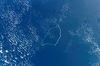
The Maloelap Atoll is a coral atoll of 71 islands in the Pacific Ocean, and forms a legislative district of the Ratak Chain of the Marshall Islands. Its land area is only 9.8 square kilometers (3.8 sq mi), but that encloses a lagoon of 972 square kilometers (375 sq mi). It is located 18 kilometers (11 mi) north of the atoll of Aur. In 2011 the population of the islands of the atoll was 682.

The Battle of Kwajalein was fought as part of the Pacific campaign of World War II. It took place from 31 January – 3 February 1944, on Kwajalein Atoll in the Marshall Islands. Employing the hard-learned lessons of the Battle of Tarawa, the United States launched a successful twin assault on the main islands of Kwajalein in the south and Roi-Namur in the north. The Japanese defenders put up stiff resistance, although outnumbered and under-prepared. The determined defense of Roi-Namur left only 51 survivors of an original garrison of 3,500.

Utirik Atoll or Utrik Atoll is a coral atoll of 10 islands in the Pacific Ocean, and forms a legislative district of the Ratak Chain of the Marshall Islands. Its total land area is only 2.4 square kilometers (0.94 sq mi), but it encloses a lagoon with an area of 57.7 square kilometers (22.29 sq mi). It is located approximately 47 kilometers (29 mi) east of Ujae Atoll. The population of Utirik Atoll is 300-400 as of 2020. it is one of the northernmost Marshall Islands with permanent habitation.

Mejit is an island in the Pacific Ocean, and forms a legislative district of the Ratak Chain of the Marshall Islands. Unlike most of the other islands of the Marshall Islands, Mejit is a stony island rather than a coral atoll, although it is surrounded by a fringing coral reef enclosing a narrow lagoon. It is located east of the main line of the Ratak chain, approximately 110 kilometers (68 mi) northeast from Wotje.

Marshall Islands International Airport, also known as Amata Kabua International Airport, is located in the western part of Rairok on the south side of Majuro Atoll, the capital of the Republic of the Marshall Islands. The airport was built during World War II (1943) on Anenelibw and Lokojbar islets. It replaced Majuro Airfield, a coral-surfaced airstrip at Delap Island near the eastern end of Majuro Atoll that had been originally constructed by Japanese occupation forces in 1942.
Jaluit Airport is a public use airstrip located one nautical mile (1.85 km) southwest of the village of Jabor on Jaluit Atoll, Marshall Islands. This airstrip is assigned the location identifier N55 by the FAA and UIT by the IATA.
Kili Airport is a public use airstrip on Kili Island, Marshall Islands. This airstrip is assigned the location identifier Q51 by the FAA and KIO by the IATA.
Maloelap Airport is a public use airport located on Taroa Island in Maloelap Atoll, Marshall Islands. This airport is assigned the location identifier 3N1 by the FAA and MAV by the IATA.
Mejit Airport is a public use airstrip on Mejit Island, Marshall Islands. This airstrip is assigned the location identifier Q30 by the FAA and MJB by the IATA.
Mili Airport is a public use airstrip in the village of Mili on Mili Atoll, Marshall Islands. This airstrip is assigned the location identifier 1Q9 by the FAA and MIJ by the IATA.
Namorik Airport is a public use airstrip located at Namorik on Namorik Atoll, Marshall Islands. This airstrip is assigned the location identifier 3N0 by the FAA and NDK by the IATA.
Utirik Airport is a public use airstrip on Utirik Island in Utirik Atoll, Marshall Islands. This airstrip is assigned the location identifier 03N by the FAA and UTK by the IATA.
N36 may refer to:

Kaven is a small island in the Maloelap Atoll in the Republic of the Marshall Islands. Situated at the northwesternmost tip of the atoll, it is the largest island and one of the few inhabited ones on the atoll. Together with a few other small islands, it forms part of the "outer islands" of the Marshalls. The island is located to the east of the Likiep Atoll, between Jeltonet in the southwest and Anejaej in the northwest. The southwesternmost tip of the island is called Anenemmwaan also. The region is uninhabited.

The following is an alphabetical list of topics related to the Marshall Islands.

French Frigate Shoals Airport is a private use airport on Tern Island in French Frigate Shoals, a coral atoll, in Hawaii, United States. It is owned by the United States Fish and Wildlife Service, as part of the Hawaiian Islands National Wildlife Refuge.
Ine Airport is a public use airstrip located in the village of Ine on Arno Atoll, Marshall Islands. This airstrip is assigned the location identifier N20 by the FAA and IMI by the IATA.
Tinak Airport,, is a public use airstrip located in the village of Tinak on Arno Atoll, Marshall Islands.

Majuro Airfield or Naval Air Facility Majuro (NAF Majuro) is a former World War II airfield on the island of Delap in the Marshall Islands. The facility was supported by the large base, Naval Base Majuro
References
- 1 2 3 4 FAA Airport Form 5010 for N36 PDF , effective 2009-10-22.
- ↑ "WTE - Wotje Atoll, Marshall Islands - Wotje Airport". Great Circle Mapper. Retrieved 2011-01-26.