Yaku was a town located on the southern half of Yakushima in Kumage District, Kagoshima Prefecture, Japan.

Kunohe District is a rural district located in Iwate Prefecture, Japan.

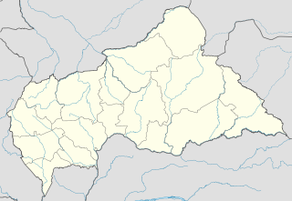
Bossembélé is a small town in Yaloke-Bossembele, in the Ombella-M'Poko Prefecture of the Central African Republic, lying 157 miles north west of Bangui on the main road to Cameroon. It is known for its market and its nightlife and is home to a cinema and an airstrip. The Lambi Falls lie near the town.

Bozoum is the capital of Ouham-Pendé, one of the 14 prefectures of the Central African Republic.

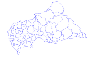
The prefectures of the Central African Republic are divided into 71 sub-prefectures. The sub-prefectures are listed below, by prefecture.

Wright Patman Lake is a reservoir in northeast Texas in the United States. The lake is a U.S. Army Corps of Engineers reservoir formed on the Sulphur River in Bowie and Cass counties by Wright Patman Dam. The reservoir provides flood control and water conservation for the communities downstream from the dam. The lake is also a popular recreational destination. The Bowie County side of the lake is part of the Texarkana metropolitan area.

Menabe is a region in western Madagascar, with its capital at Morondava. It covers an area of 46,121 square kilometres, and its population was 700,577 in 2018. The population mostly belongs to the Sakalava ethnic group. The region is named after the 18th-century Sakalava Kingdom of Menabe. The name "Menabe", in turn, means "big red", after the color of laterite rock that dominates the landscape.

Bossembélé Airport was an airstrip located within Bossembélé, a town in the Ombella-M'Poko prefecture of the Central African Republic. Mature trees now overhang the former runway.

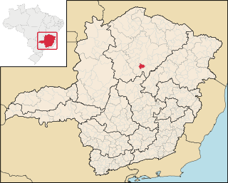
Engenheiro Navarro is a Brazilian municipality located in the north of the state of Minas Gerais. Its population as of 2020 was 7,241 people living in a total area of 632 km². The city belongs to the mesoregion of North of Minas and to the microregion of Bocaiúva. It became a municipality in 1962.

Urasar is a town in Armenia's Lori Province.

Leśnia is a village in the administrative district of Gmina Dębnica Kaszubska, within Słupsk County, Pomeranian Voivodeship, in northern Poland. It lies approximately 8 kilometres (5 mi) east of Dębnica Kaszubska, 21 km (13 mi) south-east of Słupsk, and 88 km (55 mi) west of the regional capital Gdańsk.

An Ninh is a commune (xã) and village in Quảng Ninh District, Quảng Bình Province, Vietnam.
ISO 28000:2007 is an ISO standard published by International Organization for Standardization which includes requirements of a security management system particularly dealing with security assurance in the supply chain. The standard was developed by ISO/TC 8 on "Ships and maritime technology" and published in 2007. In 2015 the responsibility for the ISO 28000 series was transferred to ISO/TC 292 on "Security and resilience", who in 2019 decided to start a revision which is expected to take 3 years. A justification study for the revision has been accepted by ISO TMB.

Shahdol Division is an administrative division of the Indian state of Madhya Pradesh.
Aïn Abessa is a town and commune in Sétif Province in north-eastern Algeria.
The following is a timeline of events during the Central African Republic Civil War.

Kalabaland Dhura is a mountain of the Garhwal Himalaya in Uttarakhand India. It situated at the head of Kalabaland Glacier. The elevation of Kalabaland Dhura is 6,105 metres (20,030 ft) and its prominence is 270 metres (886 ft). It is 158th highest located entirely within the Uttrakhand. Nanda Devi, is the highest mountain in this category. It lies 3 km south of Kalganga Dhura 6,215 metres (20,390 ft). Its nearest higher neighbor Bamba Dhura 6,334 metres (20,781 ft) lies 2.7 km ENE and it is 3.7 km west of Chiring We 6,559 metres (21,519 ft). It lies 6.9 km NW of Suli Top 6,300 metres (20,669 ft).

Gaga is a village located in the Central African Republic prefecture of Ombella-M'Poko. Artisanal gold mining is active in the commune.
This page is based on this
Wikipedia article Text is available under the
CC BY-SA 4.0 license; additional terms may apply.
Images, videos and audio are available under their respective licenses.


