
Northamptonshire is a ceremonial county in the East Midlands of England. It is bordered by Leicestershire, Rutland and Lincolnshire to the north, Cambridgeshire to the east, Bedfordshire, Buckinghamshire and Oxfordshire to the south and Warwickshire to the west. Northampton is the largest settlement and the county town.

East Northamptonshire was a local government district in Northamptonshire, England, from 1974 to 2021. Its council was based in Thrapston and Rushden. Other towns included Oundle, Raunds, Irthlingborough and Higham Ferrers. The town of Rushden was by far the largest settlement in the district. The population of the district at the 2011 Census was 86,765.

The Nene Valley Railway (NVR) is a preserved railway in Cambridgeshire, England, running between Peterborough Nene Valley and Yarwell Junction. The line is 7+1⁄2 miles (12.1 km) in length. There are stations at each terminus, and three stops en route: Orton Mere, Overton and Wansford.

Geddington is a village and civil parish on the A4300, previously A43, in North Northamptonshire between Kettering and Corby. The population of the civil parish at the 2011 census was 1,503, virtually unchanged from 1,504 at the 2001 census.

Staverton is a village and civil parish in the south-west of Northamptonshire, England. It is 2.3 miles west of Daventry, 7.9 miles east of Southam and 15.3 miles east of Leamington Spa. It straddles the A425 road from Daventry to Leamington. The Jurassic Way long-distance footpath between Banbury and Stamford passes through the village.
Newnham is a village in West Northamptonshire in England. The village is 2 miles (3 km) south of Daventry, 3 miles (5 km) west from Weedon Bec, 6 miles (10 km) west of junction 16 of the M1 motorway and 11 miles (18 km) west of Northampton. The A45 road runs a mile northwest of the village. The nearest railway station is at Long Buckby, 8 miles (13 km) northeast.

Farthingstone is a village in West Northamptonshire in England. It is close to the major trunk routes of the M1 junction 16, M40 motorway, and A5 road, at the head of a valley and is 7 miles (11 km) south of Daventry and 3.5 miles (5.6 km) south west of Weedon Bec.

Dodford is a village in West Northamptonshire, England. Prior to local government changes in 2021 it was within the Weedon Ward of Daventry District. The village is just north of the A45 road 1+1⁄2 miles (2.4 km) west of Weedon. The population of the civil parish at the 2011 Census was 203. It is 3+1⁄2 miles (5.6 km) east of Daventry and 10 miles (16 km) west of Northampton. It is also close to junction 16 of the M1 motorway. The parish consists of some 1,384 acres (560 ha) and is bounded on the east by the A5 trunk road which is the old Roman road of Watling Street. Most of the village and parish sits astride the valley of an east-flowing stream which is a tributary of the River Nene.

Barnwell is a village in North Northamptonshire in England, 2 miles (3.2 km) south of the town of Oundle, 78 miles (126 km) north of London and 14 miles (22.5 km) south-west of Peterborough. The River Nene runs north of the village, separating it from Oundle.
Rockingham Forest is a former royal hunting forest primarily located in the English county of Northamptonshire, with a small section extending into neighbouring Cambridgeshire. It is an area of some 200 sq mi (500 km2) lying between the River Welland and River Nene and the towns of Stamford and Kettering. It has a rich and varied landscape, with farmland, open pasture, pockets of woodland and villages built from local stone.
Kingsthorpe is a suburb and civil parish of Northampton, England. It is situated to the north of Northampton town centre and is served by the A508 and A5199 roads which join at Kingsthorpe's centre. The 2011 Census recorded the population of the district council ward as 4,477.

Southwick is a small village and civil parish in Northamptonshire, England. It is approximately 3 miles (4.8 km) north of the town of Oundle and is set in a valley of the River Nene. The village lies in the North Northamptonshire. Before local government changes in 2021 it fell within the non-metropolitan district of East Northamptonshire, which lay within the East Midlands region. At the time of the 2001 census, the parish's population was 180 people, increasing marginally to 181 at the 2011 Census.
Wootton is a former village about 3 miles (4.8 km) south of Northampton town centre that is now part of Northampton.

Wansford is a village straddling the City of Peterborough and Huntingdonshire districts in the ceremonial county of Cambridgeshire, England. It had a population of 506 at the 2021 Census. It is situated 7 miles (11 km) west of Peterborough and 8 miles (13 km) miles south of Stamford. It is close to the county boundary with both Lincolnshire and Northamptonshire. The village is also located close to the A1 road and was on the route of the original Great North Road before the modern A1 was built. The village has since been bypassed by the A1 but the former Great North Road still exists through the village.

Piddington is a village and former civil parish, now in the parish of Hackleton, in the West Northamptonshire district, in the ceremonial county of Northamptonshire, England. It is in the south of Northamptonshire, just north of Buckinghamshire. It is 6 miles (10 km) south of Northampton town centre, in a cul-de-sac off the main road at the War Memorial in the village of Hackleton, and about 1 mile (2 km) south-west of there. It has a geographic size of 1,693 acres (6.85 km2) and an average height of 300 ft (91 m), rising steadily to 400 ft (120 m) in Salcey Forest. In 1931 the parish had a population of 342.
Collingtree is a village and civil parish in the West Northamptonshire district of Northamptonshire, England. It is part of the Northampton built-up area.

Kislingbury is a village in Northamptonshire, England, about 4 miles (6 km) west of Northampton town centre, and close to junctions 15A and 16 of the M1 motorway.

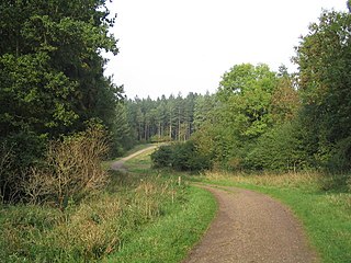
Yarwell Junction is the current western terminus of the Nene Valley Railway. It opened at Easter 2007.

North Northamptonshire is one of two local government districts in Northamptonshire, England. Its council is a unitary authority, being a district council which also performs the functions of a county council. It was created in 2021. The council is based in Corby, the district's largest town. Other notable towns are Kettering, Wellingborough, Rushden, Raunds, Desborough, Rothwell, Irthlingborough, Thrapston and Oundle.
Nassington is a village and civil parish in North Northamptonshire, England. The village is on the River Nene and the border with Cambridgeshire, around 8 miles (13 km) west of Peterborough. At the 2011 Census, the population of the parish was 827, an increase from 670 at the 2001 Census.


