Yaysky District

Last updated
Yaysky District
Яйский район(Russian)
Location of Yaysky District (Kemerovo Oblast).svg
Location of Yaysky District in Kemerovo Oblast
055 Obshchii vid mosta cherez reku Iaiu (cropped).jpg
Great Siberian Railroad, 1899, in Yaya District
Flag of Yaysky rayon (Kemerovskaya oblast).png
Flag
Location
Country Russia
Federal subject Kemerovo Oblast [1]
Administrative structure (as of November 2012)
Administrative center urban-type settlement of  Yaya [1]
Administrative divisions: [1]
Urban-type settlements 1
Rural territories 9
Inhabited localities: [1]
Urban-type settlements [2] 1
Rural localities 39
Municipal structure (as of November 2012)
Municipally incorporated asYaysky Municipal District [3]
Municipal divisions: [3]
Urban settlements1
Rural settlements9
Statistics
Area 2,669 km2 (1,031 sq mi) [4]
Population (2010 Census) 20,383 inhabitants [5]
 Urban57.3%
 Rural42.7%
Density 7.64/km2 (19.8/sq mi) [6]
Time zone KRAT (UTC+07:00) [7]
Official website
Yaysky District on WikiCommons

Yaysky District (Russian : Яйский райо́н) is an administrative district (raion), one of the nineteen in Kemerovo Oblast, Russia. [1] As a municipal division, it is incorporated as Yaysky Municipal District. [3] It is located in the north of the oblast. The area of the district is 2,669 square kilometers (1,031 sq mi). [4] Its administrative center is the urban locality (an urban-type settlement) of Yaya. [1] Population: 20,383(2010 Census); [5] 24,982 (2002 Census); [8] 26,759(1989 Census). [9] The population of Yaya accounts for 57.3% of the district's total population. [5]

Russian language East Slavic language

Russian is an East Slavic language, which is official in the Russian Federation, Belarus, Kazakhstan and Kyrgyzstan, as well as being widely used throughout Eastern Europe, the Baltic states, the Caucasus and Central Asia. It was the de facto language of the Soviet Union until its dissolution on 25 December 1991. Although, nowadays, nearly three decades after the breakup of the Soviet Union, Russian is used in official capacity or in public life in all the post-Soviet nation-states, as well as in Israel and Mongolia, the rise of state-specific varieties of this language tends to be strongly denied in Russia, in line with the Russian World ideology.

A raion is a type of administrative unit of several post-Soviet states. The term is from the French "rayon", which is both a type of a subnational entity and a division of a city, and is commonly translated in English as "district".

Contents

Related Research Articles

Anzhero-Sudzhensk Town in Kemerovo Oblast, Russia

Anzhero-Sudzhensk is a town in the Kuznetsk Basin in Kemerovo Oblast, Russia, located to the north of the oblast's administrative center of Kemerovo and to the east of the Tom River, on the route of the Trans-Siberian Railway. Population: 76,646 (2010 Census); 86,480 (2002 Census); 107,951 (1989 Census).

Leninsk-Kuznetsky (city) City in Kemerovo Oblast, Russia

Leninsk-Kuznetsky, known as Kolchugino until 1925, is a city in Kemerovo Oblast, Russia, located on both banks of the Inya River. Population: 101,666 (2010 Census); 112,253 (2002 Census); 165,487 (1989 Census); 128,000 (1972); 83,000 (1939); 20,000 (1926).

Yurga Town in Kemerovo Oblast, Russia

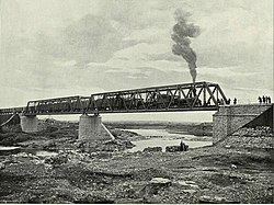
Yurga is a town in Kemerovo Oblast, Russia, located on the Tom River. Population: 81,533 (2010 Census); 85,555 (2002 Census); 93,202 (1989 Census).

Tashtagol Town in Kemerovo Oblast, Russia

Tashtagol is a town in Kemerovo Oblast, Russia, located on the Kondoma River 511 kilometers (318 mi) south of Kemerovo, the administrative center of the oblast. Population: 23,134 (2010 Census); 23,363 (2002 Census); 26,274 (1989 Census).

Topki (town), Kemerovo Oblast Town in Kemerovo Oblast, Russia

Topki is a town in Kemerovo Oblast, Russia, located 38 kilometers (24 mi) west of Kemerovo, the administrative center of the oblast. Population: 28,641 (2010 Census); 31,004 (2002 Census); 33,574 (1989 Census).

Beryozovsky, Kemerovo Oblast Town in Kemerovo Oblast, Russia

Beryozovsky is a town in Kemerovo Oblast, Russia, located between the Barzas and Shurap Rivers, 27 kilometers (17 mi) north of Kemerovo, the administrative center of the oblast. Population: 47,279 (2010 Census); 48,299 (2002 Census); 51,250 (1989 Census).

Myski Town in Kemerovo Oblast, Russia

Myski is a town in Kemerovo Oblast, Russia, located at the confluence of the Mras-Su and Tom Rivers, 350 kilometers (220 mi) southeast of Kemerovo. Population: 43,038 (2010 Census); 44,435 (2002 Census); 45,964 (1989 Census).

Kaltan Town in Kemerovo Oblast, Russia

Kaltan is a town in Kemerovo Oblast, Russia, located on the Kondoma River, 338 kilometers (210 mi) south of Kemerovo, the administrative center of the oblast. Population: 21,892 (2010 Census); 25,591 (2002 Census); 25,369 (1989 Census).

Krapivinsky District District in Kemerovo Oblast, Russia

Krapivinsky District is an administrative district (raion), one of the nineteen in Kemerovo Oblast, Russia. As a municipal division, it is incorporated as Krapivinsky Municipal District. It is located in the center of the oblast. The area of the district is 6,900 square kilometers (2,700 sq mi). Its administrative center is the urban locality of Krapivinsky. Population: 24,533 (2010 Census); 27,658 ; 31,357 (1989 Census). The population of the administrative center accounts for 30.4% of the district's total population.

Mariinsky District District in Kemerovo Oblast, Russia

Mariinsky District is an administrative district (raion), one of the nineteen in Kemerovo Oblast, Russia. As a municipal division, it is incorporated as Mariinsky Municipal District. It is located in the north of the oblast. The area of the district is 5,607 square kilometers (2,165 sq mi). Its administrative center is the town of Mariinsk. Population: 17,285 (2010 Census); 19,182 ; 22,037 (1989 Census).

Mezhdurechensky District, Kemerovo Oblast District in Kemerovo Oblast, Russia

Mezhdurechensky District is an administrative district (raion), one of the nineteen in Kemerovo Oblast, Russia. It is located in the southeast of the oblast. Its administrative center is the city of Mezhdurechensk. Population: 2,268 (2010 Census); 2,658.

Novokuznetsky District District in Kemerovo Oblast, Russia

Novokuznetsky District is an administrative district (raion), one of the nineteen in Kemerovo Oblast, Russia. As a municipal division, it is incorporated as Novokuznetsky Municipal District. It is located in the center of the oblast and spans it from border to border in the southwest-northeast direction. The area of the district is 13,039.5989 square kilometers (5,034.6173 sq mi). Its administrative center is the city of Novokuznetsk. As of the 2010 Census, the total population of the district was 50,681.

Prokopyevsky District District in Kemerovo Oblast, Russia

Prokopyevsky District is an administrative district (raion), one of the nineteen in Kemerovo Oblast, Russia. As a municipal division, it is incorporated as Prokopyevsky Municipal District. It is located in the center of the oblast. The area of the district is 3,450 square kilometers (1,330 sq mi). Its administrative center is the city of Prokopyevsk. Population: 31,442 (2010 Census); 33,705 ; 35,657 (1989 Census).

Tashtagolsky District District in Kemerovo Oblast, Russia

Tashtagolsky District is an administrative district (raion), one of the nineteen in Kemerovo Oblast, Russia. As a municipal division, it is incorporated as Tashtagolsky Municipal District. It is located in the south of the oblast. The area of the district is 11,383 square kilometers (4,395 sq mi). Its administrative center is the town of Tashtagol. Population: 31,895 (2010 Census); 34,545 ; 37,816 (1989 Census).

Tisulsky District District in Kemerovo Oblast, Russia

Tisulsky District is an administrative district (raion), one of the nineteen in Kemerovo Oblast, Russia. As a municipal division, it is incorporated as Tisulsky Municipal District. It is located in the east of the oblast. The area of the district is 8,100 square kilometers (3,100 sq mi). Its administrative center is the urban locality of Tisul. Population: 25,045 (2010 Census); 28,471 ; 34,707 (1989 Census). The population of Tisul accounts for 36.1% of the district's total population.

Tyazhinsky District District in Kemerovo Oblast, Russia

Tyazhinsky District is an administrative district (raion), one of the nineteen in Kemerovo Oblast, Russia. As a municipal division, it is incorporated as Tyazhinsky Municipal District. It is located in the northeast of the oblast. The area of the district is 3,531 square kilometers (1,363 sq mi). Its administrative center is the urban locality of Tyazhinsky. Population: 25,597 (2010 Census); 32,782 ; 32,574 (1989 Census). The population of the administrative center accounts for 43.4% of the district's total population.

Yashkinsky District District in Kemerovo Oblast, Russia

Yashkinsky District is an administrative district (raion), one of the nineteen in Kemerovo Oblast, Russia. As a municipal division, it is incorporated as Yashkinsky Municipal District. It is located in the northwest of the oblast. The area of the district is 3,484 square kilometers (1,345 sq mi). Its administrative center is the urban locality of Yashkino. Population: 30,856 (2010 Census); 34,131 ; 37,446 (1989 Census). The population of Yashkino accounts for 47.7% of the district's total population.

Yurginsky District, Kemerovo Oblast District in Kemerovo Oblast, Russia

Yurginsky District is an administrative district (raion), one of the nineteen in Kemerovo Oblast, Russia. As a municipal division, it is incorporated as Yurginsky Municipal District. It is located in the northwest of the oblast. The area of the district is 2,510 square kilometers (970 sq mi). Its administrative center is the town of Yurga. Population: 22,448 (2010 Census); 22,779 ; 22,994 (1989 Census).

Krasnobrodsky Urban-type settlement in Kemerovo Oblast, Russia

Krasnobrodsky is an urban locality in Kemerovo Oblast, Russia. Population: 11,919 (2010 Census); 11,859 (2002 Census); 12,663 (1989 Census).

Polysayevo Town in Kemerovo Oblast, Russia

Polysayevo is a town in Kemerovo Oblast, Russia, located on the right bank of the Inya River 139 kilometers (86 mi) south of Kemerovo. Population: 27,624 (2010 Census); 28,151 (2002 Census).

References

Notes

  1. 1 2 3 4 5 6 Law #215-OZ
  2. The count of urban-type settlements may include the work settlements, the resort settlements, the suburban (dacha) settlements, as well as urban-type settlements proper.
  3. 1 2 3 Law #104-OZ
  4. 1 2 "Descriptive Statistics - Yaysky District" (in Russian). Federal State Statistics Service, Russian Federation. Retrieved June 26, 2016.
  5. 1 2 3 Russian Federal State Statistics Service (2011). "Всероссийская перепись населения 2010 года. Том 1" [2010 All-Russian Population Census, vol. 1]. Всероссийская перепись населения 2010 года (2010 All-Russia Population Census) (in Russian). Federal State Statistics Service . Retrieved June 29, 2012.
  6. The value of density was calculated automatically by dividing the 2010 Census population by the area specified in the infobox. Please note that this value is only approximate as the area specified in the infobox does not necessarily correspond to the area of the entity proper or is reported for the same year as the population.
  7. Правительство Российской Федерации. Федеральный закон №107-ФЗ от 3 июня 2011 г. «Об исчислении времени», в ред. Федерального закона №271-ФЗ от 03 июля 2016 г. «О внесении изменений в Федеральный закон "Об исчислении времени"». Вступил в силу по истечении шестидесяти дней после дня официального опубликования (6 августа 2011 г.). Опубликован: "Российская газета", №120, 6 июня 2011 г. (Government of the Russian Federation. Federal Law #107-FZ of June 31, 2011 On Calculating Time , as amended by the Federal Law #271-FZ of July 03, 2016 On Amending Federal Law "On Calculating Time". Effective as of after sixty days following the day of the official publication.).
  8. Russian Federal State Statistics Service (May 21, 2004). "Численность населения России, субъектов Российской Федерации в составе федеральных округов, районов, городских поселений, сельских населённых пунктов – районных центров и сельских населённых пунктов с населением 3 тысячи и более человек" [Population of Russia, Its Federal Districts, Federal Subjects, Districts, Urban Localities, Rural Localities—Administrative Centers, and Rural Localities with Population of Over 3,000](XLS). Всероссийская перепись населения 2002 года [All-Russia Population Census of 2002] (in Russian). Retrieved August 9, 2014.
  9. Demoscope Weekly (1989). "Всесоюзная перепись населения 1989 г. Численность наличного населения союзных и автономных республик, автономных областей и округов, краёв, областей, районов, городских поселений и сёл-райцентров" [All Union Population Census of 1989: Present Population of Union and Autonomous Republics, Autonomous Oblasts and Okrugs, Krais, Oblasts, Districts, Urban Settlements, and Villages Serving as District Administrative Centers]. Всесоюзная перепись населения 1989 года [All-Union Population Census of 1989] (in Russian). Институт демографии Национального исследовательского университета: Высшая школа экономики [Institute of Demography at the National Research University: Higher School of Economics]. Retrieved August 9, 2014.

Sources

Coordinates: 56°12′00″N86°26′00″E / 56.2000°N 86.4333°E / 56.2000; 86.4333

Geographic coordinate system Coordinate system

A geographic coordinate system is a coordinate system that enables every location on Earth to be specified by a set of numbers, letters or symbols. The coordinates are often chosen such that one of the numbers represents a vertical position and two or three of the numbers represent a horizontal position; alternatively, a geographic position may be expressed in a combined three-dimensional Cartesian vector. A common choice of coordinates is latitude, longitude and elevation. To specify a location on a plane requires a map projection.