Novokuznetsky District

Last updated
Novokuznetsky District
Новокузнецкий район(Russian)
Location of Novokuznetsky District (Kemerovo Oblast).svg
Location of Novokuznetsky District in Kemerovo Oblast
Coordinates: 53°45′N87°07′E / 53.750°N 87.117°E / 53.750; 87.117 Coordinates: 53°45′N87°07′E / 53.750°N 87.117°E / 53.750; 87.117
Dolina reki Bol'shoi Tesh.JPG
The Bolshoy Tesh River valley in Novokuznetsky District
Coat of Arms of Novokuznetsk rayon (Kemerovo oblast).png
Flag of Novokuznetsk rayon (Kemerovo oblast).svg
Coat of arms
Flag
Location
Country Russia
Federal subject Kemerovo Oblast [1]
Administrative structure (as of December 2014)
Administrative center city of  Novokuznetsk [1]
Administrative divisions: [1]
rural territorie 6
Inhabited localities: [1]
Rural localities 134
Municipal structure (as of December 2015)
Municipally incorporated asNovokuznetsky Municipal District [2]
Municipal divisions: [2]
Urban settlements0
Rural settlements6
Statistics
Area (municipal district) (January 2014) 13,039.5989 km2 (5,034.6173 sq mi) [3]
Population (2010 Census) 50,681 inhabitants [4]
 Urban0%
 Rural100%
Population (January 2014 est.) 51,082 inhabitants [3]
Density 3.89/km2 (10.1/sq mi) [5]
Time zone KRAT (UTC+07:00) [6]
Official website
Novokuznetsky District on WikiCommons
Population of Novokuznetsky District
2010 Census 50,681 [4]
2002 Census 50,812 [7]
1989 Census 39,436 [8]
1979 Census 44,532 [9]

Novokuznetsky District (Russian : Новокузне́цкий райо́н) is an administrative district (raion), one of the nineteen in Kemerovo Oblast, Russia. [1] As a municipal division, it is incorporated as Novokuznetsky Municipal District. [2] It is located in the center of the oblast and spans it from border to border in the southwest-northeast direction. The area of the district is 13,039.5989 square kilometers (5,034.6173 sq mi). [3] Its administrative center is the city of Novokuznetsk (which is not administratively a part of the district). [1] As of the 2010 Census, the total population of the district was 50,681. [4]

Russian language East Slavic language

Russian is an East Slavic language, which is official in the Russian Federation, Belarus, Kazakhstan and Kyrgyzstan, as well as being widely used throughout Eastern Europe, the Baltic states, the Caucasus and Central Asia. It was the de facto language of the Soviet Union until its dissolution on 25 December 1991. Although nearly three decades have passed since the breakup of the Soviet Union, Russian is used in official capacity or in public life in all the post-Soviet nation-states, as well as in Israel and Mongolia.

A raion is a type of administrative unit of several post-Soviet states. The term is from the French "rayon", which is both a type of a subnational entity and a division of a city, and is commonly translated in English as "district".

Contents

History

On March 19, 2007 a massive methane explosion ripped through the Ulyanovskaya mine in Novokuznetsky District killing over a hundred people. The mine was the largest coal producing center in Kemerovo Oblast. It is the deadliest mining accident in recent history.

Ulyanovskaya Mine disaster mining accident at the Ulyanovskaya coal mine in Russia in 2007

The Ulyanovskaya Mine disaster was caused by a methane explosion that occurred on March 19, 2007 in the Ulyanovskaya longwall coal mine in the Kemerovo Oblast. At least 108 people were reported to have been killed by the blast, which occurred at a depth of about 270 meters (885 feet) at 10:19 local time. The mine disaster was Russia's deadliest in more than a decade.

Administrative and municipal status

Within the framework of administrative divisions, Novokuznetsky District is one of the nineteen in the oblast. [1] The city of Novokuznetsk serves as its administrative center, despite being incorporated separately as a city under oblast jurisdiction—an administrative unit with the status equal to that of the districts. [1]

Novokuznetsk City in Kemerovo Oblast, Russia

Novokuznetsk is a city in Kemerovo Oblast in south-western Siberia, Russia. Population: 547,904 (2010 Census); 549,870 (2002 Census); 599,947 (1989 Census).

City of federal subject significance is an umbrella term used to refer to a type of an administrative division of a federal subject of Russia which is equal in status to a district but is organized around a large city; occasionally with surrounding rural territories.

As a municipal division, the district is incorporated as Novokuznetsky Municipal District. [2] Novokuznetsk City Under Oblast Jurisdiction is incorporated separately from the district as Novokuznetsky Urban Okrug. [2]

Related Research Articles

Prokopyevsk City in Kemerovo Oblast, Russia

Prokopyevsk is a city in Kemerovo Oblast, Russia. Population: 210,130 (2010 Census); 224,597 (2002 Census); 273,838 (1989 Census).

Mariinsk Town in Kemerovo Oblast, Russia

Mariinsk is a town in Kemerovo Oblast, Russia, where the Trans-Siberian Railway crosses the Kiya River, 180 kilometers (110 mi) northeast of Kemerovo, the administrative center of the oblast. Population: 40,526 (2010 Census); 42,977 (2002 Census); 40,956 (1989 Census); 39,700 (1972).

Anzhero-Sudzhensk Town in Kemerovo Oblast, Russia

Anzhero-Sudzhensk is a town in the Kuznetsk Basin in Kemerovo Oblast, Russia, located to the north of the oblast's administrative center of Kemerovo and to the east of the Tom River, on the route of the Trans-Siberian Railway. Population: 76,646 (2010 Census); 86,480 (2002 Census); 107,951 (1989 Census).

Leninsk-Kuznetsky (city) City in Kemerovo Oblast, Russia

Leninsk-Kuznetsky, known as Kolchugino until 1925, is a city in Kemerovo Oblast, Russia, located on both banks of the Inya River. Population: 101,666 (2010 Census); 112,253 (2002 Census); 165,487 (1989 Census); 128,000 (1972); 83,000 (1939); 20,000 (1926).

Tashtagol Town in Kemerovo Oblast, Russia

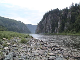
Tashtagol is a town in Kemerovo Oblast, Russia, located on the Kondoma River 511 kilometers (318 mi) south of Kemerovo, the administrative center of the oblast. Population: 23,134 (2010 Census); 23,363 (2002 Census); 26,274 (1989 Census).

Salair (town) Town in Kemerovo Oblast, Russia

Salair is a town administratively subordinated to Guryevsk Town Under Oblast Jurisdiction in Kemerovo Oblast, Russia, located 210 kilometers (130 mi) south of Kemerovo, the administrative center of the oblast. Population: 8,262 (2010 Census); 9,472 (2002 Census); 11,452 (1989 Census).

Guryevsk, Kemerovo Oblast Town in Kemerovo Oblast, Russia

Guryevsk is a town in Kemerovo Oblast, Russia, located 195 kilometers (121 mi) southeast of Kemerovo, the administrative center of the oblast. Population: 24,817 (2010 Census); 27,381 (2002 Census); 28,152 (1989 Census).

Beryozovsky, Kemerovo Oblast Town in Kemerovo Oblast, Russia

Beryozovsky is a town in Kemerovo Oblast, Russia, located between the Barzas and Shurap Rivers, 27 kilometers (17 mi) north of Kemerovo, the administrative center of the oblast. Population: 47,279 (2010 Census); 48,299 (2002 Census); 51,250 (1989 Census).

Kaltan Town in Kemerovo Oblast, Russia

Kaltan is a town in Kemerovo Oblast, Russia, located on the Kondoma River, 338 kilometers (210 mi) south of Kemerovo, the administrative center of the oblast. Population: 21,892 (2010 Census); 25,591 (2002 Census); 25,369 (1989 Census).

Leninsk-Kuznetsky District District in Kemerovo Oblast, Russia

Leninsk-Kuznetsky District is an administrative district (raion), one of the nineteen in Kemerovo Oblast, Russia. As a municipal division, it is incorporated as Leninsk-Kuznetsky Municipal District. It is located in the west of the oblast. The area of the district is 2,356 square kilometers (910 sq mi). Its administrative center is the city of Leninsk-Kuznetsky. Population: 23,760 (2010 Census); 27,825 ; 29,752 (1989 Census).

Mariinsky District District in Kemerovo Oblast, Russia

Mariinsky District is an administrative district (raion), one of the nineteen in Kemerovo Oblast, Russia. As a municipal division, it is incorporated as Mariinsky Municipal District. It is located in the north of the oblast. The area of the district is 5,607 square kilometers (2,165 sq mi). Its administrative center is the town of Mariinsk. Population: 17,285 (2010 Census); 19,182 ; 22,037 (1989 Census).

Prokopyevsky District District in Kemerovo Oblast, Russia

Prokopyevsky District is an administrative district (raion), one of the nineteen in Kemerovo Oblast, Russia. As a municipal division, it is incorporated as Prokopyevsky Municipal District. It is located in the center of the oblast. The area of the district is 3,450 square kilometers (1,330 sq mi). Its administrative center is the city of Prokopyevsk. Population: 31,442 (2010 Census); 33,705 ; 35,657 (1989 Census).

Tashtagolsky District District in Kemerovo Oblast, Russia

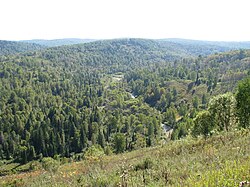
Tashtagolsky District is an administrative district (raion), one of the nineteen in Kemerovo Oblast, Russia. As a municipal division, it is incorporated as Tashtagolsky Municipal District. It is located in the south of the oblast. The area of the district is 11,383 square kilometers (4,395 sq mi). Its administrative center is the town of Tashtagol. Population: 31,895 (2010 Census); 34,545 ; 37,816 (1989 Census).

Tisulsky District District in Kemerovo Oblast, Russia

Tisulsky District is an administrative district (raion), one of the nineteen in Kemerovo Oblast, Russia. As a municipal division, it is incorporated as Tisulsky Municipal District. It is located in the east of the oblast. The area of the district is 8,100 square kilometers (3,100 sq mi). Its administrative center is the urban locality of Tisul. Population: 25,045 (2010 Census); 28,471 ; 34,707 (1989 Census). The population of Tisul accounts for 36.1% of the district's total population.

Topkinsky District District in Kemerovo Oblast, Russia

Topkinsky District is an administrative district (raion), one of the nineteen in Kemerovo Oblast, Russia. As a municipal division, it is incorporated as Topkinsky Municipal District. It is located in the northwest of the oblast. The area of the district is 2,774 square kilometers (1,071 sq mi). Its administrative center is the town of Topki. Population: 16,246 (2010 Census); 18,077 ; 19,018 (1989 Census).

Tyazhinsky District District in Kemerovo Oblast, Russia

Tyazhinsky District is an administrative district (raion), one of the nineteen in Kemerovo Oblast, Russia. As a municipal division, it is incorporated as Tyazhinsky Municipal District. It is located in the northeast of the oblast. The area of the district is 3,531 square kilometers (1,363 sq mi). Its administrative center is the urban locality of Tyazhinsky. Population: 25,597 (2010 Census); 32,782 ; 32,574 (1989 Census). The population of the administrative center accounts for 43.4% of the district's total population.

Yaysky District District in Kemerovo Oblast, Russia

Yaysky District is an administrative district (raion), one of the nineteen in Kemerovo Oblast, Russia. As a municipal division, it is incorporated as Yaysky Municipal District. It is located in the north of the oblast. The area of the district is 2,669 square kilometers (1,031 sq mi). Its administrative center is the urban locality of Yaya. Population: 20,383 (2010 Census); 24,982 ; 26,759 (1989 Census). The population of Yaya accounts for 57.3% of the district's total population.

Yurginsky District, Kemerovo Oblast District in Kemerovo Oblast, Russia

Yurginsky District is an administrative district (raion), one of the nineteen in Kemerovo Oblast, Russia. As a municipal division, it is incorporated as Yurginsky Municipal District. It is located in the northwest of the oblast. The area of the district is 2,510 square kilometers (970 sq mi). Its administrative center is the town of Yurga. Population: 22,448 (2010 Census); 22,779 ; 22,994 (1989 Census).

Krasnobrodsky Urban-type settlement in Kemerovo Oblast, Russia

Krasnobrodsky is an urban locality in Kemerovo Oblast, Russia. Population: 11,919 (2010 Census); 11,859 (2002 Census); 12,663 (1989 Census).

References

Notes

  1. 1 2 3 4 5 6 7 8 Law #215-OZ
  2. 1 2 3 4 5 Law #104-OZ
  3. 1 2 3 "Statistics on the Municipal Formations of Kemerovo Oblast" (in Russian). Federal State Statistics Service of the Russian Federation. Retrieved May 19, 2017.
  4. 1 2 3 Russian Federal State Statistics Service (2011). "Всероссийская перепись населения 2010 года. Том 1" [2010 All-Russian Population Census, vol. 1]. Всероссийская перепись населения 2010 года (2010 All-Russia Population Census) (in Russian). Federal State Statistics Service . Retrieved June 29, 2012.
  5. The value of density was calculated automatically by dividing the 2010 Census population by the area specified in the infobox. Please note that this value is only approximate as the area specified in the infobox does not necessarily correspond to the area of the entity proper or is reported for the same year as the population.
  6. Правительство Российской Федерации. Федеральный закон №107-ФЗ от 3 июня 2011 г. «Об исчислении времени», в ред. Федерального закона №271-ФЗ от 03 июля 2016 г. «О внесении изменений в Федеральный закон "Об исчислении времени"». Вступил в силу по истечении шестидесяти дней после дня официального опубликования (6 августа 2011 г.). Опубликован: "Российская газета", №120, 6 июня 2011 г. (Government of the Russian Federation. Federal Law #107-FZ of June 31, 2011 On Calculating Time , as amended by the Federal Law #271-FZ of July 03, 2016 On Amending Federal Law "On Calculating Time". Effective as of after sixty days following the day of the official publication.).
  7. Russian Federal State Statistics Service (May 21, 2004). "Численность населения России, субъектов Российской Федерации в составе федеральных округов, районов, городских поселений, сельских населённых пунктов – районных центров и сельских населённых пунктов с населением 3 тысячи и более человек" [Population of Russia, Its Federal Districts, Federal Subjects, Districts, Urban Localities, Rural Localities—Administrative Centers, and Rural Localities with Population of Over 3,000](XLS). Всероссийская перепись населения 2002 года [All-Russia Population Census of 2002] (in Russian). Retrieved August 9, 2014.
  8. Demoscope Weekly (1989). "Всесоюзная перепись населения 1989 г. Численность наличного населения союзных и автономных республик, автономных областей и округов, краёв, областей, районов, городских поселений и сёл-райцентров" [All Union Population Census of 1989: Present Population of Union and Autonomous Republics, Autonomous Oblasts and Okrugs, Krais, Oblasts, Districts, Urban Settlements, and Villages Serving as District Administrative Centers]. Всесоюзная перепись населения 1989 года [All-Union Population Census of 1989] (in Russian). Институт демографии Национального исследовательского университета: Высшая школа экономики [Institute of Demography at the National Research University: Higher School of Economics]. Retrieved August 9, 2014.
  9. "Всесоюзная перепись населения 1979 г. Национальный состав населения по регионам России. (All Union Population Census of 1979. Ethnic composition of the population by regions of Russia.)". Всесоюзная перепись населения 1979 года (All-Union Population Census of 1979) (in Russian). Demoscope Weekly (website of the Institute of Demographics of the State University—Higher School of Economics. 1979. Retrieved 2008-11-25.

Sources