Related Research Articles
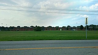
Fairdale is a former census-designated place in southern Jefferson County, Kentucky, United States. The population was 7,658 at the 2000 census. In 2003, the area was annexed to the city of Louisville due to a merger between the city and Jefferson County's unincorporated community. Fairdale is now a neighborhood within the city limits of Louisville. It is within the boundaries of the Fairdale Fire Protection District which serves Fairdale and surrounding areas including the large Jefferson Memorial Forest and historic South Park Country Club, the oldest country club in the state of Kentucky.
Fern Creek is a historic community in southeastern Jefferson County, Kentucky, United States. The population was 20,009 at the 2008 census. In 2003, The area was annexed to the city of Louisville as part of a merger between the city and Jefferson County's unincorporated communities. Fern Creek was formerly a census-designated place. It is now considered a neighborhood of Louisville. It is located about 12 miles from Downtown Louisville.
Highview is a former census-designated place in Jefferson County, Kentucky, United States. The population was 15,161 at the 2000 census. On January 6, 2003, the area was annexed to the city of Louisville due to a merger between the city and Jefferson County's unincorporated communities. Highview is now a neighborhood within the city limits of Louisville.
Newburg is a former census-designated place in Jefferson County, Kentucky, United States. The population was 20,636 at the 2000 census. On January 6, 2003, the area was annexed to the city of Louisville due to a merger between the city and Jefferson County's unincorporated communities. Newburg is now a neighborhood on the south side, within the pre-merger city limits of Louisville.
Valley Station is a former census-designated place in southwest Jefferson County, Kentucky, United States. It is known for housing the largest mobile home community in all of Jefferson County. The population was 22,946 at the 2000 census. When the government of Jefferson County merged with the city of Louisville, Kentucky in 2003, residents of Valley Station also became citizens of Louisville Metro. As a result, Valley Station is now a neighborhood within the city limits of Louisville. It was named for its location in the valley between Muldraugh Hill and the Knobs.
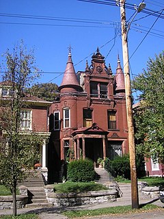
The Original Highlands is a historic neighborhood in the Highlands area of Louisville, Kentucky, United States.
St. Joseph is a neighborhood two miles south of downtown Louisville, Kentucky, United States, and immediately east of the University of Louisville. The area was named after the St. Joseph's Infirmary hospital, which was established by the Sisters of Charity of Nazareth. The building, once located at the corner of Preston Street and Eastern Parkway, was razed in 1980.

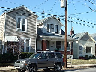
Meriwether is a neighborhood two miles southeast of downtown Louisville, Kentucky, USA, and just east of the University of Louisville. It was laid out by David Meriwether in 1871 and the first houses were built in 1891. Nearly all of the homes are shotgun houses.
Clifton is a neighborhood east of downtown Louisville, Kentucky USA. Clifton was named because of its hilly location on the Ohio River valley escarpment. Clifton is bounded by I-64, N Ewing Ave, Brownsboro Road, and Mellwood Ave.
Irish Hill is a neighborhood east of downtown Louisville, Kentucky USA. It is bounded by Baxter Avenue to the west, Lexington Road to the north, the middle fork of Beargrass Creek and I-64 to the east. Cave Hill Cemetery is located directly south of Irish Hill. It is in the inner Highlands area of Louisville.

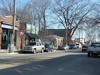
Crescent Hill is a neighborhood four miles (6 km) east of downtown Louisville, Kentucky USA. This area was originally called "Beargrass" because it sits on a ridge between two forks of Beargrass Creek. The boundaries of Crescent Hill are N Ewing Ave to the St. Matthews city limit by Brownsboro Road to Lexington Road. Frankfort Avenue generally bisects the neighborhood.

Shelby Park is a neighborhood two miles southeast of downtown Louisville, Kentucky USA named after Kentucky's first governor, Isaac Shelby. Shelby Park has always been considered a working-class neighborhood. It was first populated by German immigrants in the early 1900s. By the 1950s, the neighborhood was majority African American. Today, Shelby Park is a blend of ethnic and economic diversity. People from all walks of life co-exist in a vibrant, art-filled community.
Clifton Heights is a neighborhood two miles east of downtown Louisville, Kentucky USA. It was named because of its hilly location atop a ridge about 100 feet above the Ohio River floodplain, overlooking the adjacent community of Clifton. Though first planned in the 1890s as Summit Park, actual growth didn't begin until after World War I when automobiles made the hilly area accessible. Clifton Heights has had an African American presence since its founding, in 2000 they accounted for 21% of the population. Housing stock includes a variety of styles and time frames, from older shotgun houses and bungalows to suburban ranch homes built in the 1970s.
Camp Taylor is a neighborhood and former military base six miles southeast of downtown Louisville, Kentucky, United States. First announced on June 11, 1917 it was originally a military camp named for former president Zachary Taylor. For a time it was America's largest military training camp, housing 47,500 men at one time, and spurred development in an area that was previously dominated by farmland.
Audubon is a neighborhood in Louisville, Kentucky, United States. Its boundaries are Clarks Lane to the north, Poplar Level Road to the east, Preston Highway to the west, and the city of Audubon Park to the south. The smaller city of Parkway Village is surrounded by Audubon. George Rogers Clark Park, the site of a cabin owned by the parents of George Rogers Clark, is a prominent feature of the neighborhood.
Poplar Level is a neighborhood five miles (8 km) southeast of downtown Louisville, Kentucky, United States. It is part of the larger Camp Zachary Taylor area.
Bon Air is a neighborhood in eastern Louisville, Kentucky, United States. Its boundaries are I-264 to the north, Bardstown Road to the west, Furman Boulevard to the east, and subdivisions to the south. The earliest residential development was the Wellingmoor subdivision in 1939, laid out by Ralph Drake. Growth picked up after World War II, but was broken up somewhat by the construction of the Watterson Expressway in the late 1940s.
Brownsboro-Zorn is a neighborhood in northeast Louisville, Kentucky, United States. Its boundaries are Brownsboro Road to the south, Birchwood Avenue to the west, Mellwood Avenue to the north, and Mockingbird Valley to the east. Residential development began in 1911 between Birchwood and Zorn Avenue, a wide street which bisects the neighborhood. The core of the neighborhood is residential, but there is substantial commerce along Brownsboro Road. The Veterans Affairs Medical Center is located along Zorn.
Prestonia is a neighborhood five miles southeast of downtown Louisville, Kentucky, U.S. Its boundaries are Preston Highway, Interstate 65, Interstate 264 and the Norfolk Southern Railway tracks. Many of Prestonia's streets are named after Kentucky counties. It was probably named for the local highway, which was in turn named after early Louisville landowner Col. William Preston.

Louisville is a city in Jefferson County, in the U.S. state of Kentucky. It is located at the Falls of the Ohio River.
References
- ↑ "Community Resource Network" . Retrieved 2005-11-18.[ permanent dead link ]
