Dolmen of Carapito I

Last updated
Dolmen of Carapito I
Dolmen I de Carapito.png
Location Guarda, Dão-Lafões, Centro, Portugal
Coordinates 40°45′3.4″N7°27′51.1″W / 40.750944°N 7.464194°W / 40.750944; -7.464194 Coordinates: 40°45′3.4″N7°27′51.1″W / 40.750944°N 7.464194°W / 40.750944; -7.464194
Altitude651 m (2,136 ft)
Type Dolmen
Site notes
Archaeologistsunknown
OwnershipPortuguese Republic
Public accessPrivate EC583 in the direction of Queiriz, on the western margin of the Ribeira do Carapito

Dolmen of Carapito I (Portuguese : Anta de Carapito I) is a megalithic monument located in the civil parish of Carapito, in the municipality of Aguiar da Beira in the Guarda District of Portugal.

Contents

History

The dolmen was constructed during the Megalithic period, approximately around 2900 BC. [1] [2]

The first explorations of the site were completed by J. Coelho, who collected ceramic fragments. [1] At the time, the ceiling was discovered caved-in, and the pillar to the south broken and fallen, that occurred sometime at the beginning of the 20th century. [1] The southern pillar, near the opening and the northern pillar by the master stone were also intact, although a pillar was crossed within the interior chamber. [1]

In 1955, Irisalva Moita visited the site, encountering a ruined structure, even as the ceiling remained intact. [1]

Excavations by Vera Leisner and Leonel Ribeiro were undertaken in 1966. At that time, the southern pillar at the entranceway and the first and second pillars to the north had fallen. [1] During the dig, the team discovered stones from the ceiling, as well as two pillars with solar or serpentine carvings. [1] The fragmentation of the pillars were associated with tectonic movements, rather than human intervention. Radiocarbon dating of the artefacts unearthed on the site were undertaken on coarse pottery, microliths and flint blades, shale beads and calaite. [1] [2] [3] At another level of the chamber, there were encountered blades and lamellae. [2]

The IPPC Serviços de Arquelogia da Zona Centro (Centro Zone Archaeological Services intervened at the site in 1988, with archaeological excavations under the direction of Raquel Vilaça. [1] This led to the 1990 work to consolidate the site, including supporting two pillars with iron and cement, drainage to the north pillar and repairing fragments that were encountered spread in the surrounding area. [1]

Architecture

Located near Guarda, the dolmen is located in a rural landscape, isolated on the western margin of the Ribeira do Carapito, encircled to the north by pine-trees. [1] [2] The structure was part of three dolmens encountered and explored by V. Leisner and L. Ribeiro in the civil parish of Carapito in 1966. [1] [2]

Carapito I is the type of megalithic dolmen characterised by I. Moita as a simple structure with a ten-sided polygonal chamber without a corridor, facing the northwest. [1] The pillars or stone sheets are about 3.5 metres (11 ft) height and 2.3 metres (7.5 ft) medium width. [2] Alongside the ravine is the 3.5–3.8 metres (11–12 ft) "ceiling" of the dolmen. [2] To the south, is the main slab and four pillars, with the first alongside the entranceway, fractured (but consolidated with iron and cement). [2] Peninsular, constituting a reduction in chamber dolmens and developed corridor. [1] However, the variant most characteristic of Beira is the dolmen polygonal chamber with short or incipient corridor, like the Carapito III and IV dolmens. [1] Carapito I is a large dolmen with two pillars decorated with solar and serpentine motifs. [1] It is largely fragmented, but partially reconstituted, situated on fertile soil, indicating the existence of an agrarian community. [1]

Related Research Articles

Great Dolmen of Zambujeiro is a megalithic monument located in Nossa Senhora da Tourega, near Valverde, in the municipality of Évora, considered one of the biggest such structures in the Iberian Peninsula.
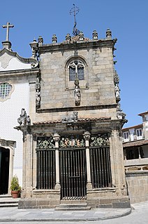
Capela dos Coimbras Church in Norte, Portugal

The Chapel of the Coimbras is a Manueline chapel located in the civil parish of São João do Souto, in the municipality of Braga. It has been classified as a National Monument since 1910.

Coliseu dos Recreios Multi-purpose auditiorium in Lisbon, Portugal

The Coliseu dos Recreios is a multi-purpose auditorium located in Lisbon, Portugal.
Mexilhoeira Grande Civil parish in Algarve, Portugal

Mexilhoeira Grande is a civil parish in the municipality (concelho) of Portimão in the southern Portuguese region of the Algarve. The population in 2011 was 4,029, in an area of 91.15 km².

Coruche (Aguiar da Beira) Civil parish in Centro, Portugal

Coruche is a former freguesia in Aguiar da Beira Municipality, Guarda District, Portugal. It was merged with Aguiar da Beira in 2013 to form the new freguesia Aguiar da Beira e Coruche. The Portucalense Bridge over the River Coja is located in this former freguesia.

Dolmen of Cunha Baixa dolmen in Cunha Baixa, Portugal

The Dolmen of Cunha Baixa is a dolmen in the civil parish of Cunha Baixa, in the municipality of Mangualde. It is located in a valley area of the Rio Castelo, between the villages of Cunha Baixa and Espinho.
Castle of Sortelha

The Castle of Sortelha (Portuguese: Castelo de Sortelha is a castle in the civil parish of Sortelha in the municipality of Sabugal in the Portuguese Centro region, classified as a National Monument.

Castle of Folgosinho

The Castle of Folgosinho, is a medieval castle in the civil parish of Folgosinho, municipality of the Gouveia in the district of Guarda in the Centre region of Portugal.
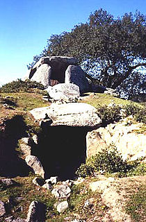
Great Dolmen of Comenda da Igreja Dolmen in Montemor-o-Novo, Portugal

The Great Dolmen of Comenda da Igreja is a megalithic funerary site in the civil parish of Nossa Senhora do Bispo, in the municipality of Montemor-o-Novo, in the central Alentejo region of continental Portugal.

Torrão Civil parish in Alentejo, Portugal

Torrão is a civil parish and town, in the municipality of Alcácer do Sal, in the Portuguese district of Setúbal, bordering on the districts of Évora and the Beja. It is crossed by the river Xarrama River. The population in 2011 was 2,295, in an area of 372.39 km².

Carapito Civil parish in Centro, Portugal

Carapito is a freguesia in Aguiar da Beira Municipality, Guarda District, Portugal. The population in 2011 was 442, in an area of 17.26 km2. The Dolmen of Carapito I is located in this freguesia.

Aguiar da Beira (freguesia) Civil parish in Centro, Portugal

Aguiar da Beira is a former freguesia in Aguiar da Beira Municipality, Guarda District, Portugal. It was merged with Coruche in 2013 to form the new freguesia Aguiar da Beira e Coruche. The Pillory of Aguiar da Beira is located in this former freguesia.

Pillory of Aguiar da Beira

The Pillory of Aguiar da Beira is a pillory located in the civil parish of Aguiar da Beira e Coruche, in the municipality of Aguiar da Beira, Portuguese district of Guarda.

Castle of Castelo Bom

The Castle of Castelo Bom, is a medieval castle in the civil parish of Castelo Bom, municipality of the Almeida in the district of Guarda in the Centre region of Portugal.
Church of São Gião Church in Centro, Portugal

A Church of São Gião is an 18th-century church in the civil parish of São Gião, in the municipality of Oliveira do Hospital, in the Portuguese district of Coimbra. Classified as a national monument since 1910, it is locally known as the Cathedral das Beiras, although unrecognized by IGESPAR or the Diocese of Guarda.

Anta do Monte Abraão megalithic site near Odivelas, Portugal

The Anta do Monte Abraão was a megalithic dolmen located in the parish of Monte Abraão, in Queluz, Sintra Municipality, Lisbon District, Portugal. The dolmen was first identified in 1876, by Carlos Ribeiro, who carried out excavations until 1878 and published his results in 1880. Excavations suggest that it served as a tomb for about 80 individuals and that it dates back to the middle to end of the Neolithic period. The Anta do Monte Abraão and the nearby Anta da Pedra dos Mouros and Anta da Estria are collectively known as the Antas de Belas.

Anta da Pedra dos Mouros Megalithic site near Belas, Portugal

The Anta da Pedra dos Mouros, also known as the Anta do Senhor da Serra, is a megalithic dolmen situated near Belas and Queluz in the Lisbon District of Portugal. It is believed to date back to the late-Neolithic and early-Chalcolithic eras. The Anta da Pedra dos Mouros, the Anta da Estria, and the Anta do Monte Abraão are a short distance from each other and are collectively known as the Antas de Belas. The Anta da Pedra dos Mouros was first identified in the 1850s by Carlos Ribeiro. Despite being registered and protected as a national monument in 1910, the dolmen has recently suffered significant damage.

Anta de Agualva megalithic site near Agualva, Portugal

The Anta de Agualva, also known as the Anta do Carrascal, is a megalithic dolmen situated in an urban area of Agualva-Cacém in the municipality of Sintra, in the Lisbon District of Portugal. First identified by Carlos Ribeiro in 1875, the dolmen has recently been restored and can be easily visited.

Anta do Alto da Toupeira Megalithic site near Loures, Portugal

The Anta do Alto da Toupeira, also called the Anta da Toupeira or the Anta de Salemas, is a Neolithic dolmen, or megalithic tomb, situated in the parish of Lousa in the municipality of Loures, in the Lisbon District of Portugal. It dates back to the Chalcolithic.

References

Notes
  1. 1 2 3 4 5 6 7 8 9 10 11 12 13 14 15 16 17 Conceição, Margarida (1992). SIPA (ed.). "Dólmen de Carapito I / Casa da Moura (IPA.00001369/PT020901020005)" (in Portuguese). Lisbon, Portugal: SIPA–Sistema de Informação para o Património Arquitectónico. Retrieved 19 April 2015.
  2. 1 2 3 4 5 6 7 8 Martin, A (5 February 2014), IGESPAR (ed.), Dólmen de Carapito I, também conhecido por «Casa da Moura» (in Portuguese), Lisbon, Portugal: IGESPAR-Instituto de Gestão do Património Arquitectónico e Arqueológico, retrieved 21 April 2015
  3. V. Leisner and L. Ribeiro
Sources