Harveys Lake, Pennsylvania

Last updated
Harveys Lake, Pennsylvania
Borough
Harveys Lake from the south.JPG
A view of Harveys Lake from the south
Luzerne County Pennsylvania Incorporated and Unincorporated areas Harveys Lake Highlighted.svg
Location of Harveys Lake in Luzerne County, Pennsylvania.
USA Pennsylvania location map.svg
Red pog.svg
Harveys Lake
Usa edcp location map.svg
Red pog.svg
Harveys Lake
Coordinates: 41°21′48″N76°02′38″W / 41.36333°N 76.04389°W / 41.36333; -76.04389
Country United States
State Pennsylvania
County Luzerne
Settled1781
Incorporated1968 [1]
Government
  TypeBorough Council
  MayorMichael Rush
Area
[2]
  Total6.42 sq mi (16.62 km2)
  Land5.40 sq mi (13.98 km2)
  Water1.02 sq mi (2.64 km2)
Population
 (2020) [3]
  Total2,788
  Density516.68/sq mi (199.49/km2)
Time zone UTC-5 (Eastern (EST))
  Summer (DST) UTC-4 (EDT)
ZIP code
18618
Area code 570
FIPS code 42-33000
Website harveyslakeborough.com

Harveys Lake is a borough in Luzerne County, Pennsylvania, United States. It is part of the Back Mountain, a one hundred and eighteen-square mile region in northern Luzerne County.

Contents

The borough is named after the lake, its principal feature, which in turn was named after Benjamin Harvey, a local settler. Harvey was a member of the Sons of Liberty, an eminent colonial-era group that fought against Great Britain's Stamp Act of 1765.

As of the 2020 census, the population of the borough of Harveys Lake was 2,786. [4]

History

Harveys Lake was not officially incorporated as a borough until 1968. Prior to that, the area was an unincorporated part of Lake Township.

According to The Jesuit Relations, prior to European colonization, the region was inhabited by the Scahentoarrhonon people, an Iroquoian-speaking group.

Historically, the first White resident in the vicinity of the lake was Matthew Scouten, who arrived in the early 1790s, but the first White settlers were the Worthingtons, who arrived in 1806.

Harveys Lake became a major resort destination in the early 20th century, attracting tourists from all over the Northeast. Hotels, cottages, boathouses, a casino, and even an amusement park were constructed around the lake. The grand Hotel Oneonta was especially prominent in the early 1900s; former United States President Theodore Roosevelt was a guest in August 1912. [5]

From 1952 to 1956, Pennsylvania State Senator T. Newell Wood hosted the Brynfan Tyddyn Road Race around his estate in Harveys Lake. [6] Brynfan Tyddyn is Welsh for "large farm on a hilltop" and the race consisted of 10 laps around a 3.5 mile course around the estate. [7] The race was discontinued in 1957 after a fatal accident and officials determined the course was too dangerous and difficult for participants and spectators to reach. [8]

Geography

Harveys Lake is located at 41°21′48″N76°2′38″W / 41.36333°N 76.04389°W / 41.36333; -76.04389 (41.363335, -76.043989). [9]

According to the United States Census Bureau, the borough has a total area of 6.2 square miles (16.0 km2), of which 5.2 square miles (13.4 km2) is land and 1.0 square mile (2.6 km2), or 16.45%, is water. [10] The lake has a maximum depth of 104 feet (32 m). Pennsylvania Route 415, which encircles the lake, is a major highway in the borough. Most of the homes and businesses are located within proximity to the lake. Forested mountains are located on the outskirts of town.

Pennsylvania Route 415 in southwestern Harveys Lake.JPG
Pennsylvania Route 415 encircling Harveys Lake
Harveys Lake as viewed from OpenStreetMap.PNG
Map of Harveys Lake
Boats on Harveys Lake.JPG
Boats on Harveys Lake

Demographics

Historical population
CensusPop.Note
1970 1,693
1980 2,31836.9%
1990 2,74618.5%
2000 2,8885.2%
2010 2,791−3.4%
2020 2,786−0.2%
2021 (est.)2,792 [4] 0.2%
Sources: [11] [12] [13] [3]
Old postcard of Harveys Lake Sunset, Harvey's Lake, Pennsylvania (75649).jpg
Old postcard of Harveys Lake

As of the census [12] of 2000, there were 2,888 people, 1,185 households, and 791 families residing in the borough. The population density was 540.1 inhabitants per square mile (208.5/km2). There were 1,735 housing units at an average density of 324.5 per square mile (125.3/km2). The racial makeup of the borough was 98.10% White, 0.14% African American, 0.31% Native American, 0.38% Asian, 0.03% Pacific Islander, 0.31% from other races, and 0.73% from two or more races. Hispanic or Latino of any race were 0.76% of the population.

There were 1,185 households, out of which 29.6% had children under the age of 18 living with them, 53.8% were married couples living together, 8.7% had a female householder with no husband present, and 33.2% were non-families. 27.7% of all households were made up of individuals, and 8.6% had someone living alone who was 65 years of age or older. The average household size was 2.44 and the average family size was 2.97.

In the borough the population was spread out, with 22.8% under the age of 18, 7.3% from 18 to 24, 30.1% from 25 to 44, 26.8% from 45 to 64, and 13.0% who were 65 years of age or older. The median age was 39 years. For every 100 females there were 97.8 males. For every 100 females age 18 and over, there were 95.3 males.

The median income for a household in the borough was $37,656, and the median income for a family was $51,319. Males had a median income of $31,059 versus $25,528 for females. The per capita income for the borough was $22,795. About 3.0% of families and 6.7% of the population were below the poverty line, including 6.2% of those under age 18 and 6.9% of those age 65 or over.

Notable person

Related Research Articles

<span class="mw-page-title-main">Troy, Pennsylvania</span> Borough in Pennsylvania, United States

Troy is a borough in Bradford County, Pennsylvania, United States. It is part of Northeastern Pennsylvania. The population was 1,354 at the 2010 census. Children residing in the borough are assigned to attend the Troy Area School District.

<span class="mw-page-title-main">East Side, Pennsylvania</span> Borough in Pennsylvania, United States

East Side is a borough in Carbon County, Pennsylvania. It is part of Northeastern Pennsylvania. The population was 317 at the 2010 census.

<span class="mw-page-title-main">Benton Township, Columbia County, Pennsylvania</span> Township in Pennsylvania, United States

Benton Township is a township in Columbia County, Pennsylvania. It is part of Northeastern Pennsylvania. The population was 1,323 at the 2020 census.

<span class="mw-page-title-main">Briar Creek Township, Columbia County, Pennsylvania</span> Township in Pennsylvania, United States

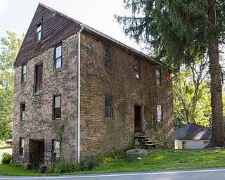
Briar Creek Township is a township in Columbia County, Pennsylvania. It is part of Northeastern Pennsylvania. The population was 2,992 at the 2020 census.

<span class="mw-page-title-main">Wormleysburg, Pennsylvania</span> Borough in Pennsylvania, United States

Wormleysburg is a borough in Cumberland County, Pennsylvania, United States. The population was 3,070 at the 2010 census. It is part of the Harrisburg–Carlisle Metropolitan Statistical Area.

<span class="mw-page-title-main">Brownsville Township, Fayette County, Pennsylvania</span> Township in Pennsylvania, United States

Brownsville Township is a township in Fayette County, Pennsylvania, United States. The population was 534 at the 2020 census, a decline from the figure of 683 tabulated in 2010. It is served by the Brownsville School District.

<span class="mw-page-title-main">Luzerne Township, Fayette County, Pennsylvania</span> Township in Pennsylvania, United States

Luzerne Township is a township in Fayette County, Pennsylvania, United States. The population was 5,652 at the 2020 census, down from 5,965 at the 2010 census.

<span class="mw-page-title-main">Back Mountain</span> Region in Pennsylvania, United States

The Back Mountain is a region and former census-designated place (CDP) in Luzerne County, Pennsylvania, United States. It is near the cities of Scranton and Wilkes-Barre. The population was 33,551 as of 2016. The region has a total area of 117.59 square miles (304.6 km2). The area was not delineated as a CDP for the 2010 census. The name "Back Mountain" refers to the area's location behind the mountain ridge forming the northwest side of the Wyoming Valley. The area includes the townships of Dallas, Franklin, Jackson, Kingston, Lake, and Lehman. The region also includes the boroughs of Dallas and Harveys Lake. Each township and borough is independently governed.

<span class="mw-page-title-main">Conyngham, Pennsylvania</span> Borough in Pennsylvania, United States

Conyngham is a borough in Luzerne County, Pennsylvania, United States. The population was 1,820 at the 2020 census.

<span class="mw-page-title-main">Conyngham Township, Luzerne County, Pennsylvania</span> Township in Pennsylvania

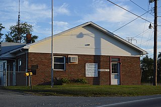
Conyngham Township is a township in Luzerne County, Pennsylvania, United States. The population was 1,309 at the 2020 census.

<span class="mw-page-title-main">Dallas, Pennsylvania</span> Borough in Pennsylvania, United States

Dallas is a borough in Luzerne County, Pennsylvania, United States. The population was 2,692 at the 2020 census. The local government describes the borough as the "Pride" of the Back Mountain. The area includes the townships of Dallas, Franklin, Jackson, Kingston, Lake, and Lehman. The region also includes the boroughs of Dallas and Harveys Lake. Dallas is in the vicinity of Misericordia University and Dallas State Correctional Institution.

<span class="mw-page-title-main">East Berwick, Pennsylvania</span> Census-designated place in Pennsylvania, United States

East Berwick is a census-designated place (CDP) in Salem Township, Luzerne County, Pennsylvania, United States. The population was 2,007 at the 2010 census.

<span class="mw-page-title-main">Jeddo, Pennsylvania</span> Borough in Pennsylvania, United States

Jeddo is a borough in Luzerne County, Pennsylvania, United States. As of the 2020 census, the population was 109, making it the least populous borough in the county.

<span class="mw-page-title-main">Lake Township, Luzerne County, Pennsylvania</span> Township in Pennsylvania, United States

Lake Township is a township that is located in Luzerne County, Pennsylvania, United States. It is part of the Back Mountain, a 118-square mile region in northern Luzerne County. The population was 1,994 at the time of the 2020 census.

<span class="mw-page-title-main">Luzerne, Pennsylvania</span> Borough in Pennsylvania, United States

Luzerne is a borough located 5 miles (8 km) north of Wilkes Barre in Luzerne County, Pennsylvania, United States.

<span class="mw-page-title-main">New Columbus, Pennsylvania</span> Borough in Pennsylvania, United States

New Columbus is a borough in Luzerne County, Pennsylvania, United States. The population was 219 at the 2020 census.

<span class="mw-page-title-main">Nuangola, Pennsylvania</span> Borough in Pennsylvania, United States

Nuangola is a borough in Luzerne County, Pennsylvania. The population was 663 as of the 2020 census. Developed as a summer resort in the early 20th century, the borough is built around a heart-shaped lake called Nuangola Lake.

<span class="mw-page-title-main">Penn Lake Park, Pennsylvania</span> Borough in Pennsylvania, United States

Penn Lake Park is a borough in Luzerne County, Pennsylvania, United States. The population was 359 at the 2020 census.

<span class="mw-page-title-main">Deer Lake, Pennsylvania</span> Borough in Pennsylvania, United States

Deer Lake is a borough in Schuylkill County, Pennsylvania. The population was 670 at the 2020 census. The mayor of the borough is Larry Kozlowski.

<span class="mw-page-title-main">Deemston, Pennsylvania</span> Borough in Pennsylvania, United States

Deemston is a borough in Washington County, Pennsylvania, United States and part of the Pittsburgh metropolitan area since 1950. The population was 751 at the 2020 census.

References

  1. "History of Harveys Lake" . Retrieved 10 January 2014.
  2. "ArcGIS REST Services Directory". United States Census Bureau. Retrieved October 12, 2022.
  3. 1 2 "Census Population API". United States Census Bureau. Retrieved Oct 12, 2022.
  4. 1 2 Bureau, US Census. "City and Town Population Totals: 2020—2021". Census.gov. US Census Bureau. Retrieved August 4, 2022.
  5. Harrison Wick (2009), Pennsylvania's Back Mountain, Arcadia Publishing, pp. 116–119, ISBN   9780738562780
  6. "Bryfan Tyddyn Home Team Advantage". www.thechicane.com. Retrieved 30 November 2019.
  7. Petrillo, F. Charles. "Harvey's Lake History". www.harveyslake.org. Retrieved 30 November 2019.
  8. Skrapits, Elizabeth. "Remembering the glory days of car races at Harveys Lake". www.citizensvoice.com. Retrieved 30 November 2019.
  9. "US Gazetteer files: 2010, 2000, and 1990". United States Census Bureau. 2011-02-12. Retrieved 2011-04-23.
  10. "Geographic Identifiers: 2010 Demographic Profile Data (G001): Harveys Lake borough, Pennsylvania". United States Census Bureau . Retrieved April 12, 2012.
  11. "Census of Population and Housing". U.S. Census Bureau. Retrieved 11 December 2013.
  12. 1 2 "U.S. Census website". United States Census Bureau . Retrieved 2008-01-31.
  13. "Incorporated Places and Minor Civil Divisions Datasets: Subcounty Resident Population Estimates: April 1, 2010 to July 1, 2012". Population Estimates. U.S. Census Bureau. Archived from the original on 11 June 2013. Retrieved 11 December 2013.

Commons-logo.svg Media related to Harveys Lake, Pennsylvania at Wikimedia Commons