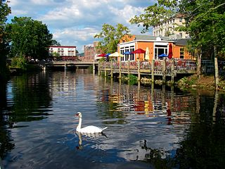
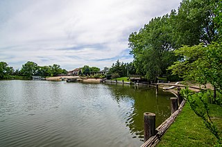
Pawcatuck is a village and census-designated place (CDP) in the town of Stonington which is located in New London County, Connecticut. The population was 5,624 at the 2010 census. It is located across the Pawcatuck River from Downtown Westerly, Rhode Island. The Mechanic Street Historic District of Pawcatuck is listed on the National Register of Historic Places and includes sites of shipbuilding, mills, and worker housing in a 147-acre (0.59 km2) area.

Elim is an unincorporated community and census-designated place (CDP) in Upper Yoder Township, Cambria County, Pennsylvania, United States. The population was 3,727 at the 2010 census, down from 4,175 at the 2000 census.
Dixonville is an unincorporated community in Indiana County, Pennsylvania, United States. The area is recorded as the "Dicksonville" census-designated place (CDP), with a population of 467 at the 2010 census. The CDP lies mostly on the western edge of Green Township, though a small portion extends west into Rayne Township.

Devon is a census-designated place (CDP) located in Easttown township in Chester County, Pennsylvania, United States. The population was 1,515 at the 2010 census. The area is part of the Philadelphia Main Line suburbs.
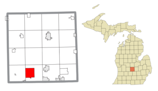
Wacousta is an unincorporated community and census-designated place (CDP) in Clinton County in the U.S. state of Michigan. The CDP is located within Watertown Charter Township. As of the 2010 census, it had a population of 1,440.

Lealman, known as East Lealman until 2010, is a census-designated place (CDP) in Pinellas County, Florida, United States. The population was 19,879 at the 2010 census. Prior to 2010, Lealman was part of a larger CDP named West and East Lealman.
Mount Morris is an unincorporated community and census-designated place (CDP) in Greene County, Pennsylvania, United States. It is located in Perry Township, near I-79. As of the 2010 census, the population was 737.

Cochranville is a census-designated place (CDP) in West Fallowfield Township, Chester County, Pennsylvania, United States. The population was 668 at the 2010 census. It is the hometown of Olympic swimmer Cierra Runge.
Overland is a census-designated place (CDP) in Hamilton County, Nebraska, United States. The population was 153 at the 2010 census.
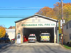
Hickory Hills is a census-designated place (CDP) in Foster Township, Luzerne County, Pennsylvania, southwest of the borough of White Haven. The CDP population was 562 at the 2010 census.
Upper Exeter is a census-designated place (CDP) in Exeter Township, Luzerne County, Pennsylvania, United States. The population was 707 at the 2010 census.
Florence is an unincorporated community and census-designated place (CDP) located within Florence Township, in Burlington County, in the U.S. state of New Jersey, that was established as part of the 2010 United States Census. As of the 2000 United States Census, the CDP was combined as Florence-Roebling, which had a total population of 8,200. As of the 2010 Census, the Florence-Roebling CDP was split into its components, Roebling and Florence. As of the 2010 Census, the population of the Florence CDP was 4,426.

Windsor is a census-designated place (CDP) comprising the main settlement within the town of Windsor, Windsor County, Vermont, United States. The population of the CDP was 2,066 at the 2010 census, compared with 3,553 for the town as a whole.

Crucible is a census-designated place and coal town in Greene County, Pennsylvania, United States. Their post office opened in 1914. The 2010 census reported Crucible with a population of 725. 70.6% of households are families, with an average family size of 3.02.

Caln is a census-designated place (CDP) in Caln Township, Chester County, Pennsylvania, United States. The population was 1,519 at the 2010 census. It is located east of the city of Coatesville and lies west of Philadelphia.

Pomeroy is a census-designated place (CDP) in Sadsbury Township, Chester County, Pennsylvania, United States. The population was 401 at the 2010 census.

Westwood is a census-designated place (CDP) in Valley Township in Chester County, Pennsylvania, United States. The population was 950 at the 2010 census.

Deerfield is a census-designated place (CDP) in the town of Deerfield in Franklin County, Massachusetts, United States. The population was 643 at the 2010 census. It corresponds roughly to the area of Historic Deerfield, a historic district comprising the original town center of Deerfield. It is the home of Deerfield Academy, a college-preparatory school.
Panther Valley is an unincorporated community and census-designated place (CDP) located within Allamuchy Township, in Warren County, in the U.S. state of New Jersey. As of the 2010 United States Census, the CDP's population was 3,327.
Rock House is a census-designated place (CDP) in Gila County, Arizona, United States. The population was 50 at the 2010 census.