East Berwick, Pennsylvania

Last updated
East Berwick, Pennsylvania
East Front Street in East Berwick, Pennsylvania.JPG
East Front Street in East Berwick
USA Pennsylvania location map.svg
Red pog.svg
East Berwick
Location in Pennsylvania
Usa edcp location map.svg
Red pog.svg
East Berwick
Location in the United States
Coordinates: 41°3′46″N76°13′28″W / 41.06278°N 76.22444°W / 41.06278; -76.22444 Coordinates: 41°3′46″N76°13′28″W / 41.06278°N 76.22444°W / 41.06278; -76.22444
Country United States
State Pennsylvania
County Luzerne
Township Salem
Area
[1]
  Total1.00 sq mi (2.59 km2)
  Land0.91 sq mi (2.36 km2)
  Water0.09 sq mi (0.24 km2)
Population
 (2020) [2]
  Total2,042
  Density2,246.42/sq mi (866.91/km2)
Time zone UTC-5 (Eastern (EST))
  Summer (DST) UTC-4 (EDT)
ZIP code
18603
Area code 570
FIPS code 42-20800

East Berwick is a census-designated place (CDP) in Salem Township, Luzerne County, Pennsylvania, United States. The population was 2,007 at the 2010 census. [3]

Contents

Geography

The fire hall of the East Berwick Fire Company East Berwick Fire Co 2.png
The fire hall of the East Berwick Fire Company

East Berwick is located along the Susquehanna River at 41°3′46″N76°13′28″W / 41.06278°N 76.22444°W / 41.06278; -76.22444 (41.062789, -76.224529). [4] East Berwick borders Berwick Borough, which is in neighboring Columbia County. The CDP is also adjacent to Nescopeck Borough, which is on the opposite bank of the Susquehanna River.

According to the United States Census Bureau, the CDP has a total area of 1.0 square mile (2.6 km2), of which 0.9 square miles (2.3 km2) is land and 0.1 square miles (0.26 km2), or 13.13%, is water.

Demographics

Historical population
CensusPop.
2020 2,042
U.S. Decennial Census [5]

At the 2000 census there were 1,998 people, 846 households, and 611 families living in the CDP. The population density was 2,308.0 people per square mile (886.7/km2). There were 878 housing units at an average density of 1,014.2/sq mi (389.7/km2). The racial makeup of the CDP was 98.25% White, 0.60% African American, 0.50% Asian, 0.20% from other races, and 0.45% from two or more races. Hispanic or Latino of any race were 0.85%. [6]

There were 846 households, 26.0% had children under the age of 18 living with them, 60.4% were married couples living together, 9.0% had a female householder with no husband present, and 27.7% were non-families. 25.2% of households were made up of individuals, and 15.5% were one person aged 65 or older. The average household size was 2.36 and the average family size was 2.79.

The age distribution was 20.4% under the age of 18, 6.1% from 18 to 24, 23.5% from 25 to 44, 25.8% from 45 to 64, and 24.1% 65 or older. The median age was 45 years. For every 100 females, there were 91.0 males. For every 100 females age 18 and over, there were 87.3 males.

The median household income was $40,489 and the median family income was $46,458. Males had a median income of $30,887 versus $27,813 for females. The per capita income for the CDP was $19,531. About 4.3% of families and 5.4% of the population were below the poverty line, including 15.8% of those under age 18 and 1.9% of those age 65 or over.

Related Research Articles

Rheems is an unincorporated community and census-designated place (CDP) in Lancaster County, Pennsylvania, United States, between the boroughs of Elizabethtown and Mount Joy. The population was 1,598 during the 2010 census.

<span class="mw-page-title-main">Hyde, Pennsylvania</span> Census-designated place in Pennsylvania, United States

Hyde is an unincorporated community and census-designated place (CDP) in Clearfield County, Pennsylvania, United States. The population was 1,303 at the 2020 census.

<span class="mw-page-title-main">Almedia, Pennsylvania</span> Census-designated place in Pennsylvania, United States

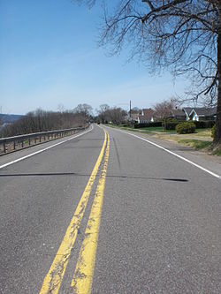
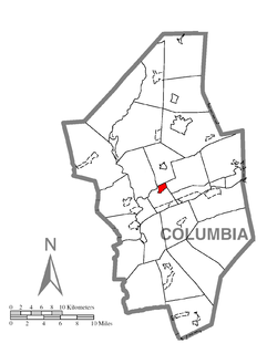
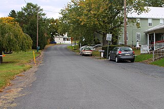
Almedia is a census-designated place (CDP) in Columbia County, Pennsylvania, United States. The population was 1,078 at the 2010 census. It is part of the Bloomsburg–Berwick Micropolitan Statistical Area.

<span class="mw-page-title-main">Briar Creek, Pennsylvania</span> Borough in Pennsylvania, United States

Briar Creek is a borough in Columbia County, Pennsylvania, United States. The population was 660 at the 2010 census. It is part of the Bloomsburg–Berwick Micropolitan Statistical Area.

<span class="mw-page-title-main">Buckhorn, Pennsylvania</span> Census-designated place in Pennsylvania, United States

Buckhorn is a census-designated place (CDP) in Columbia County, Pennsylvania, United States. The population was 318 at the 2010 census. It is part of the Bloomsburg–Berwick Micropolitan Statistical Area. It uses the Bloomsburg ZIP code of 17815.

<span class="mw-page-title-main">Espy, Pennsylvania</span> Census-designated place in Pennsylvania, United States

Espy is a census-designated place (CDP) in Columbia County, Pennsylvania, United States. The population was 1,642 at the 2010 census. It is part of the Bloomsburg–Berwick Micropolitan Statistical Area. Espy was first settled in the late 18th century. It was home to a boatyard in the 19th century.

<span class="mw-page-title-main">Fernville, Pennsylvania</span> Census-designated place in Pennsylvania, United States

Fernville is a census-designated place (CDP) in Columbia County, Pennsylvania, United States. The population was 556 at the 2010 census. It is part of the Bloomsburg–Berwick Micropolitan Statistical Area.

Foundryville is a census-designated place (CDP) in Columbia County, Pennsylvania, United States. The population was 256 at the 2010 census. It is part of the Bloomsburg–Berwick Micropolitan Statistical Area.

<span class="mw-page-title-main">Jonestown, Columbia County, Pennsylvania</span> Census-designated place in Pennsylvania, United States

Jonestown is a census-designated place (CDP) in Columbia County, Pennsylvania, United States. The population was 64 at the 2010 census. It is part of the Bloomsburg–Berwick Micropolitan Statistical Area.

<span class="mw-page-title-main">Lightstreet, Pennsylvania</span> Census-designated place in Pennsylvania, United States

Lightstreet is a census-designated place (CDP) in Columbia County, Pennsylvania, United States. The population was 1,093 at the 2010 census. It is part of the Bloomsburg–Berwick Micropolitan Statistical Area. The CDP is named after a street in Baltimore.

<span class="mw-page-title-main">Lime Ridge, Pennsylvania</span> Census-designated place in Pennsylvania, United States

Lime Ridge is a census-designated place (CDP) in Columbia County, Pennsylvania, United States. The population was 890 at the 2010 census. It is part of the Bloomsburg–Berwick Micropolitan Statistical Area.

Locustdale is a census-designated place (CDP) in Columbia and Schuylkill counties, Pennsylvania, United States. The population was 177 at the 2010 census. It is part of the Bloomsburg–Berwick Micropolitan Statistical Area.

<span class="mw-page-title-main">Mifflinville, Pennsylvania</span> Census-designated place in Pennsylvania, United States

Mifflinville is an unincorporated community and census-designated place (CDP) in Columbia County, Pennsylvania, United States. The population was 1,253 at the 2010 census. It is part of the Bloomsburg–Berwick Micropolitan Statistical Area.

<span class="mw-page-title-main">Rohrsburg, Pennsylvania</span> Census-designated place in Pennsylvania, United States

Rohrsburg is a census-designated place (CDP) in Columbia County, Pennsylvania, United States. The population was 145 at the 2010 census. It is part of the Bloomsburg–Berwick Micropolitan Statistical Area.

<span class="mw-page-title-main">Rupert, Pennsylvania</span> Census-designated place in Pennsylvania, United States

Rupert is a census-designated place (CDP) in Columbia County, Pennsylvania, United States. The population was 183 at the 2010 census. It is part of the Bloomsburg–Berwick Micropolitan Statistical Area.

<span class="mw-page-title-main">Slabtown, Pennsylvania</span> Census-designated place in Pennsylvania, United States

Slabtown is a census-designated place in Columbia County, Pennsylvania, United States. The population was 156 at the 2010 census. It is part of the Bloomsburg–Berwick Micropolitan Statistical Area.

<span class="mw-page-title-main">Progress, Pennsylvania</span> Census-designated place in Pennsylvania, United States

Progress is an unincorporated community and census-designated place (CDP) mainly in Susquehanna Township but also in Lower Paxton Township, Dauphin County, Pennsylvania, United States. The population was 9,765 at the 2010 census. It is part of the Harrisburg–Carlisle Metropolitan Statistical Area and is pronounced "PRO-gress."

Timber Hills is an unincorporated community and census-designated place (CDP) in Lebanon County, Pennsylvania, United States. The population was 360 at the 2010 census.

<span class="mw-page-title-main">Port Trevorton, Pennsylvania</span> CDP in Pennsylvania, United States

Port Trevorton is a census-designated place (CDP) in Snyder County, Pennsylvania, United States. The population was 451 at the 2000 census.

<span class="mw-page-title-main">Susquehanna Trails, Pennsylvania</span> CDP in Pennsylvania, United States

Susquehanna Trails is a census-designated place (CDP) in York County, Pennsylvania, United States. The population was 2,264 at the 2010 census.

References

  1. "ArcGIS REST Services Directory". United States Census Bureau. Retrieved October 12, 2022.
  2. "Census Population API". United States Census Bureau. Retrieved Oct 12, 2022.
  3. "Profile of General Population and Housing Characteristics: 2010 Demographic Profile Data (DP-1): East Berwick CDP, Pennsylvania". United States Census Bureau . Retrieved April 19, 2012.
  4. "US Gazetteer files: 2010, 2000, and 1990". United States Census Bureau. 2011-02-12. Retrieved 2011-04-23.
  5. "Census of Population and Housing". Census.gov. Retrieved June 4, 2016.
  6. "U.S. Census website". United States Census Bureau . Retrieved 2008-01-31.